Download
1 / 1
60 likes | 339 Views
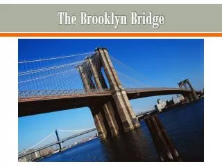
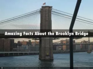
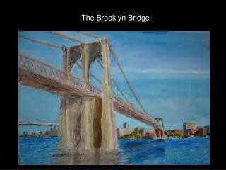
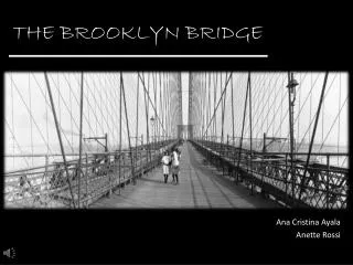
PICNIC/BBQ AREA. Brooklyn Bridge Pier 6 Site analysis. 1 BROOKLYN BRIDGE PARK. TRANSPORTATION: BUSES- B63 B61 SUBWAY STATIONS- 10 MINUTE WALK COURT STREET (R) BOROUGH HALL (2,3,4,5) WATERWAYS: WATER TAXI(10 MIN WALK) GOVERNOR’S ISLAND FERRY EASTRIVER FERRY (10MIN WALK) DRIVING:

E N D
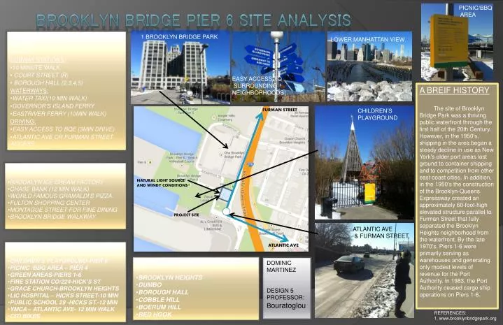
PICNIC/BBQ AREA Brooklyn Bridge Pier 6 Site analysis 1 BROOKLYN BRIDGE PARK • TRANSPORTATION: • BUSES- • B63 B61 • SUBWAY STATIONS- • 10 MINUTE WALK • COURT STREET (R) • BOROUGH HALL (2,3,4,5) • WATERWAYS: • WATER TAXI(10 MIN WALK) • GOVERNOR’S ISLAND FERRY • EASTRIVER FERRY (10MIN WALK) • DRIVING: • EASY ACCESS TO BQE (3MIN DRIVE) • ATLANTIC AVE OR FURMAN STREET ACCESS LOWER MANHATTAN VIEW EASY ACCESS TO SURROUNDING NEIGHBORHOODS A BREIF HISTORY The site of Brooklyn Bridge Park was a thriving public waterfront through the first half of the 20th Century. However, in the 1950's, shipping in the area began a steady decline in use as New York's older port areas lost ground to container shipping and to competition from other east coast cities. In addition, in the 1950's the construction of the Brooklyn-Queens Expressway created an approximately 60-foot-high elevated structure parallel to Furman Street that fully separated the Brooklyn Heights neighborhood from the waterfront. By the late 1970's, Piers 1-6 were primarily serving as warehouses and generating only modest levels of revenue for the Port Authority. In 1983, the Port Authority ceased cargo ship operations on Piers 1-6. FURMAN STREET CHILDREN’S PLAYGROUND • COMMERCE: • BROOKLYN ICE CREAM FACTORY • CHASE BANK (12 MIN WALK) • WORLD FAMOUS GRAMALDI’S PIZZA • FULTON SHOPPING CENTER • MONTAGUE STREET FOR FINE DINING • BROOKLYN BRIDGE WALKWAY NATURAL LIGHT SOURCE AND WINDY CONDITIONS 1 PROJECT SITE ATLANTIC AVE & FURMAN STREET ATLANTIC AVE • GENERAL INFORMATION: • CHILDREN’S PLAYGROUND-PIER 6 • PICNIC /BBQ AREA – PIER 4 • GREEN AREAS-PIERS 1-6 • FIRE STATION CO/224-HICK’S ST • GRACE CHURCH-BROOKLYN HEIGHTS • LIC HOSPITAL – HICKS STREET-10 MIN • PUBLIC SCHOOL 29 -HICKS ST.-12 MIN • YMCA – ATLANTIC AVE- 12 MIN WALK • CITI BIKES • SURROUNDING NEIGHBORHOODS: • BROOKLYN HEIGHTS • DUMBO • BOROUGH HALL • COBBLE HILL • BOERUM HILL • RED HOOK DOMINIC MARTINEZ DESIGN 5 PROFESSOR: Bouratoglou REFERENCES: 1. www.brooklynbridgepark.org