Download
1 / 13
130 likes | 241 Views
3 March 2005 實際天氣圖. 中央氣象局 天氣預報. 昨日. 今日. 4 日. 5 日. 三月寒流 十年新紀錄. 四 日 開 始 , 臺 南 以 北 平 地 只 有 五 度 , 空 曠 地 區 可 能 降 到 五 度 以 下 。 由 於 有 鋒 面 影 響 , 高 山 可 能 會 再 度 降 雪 。 不 過 周 末 轉 為 乾 冷 。 周 六 到 下 周 一 是 寒 流 最 強 的 時 候 , 農 漁 養 殖 業 應 嚴 防 寒 害 。

E N D
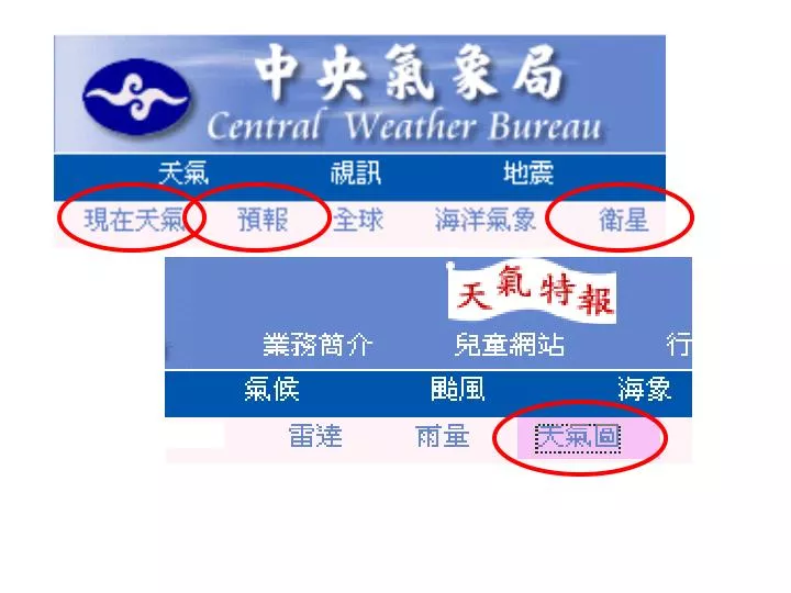
中央氣象局 天氣預報 昨日 今日 4日 5日
三月寒流 十年新紀錄 • 四 日 開 始 , 臺 南 以 北 平 地 只 有 五 度 , 空 曠 地 區 可 能 降 到 五 度 以 下 。 • 由 於 有 鋒 面 影 響 , 高 山 可 能 會 再 度 降 雪 。 不 過 周 末 轉 為 乾 冷 。 • 周 六 到 下 周 一 是 寒 流 最 強 的 時 候 ,農 漁 養 殖 業 應 嚴 防 寒 害 。 • 氣 象 局 已 對 局 部 地 區 發 布 豪 雨 特 報 , 玉 山 昨 日 清 晨 飄 下 瑞 雪 , 積 雪 有 五 十 公 分 。 • 鋒 面 水 氣 充 沛 , 玉 山 昨 日 清 晨 開 始 飄 雪 ,玉 山 氣 象 站 指 出 , 昨 日 凌 晨 玉 山 最 低 溫 為 攝 氏 零 下 2.2度 。
颱風 • 土石流 • 豪雨、洪水 • 寒害 • 放大效應
寒潮 • 根據中央氣象局規定, 當冷空氣南下,使得氣溫在24小時內劇降10°C以上者稱為『寒潮』。 • 寒潮大多於冬季來襲,約持續三至四天,有時可達八至九天。 • 伴隨鋒面南下的強勁極地冷氣團,因為冷乾的氣團特性, 除了發生氣溫驟降與強風等天氣現象,並不常發生降水。 • 衛星雲圖上寒潮爆發的特徵相當明顯, 當冷空氣直驅至大陸沿海,常在洋面上產生積雨雲胞。
任立渝 • http://www.weather-liyu.com.tw/ • 中央氣象局 • http://www.cwb.gov.tw/ • 寒潮的知識 • http://www.geocities.com/jasonzacker/Metorology/new_page_8.htm