Download
1 / 20
200 likes | 302 Views
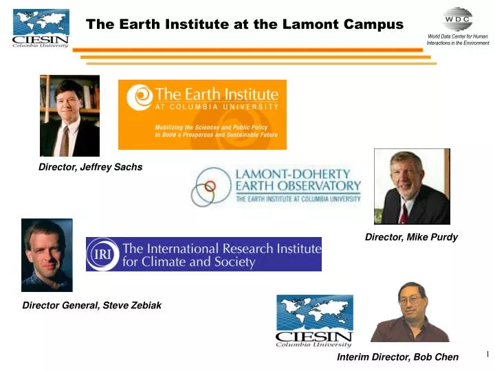
The Earth Institute at the Lamont Campus. Director, Jeffrey Sachs. Director, Mike Purdy. Director General, Steve Zebiak. Interim Director, Bob Chen. CIESIN founded in 1989 as a non-profit consortium based in Michigan In July 1998, CIESIN became a center within the Earth Institute

E N D
The Earth Institute at the Lamont Campus Director, Jeffrey Sachs Director, Mike Purdy Director General, Steve Zebiak Interim Director, Bob Chen
CIESIN founded in 1989 as a non-profit consortium based in Michigan In July 1998, CIESIN became a center within the Earth Institute CIESIN has more than 40 professional staff from the social and natural sciences, information technology & data management plus many students, postdocs, and visitors CIESIN now has 4 divisions: Science Applications Information Services Information Technology Geospatial Applications Center for International Earth Science Information Network (CIESIN)
NASA Socioeconomic Data and Applications Center (SEDAC) National Biological Information Infrastructure (NBII) Northeast Information Node Climate Change Information Resources for the New YorkMetropolitan Region Environmental Sustainability & Performance Indices Health Effects & Geochemistry of Arsenic and Manganese Petrologic Database of the Ocean Floor (PetDB) Data Management System for Sediment Geochemistry(SedDB) Remote Sensing Technologies for Ecosystem Management Treaties Millennium Development Project Support/Poverty Mapping Global Natural Disaster Risk Hotspots Managing Geospatial Electronic Records Human Dynamics of Emerging Diseases Metadata Training for Public Health Records Data Selected Recent CIESIN Programs & Collaborative Projects
Designated the World Data Center for Human Interactions in the Environment by ICSU Associate Member of the Open Geospatial Consortium Team GeoMedia Registered Research Lab (Intergraph) Founding member, Global Spatial Data Infrastructure Assoc. Member of the NASA ESIP Federation, DAAC Alliance, and the Alliance for Earth Observations Nongovernmental organization recognized by ECOSOC Very active in the Open Meetings of the Human Dimensions of Global Environmental Change Research Community Participant in eGY and IPY Participant in UN Geographic Information Support Team, UN Geographic Information Working Group, Geonetwork community Active in GEOSS development via OGC & CODATA Participant in UN Commission for Sustainable Development (CSD) Expert Group on Indicators Host of Socioeconomic Data Distribution Center for the Intergovernmental Panel on Climate Change Host of Population Environment Research Network (PERN) for the International Union for the Scientific Study of Population Selected CIESIN Affiliations
Socioeconomic Data & Applications Center(SEDAC) • Focus on human dimensions of environmental change • Integration of social and Earth science data, especially with remote sensing • Direct support to scientists, applied and operational users, decision makers, and policy communities • Strong links to geospatial data community
Gridded Population of the World, Version 3 (GPW) Global Rural-Urban Mapping Project (GRUMP) collection Projected Population Distribution, 2015 Population, Landscape, And Climate Estimates (PLACE) Ramsar Wetlands Data Gateway Low-Elevation Coastal Zone dataset Human Footprint/Last of the Wild Environmental Sustainability Index (ESI) & Environmental Performance Index (EPI) Environmental Treaties & Resource Indicators (ENTRI) Global Distribution of Poverty Global Geographical Distribution of Vulnerability to Climate Change Special Report on Emission Scenarios (SRES) data Global Natural Disaster Hotspots Key SEDAC Global Environmental & Socioeconomic Datasets
Millennium Ecosystem Assessment UN Millennium Project UN Geographic Information Support Team The World Bank National Geographic Earth & Sky The Times Atlas IPCC Fourth Assessment Example Users and Uses of SEDAC Data
Global, national, and subnational data on poverty developed in collaboration with the World Bank Development Economics Data Group Poverty Mapping Data
IPCC Socioeconomic Data Distribution Centre • Special Report on Emissions Scenarios (SRES) data • IS92 scenarios • Baseline socioeconomic datasets http://sedac.ciesin.columbia.edu/ddc
Estimates of population at low elevation in the coastal zone SEDAC GPW version 3 and Global Rural Urban Mapping Project (GRUMP) datasets Low Elevation Coastal Zone
Beta version released Landsat data developed by Lamont scientist C. Small Freely accessible Landsat data Urban Landsat: Cities from Space
Support for WMS, WFS, WCS Supports contexts (WMC) to permit specific preset thematic/regional views Advanced search will permit addition of external layers, e.g., via CRS, plus filtering and other functions Interoperable Map Services
GPW served via WMS Simple KML file to provide access to data Global Data via SEDAC’s WMS Serviceand Google Earth (beta)
SEDAC version of TerraViva! Global Data Viewer now available Provides visualization of multiple SEDAC and remote sensing datasets in integrated desktop application Desktop Mapping Application: TerraViva! SEDAC
Dell Linux server installed Registered on GEON grid Geongrid Cluster Installed
Collaboration with Columbia University Library System Mission: The SEDAC Long-Term Archive acquires, preserves, and maintains the content of selected high-quality data, data products, documentation, and services relevant to human dimensions of global change in a digital form to support the discovery, access, and use of archived resources by scientific, educational, and decision-making communities for at least the next 50 years. Currently being implemented using Fedora, an open source digital object repository and asset management system SEDAC Long-Term Archive
Developing content for 9 thematic areas initially: Climate Conservation Hazards Health Population Poverty Sustainability Treaties Integrates data, maps, news, publications, links, etc. Links to other global data centers & networks World Data Center Portal (in development)
NASA Discovery, Access, and Delivery of Data for the International Polar Year (DADDI) Urban and Suburban Detection and Classification (via JPL) US National Science Foundation Integrated Data Management for Solid Earth Geochemistry (EarthChem) System for Earth Sample Registration (SESAR) Civil Conflict and Access to Water (with the University of New Hampshire) Social and Environmental Vulnerability in the Disaster Context: Spatial Analysis and Improved Information Management for Decision Making in Disaster Response (led by Johns Hopkins University) New England Interstate Water Pollution Control Commission Identification of Coastal Parcels in New York Pitney Bowes Urban Disaster Risk Analysis US National Institutes of Health Revitalizing Urban Population Projections: New Data,New Methods (with the Population Council) UN Environment Program Global Environmental Outlook-4 Report US Agency for International Development Vulnerability indicators New Research and Data Activities
Thank You! • Please come for a visit – real or virtual!! • http://www.ciesin.columbia.edu • Questions, comments: • Bob Chenbchen@ciesin.columbia.edu+1 845-365-8952