Download
1 / 13
130 likes | 149 Views
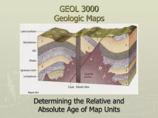
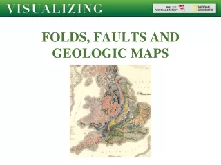
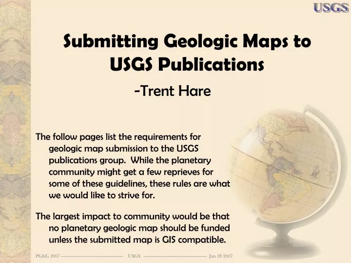
Submitting Geologic Maps to USGS Publications. The follow pages list the requirements for geologic map submission to the USGS publications group. While the planetary community might get a few reprieves for some of these guidelines, these rules are what we would like to strive for.

E N D
Submitting Geologic Maps to USGS Publications The follow pages list the requirements for geologic map submission to the USGS publications group. While the planetary community might get a few reprieves for some of these guidelines, these rules are what we would like to strive for. The largest impact to community would be that no planetary geologic map should be funded unless the submitted map is GIS compatible. -Trent Hare
Memo To: Geologic Mappers in the Western Region Memo From: Western Regional Publications Manager Date: May 14, 2007 Subject: New Requirements for Geologic Map Information Products One of the Western Region Publishing Network’s (PN) goals is to improve our workflow and production processes to help reduce both the time and the cost to produce a geologic map. To accomplish this goal the PN is implementing some changes to expedite the publication process for maps. The PN has created lists of new map and database requirements that are effective immediately (see attached …
Submittal Requirements “Before your map is edited, your map, database, and associated files will be evaluated for compliance and suitability for print production.” • Double-spaced manuscript of all text materials, including text, references, Description of Map Units (DMU), List of Map Units (LMU), symbol explanation, tables, figure and photo captions, credit notes, etc. • Plots of geologic maps, base maps (publication quality), cross sections, Correlation of Map Units (CMU), symbol explanation, and map marginalia. Note that it is not necessary to layout the DMU/LMU and (or) text on a fully formatted map sheet • Printouts of all figures and photographs • Printouts of lookup or frequency tables listing the names (attribute values) of all features symbolized on your map, generated from the labeling fields in the database • For maps that will be released as a CD-ROM, printouts of any supplemental materials that will be added to the CD version • Technical reviews • Geologic Names Review • Hawaiian language review (if applicable) • FGDC-compliant metadata (preliminary version, electronic file only)
Submittal Requirements • ReadMe file (if applicable) • For maps that will be printed, additional documentation of database structure, field descriptions, special coding schemes, symbolsets, styles, AMLs, scripts, etc. • For all maps, a CD containing electronic files of all your manuscript materials, including (if applicable) text, references, CMU, DMU, LMU, symbol explanation, cross sections, tables, figures, photos, figure and photo captions, credit notes, lookup or frequency tables, database documentation, FGDC-compliant metadata, ReadMe file, supplemental materials for CD release. • For maps that will be printed, a CD containing the PostScript (PDF) file of your map plot, as well as the Arc workspace or directory that has in it all database elements used to generate the plot to be edited (see last bulleted item in our "Database Requirements for Geologic Maps Submitted to the Menlo Park Publishing Service Center (PSC 18) for Print Production") • For maps that will be released as a CD-ROM, a preliminary "mock up" CD that shows its structure, organization, and contents.
Database Requirements for Geologic Maps If your map is to be printed, your map database must meet the following requirements… 1.) Labeling field In each layer or coverage, create a single labeling field that contains the real name (map-unit symbol, line type, or point symbol type) of each feature plotted on the map. This field should contain the attribute values that are listed in the Table of Contents (in ArcMap) or called by the lookup tables when symbolizing the map (in Arc Workstation). There should be a one-to-one correspondence between the attribute values in this field and the content of both the map and the explanatory material (DMU and symbol explanation), unless geologic-age characters are used in the map-unit symbols (see next page). Older original, precompilation, or numeric coding schemes may be retained if desired, as long as they are fully documented.
Database Requirements for Geologic Maps 2.) Diacriticals If keyboard substitutions are needed to incorporate geologic-age characters in the map-unit symbols, create a separate unit-name field that contains a more legible (plain language) version of the unit symbol. For example, the map-unit symbol for Triassic sedimentary rocks ( ) requires the attribute in the labeling field to be '^s' (the caret or ^ character is the keyboard substitution for the character in the FGDC GeoAge geologic-age symbol font); in this case, the attribute in the unit-name field would be 'Trs'
Database Requirements for Geologic Maps 3.) Subset If the map is a subset of a larger database (for example, the database for an entire State), extract the information for the map area to be published and create one database specific to the area of the map.
Database Requirements for Geologic Maps 4.) Merge If the map is composed of separate databases (for example, several 1:24,000-scale quadrangles combined to produce one 1:100,000-scale map), merge the databases to create one database specific to the area of the map. If this is not possible or preferable, note that additional time (and, therefore, cost) may be needed to produce your map.
Database Requirements for Geologic Maps 5.) Generalize If the map is a compilation of more detailed mapping and pre-existing units have been lumped into more generalized units, dissolve any contacts that are no longer needed between the old units.
Database Requirements for Geologic Maps 6.) Clean Compile, register, rectify, and clean up all base materials to produce a publication-quality base map. For maps that are to be printed, usually a high-quality raster version (when available) is used for final publication.
Database Requirements for Geologic Maps 7.) Correct Correct all errors in the database that were detected during the Team Digital Review (coding problems, label errors, etc.).
Database Requirements for Geologic Maps 8.) Gather Gather all database elements used to generate the plot to be edited (including the base map) into one stand-alone workspace or directory, using local (relative) pathnames. For ArcMap, include all feature datasets, feature classes, layers, tables, relationship classes, map documents, styles, fonts, scripts, custom tool kits, etc. For Arc Workstation, include all coverages, symbolsets, fonts, lookup tables, AMLs, plot files, projection files, etc. We should be able to plot your map completely and correctly after your workspace or directory is copied onto our computers