Download
1 / 6
60 likes | 191 Views
Tottenville Staten Island, New York. Date Visited: March 7 & 18, 2012 By: Argeta Benis Sarah Giglio Amy Luo , Tzivya Weiss Lucinda Zawadzki. Waterfront Route. Our route took us along the waterfront of Tottenville .

E N D
TottenvilleStaten Island, New York Date Visited: March 7 & 18, 2012 By: ArgetaBenis Sarah Giglio Amy Luo, Tzivya Weiss Lucinda Zawadzki
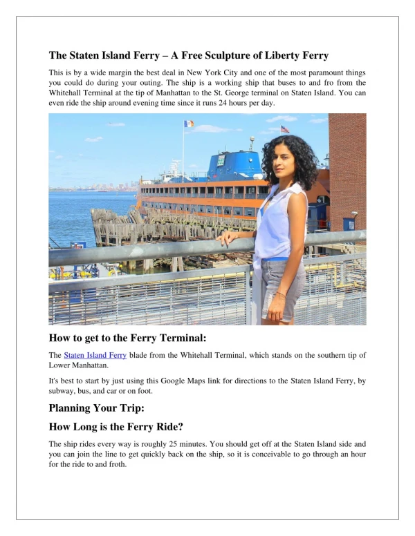
Waterfront Route • Our route took us along the waterfront of Tottenville. • We visited Conference House Park, which included the Billop House (also known as the Conference House), and the Almer G. Russell Recreation Pavilion that overlooked the water. • The waterfront by Angelina’s included the Staten Island Railroad and a view of the Outerbridge Crossing. Behind Angelina’s was a field that ran along the beach, and then the beach itself. • Our route took us down Main Street and onto Amboy Road. • We found some really old buildings, one which even had a well in front. They have their own police station, as well as the Tottenville library, which is two blocks down Amboy. • Along Main Street there were 5 churches and a few taverns. There was also a string of storefronts and side streets with communities of houses. Main Street Route
Waterfront Route The route along the waterfront seemed moderately populated with communities right across from the park, as well as across from the train. The area inside and around Conference House Park incorporated Historic as well as Suburban elements. The park had two historic buildings, while the surrounding area was more suburban with houses along side streets. The populated areas (side streets) were clean, however both beaches had some trash strewn about. The waterfront led to the development of the park which has a beach, as well as the Recreation Pavilion that overlooks the water. By Angelina’s a bridge was built, linking Staten Island to New Jersey.
Main Street Route The route along Main Street seemed moderately populated with living space mixed into the business arena in true village style i.e., strictly suburban. The history of the town was clearly visible along this route - old houses (some that were falling apart), churches (some established in the 1800’s) and taverns – all were common on main street. The area was quite clean. The waterfront was key in the development of Tottenville. “The planting and harvesting of oysters in the surrounding waters created a new industry that sparked the greatest period of commercial and residential development” (Tottenville Historical Society 7). There were 5 churches situated along three blocks of Main St..