Download
1 / 18
190 likes | 350 Views
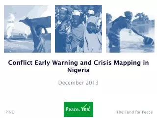
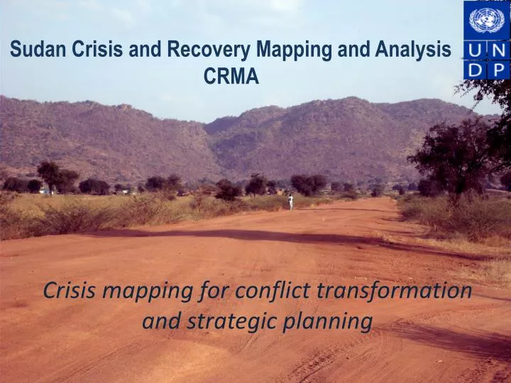
Sudan Crisis and Recovery Mapping and Analysis CRMA . Crisis mapping for conflict transformation and strategic planning. Rationale. Building local capacities for crisis mapping, conflict analysis and strategic planning

E N D
Sudan Crisis and Recovery Mapping and Analysis CRMA Crisis mapping for conflict transformation and strategic planning
Rationale • Building local capacities for crisis mapping, conflict analysis and strategic planning • Using innovative GIS-enabled platforms and participatory methods for early warning and conflict prevention • Strengthening knowledge management and coordination capacity for government partners and humanitarian actors • Institutionalising evidence-based and conflict-sensitive planning across UNDP portfolio
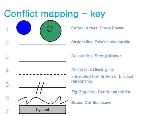
CRMA Methodology CRMA CRMA
Key achievements • Participatory mapping cycles of conflict, threats and risks completed for all states of West Darfur, Eastern Sudan and Three Protocol Areas with South Darfur underway • State governments have developed evidence-based and conflict-sensitive State Situation Analyses that now form the basis for their 5-year strategic planning process • RPCM conflict advisory council and UNDP CRP established and supported in Southern Kordofan to target and consolidate peace-building interventions together with conflicting communities • States in Eastern Sudan made recovery and development of war-affected communities and marginalized groups strategic priorities for the first time • Capacity Development Course and ToT delivered for Red Sea, Kassala, Gedaref, Blue Nile and SKS on: • Data Collection • Data Processing • Data Analysis for Strategic Planning
IMWG established in Khartoum and Darfur, with quarterly Digital Atlases produced providing a common platform for data collection, management and standardization across the UN, with national and international partners • Standardisation Task Force • 7 Digital Atlases released • IDP camp mapping across Darfur • State Information and Knowledge Management (IKM) systems diagnosis and enhancement plan completed for Southern Kordofan, Red Sea, Gedarefand Kassala States. • Technical support offered to ensure successful implementation of CRMA across all ten states of South Sudan
UNDP has become a trusted source of information and analysis for its partners. Internal capacity development underway to ensure that programme staff are able to fully capitalize on the information and tools available for their planning. Intranet Resource Centre designed. • A coordination system has been established for recovery and development actors through a “Who does What, Where and When’ system piloted by the RCSO in SKS and Darfur • Donors and UN agencies receive support to target and design their portfolios in an evidence-based and conflict-sensitive manner. • CIDA • EC • JICA • IDB
Sudan Information Management Working Group (IMWG) • Objective: to facilitate coherent information management for UN agencies and INGOs in cooperation with local actors • Metadata standards • Information Sharing Protocols • Data Licensing • Established: National (North Sudan) IMWG and regional Darfur IMWG established • Products: 7 quarterly updates of the Digital Atlas for Darfur, Three Areas and East Sudan Inter-agency IDP camp mapping in Darfur Online resource-centre for Sudan designed Standardisation Task-Force launched Technical support offered to National IM Network
CRMA IM integrated toolkit Who does What, Where and When Basic Services Mapper 4Ws BSM Services and Infrastructure: status, functionality and resources Project targeting, tracking and coordination Integrated toolkit Crisis & Recovery risk Mapper Incidents and Events Mapper CRM IEM Community perceptions of crisis and socio-economic recovery risks Community stability related incidents and events
Crisis and Recovery related Risks: Geographic targeting in Eastern Sudan • Presence of landmines and small arms • Abandoned areas due to war • Restricted movement • Food insecurity • Limited resources available for resettlement and recovery • Population pressure and strain on resources due to displacement • Coping mechanisms weakened • Tension between livelihood groups
Crisis and Recovery related Risks: Environmental threats to livelihoods in Red Sea • Desert encroachment on agricultural land and pastures • Spread of mesquite threatening food productivity • Oil production threatens marine biodiversity • Desalination plants along the coast cause environmental pollution • NDVI showing limited vegetation across the state
Incidents and Events: Areas of insecurity in Darfur • Consolidated security information from operational actors (OCHA/UNDSS) • Major incidences concentrated in areas around IDP camps, such as Kass and Kutum • Map used for UNAMID operations
Basic Services and CRM: Access to education in Blue Nile State • Geographic distribution of primary and secondary schools • Heat map showing density of non-functioning schools
Conflict Management and Early Warning RPCM - Capacity development of local institutions - • Participatory conflict risk mapping cycle • Multi-actor Conflict and Security Analysis Report • Peacebuilding conferences consolidating prioritised interventions • Integrated rapid response mechanism • Monitoring of minimum essential indicators for early warning and prevention
CRMA Phase II • Component I: • National and State information and knowledge management capacity enhancement • Establishment of a National Information Management Network • Strengthening aid coordination management capacities in MIC • Sustainable integration of CRMA toolkit in UNDP programme management and RCSO activity • Institutionalisation of the UN IMWG • Standardisation of approach and CRMA replication • Component II: • Implementation of full CRMA cycle across Darfur, including full-scale roll-out of capacity development efforts
(1) • Consolidation of basic layers of information (IMWG Atlas) • (4C) • Early Warning System CRMA PROCESS CYCLE • (6) • Capacity development, and supported roll-out of DB/GIS tools • (2) • Participatory Mapping Cycle • (4B) • Develop and Monitor Minimum Essential Indicators (MEI) • (3) • Data Processing and Validation CRMA • (4A) • Support to Consultative Analysis • (5A) • Targeting for CBR and CRP intervention • (5B) • Support to Evidence-based and Conflict Sensitive Strategic Planning
Replication Opportunities and Resources • Challenges: • Delivering as One • Evidence-based and conflict-sensitive programming in crisis settings • Critical responses in RCSO and UNDP COs on Info Management and Strategic Planning: • IMWG information management platform • 4Ws coordination support • Crisis mapping and knowledge management for UNDP CO programming • Conflict mapping and early warning through local institutions
CRMA resources Processes, tools, evaluations documented to ensure lessons learned • Full CRMA manual • Project Overview and Structure • IMWG (including TORs and Info Sharing Protocols) • GIS Support and IM toolkit • CRM Methodology and Best Practices • Analysis Support Methodology • Support to Evidence-based and Conflict Sensitive Planning • Capacity Development on Knowledge Management for Strategic Planning (including process overview, training manuals and materials) • Standardized ArcReader GIS package • Common, customizable information-sharing, GIS-enabled platform • Strategy and support structure for replication of approach, processes and tools