Download
1 / 21
220 likes | 546 Views
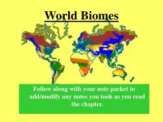
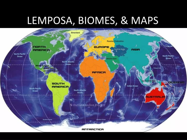
LEMPOSA, BIOMES, & MAPS. High, Mid & Low Latitude Zones. High Latitudes. Mid Latitudes. Low Latitudes. Mid Latitudes . High Latitude. Biomes found in…

E N D
High, Mid & Low Latitude Zones High Latitudes Mid Latitudes Low Latitudes Mid Latitudes High Latitude
Biomes found in… • High Latitudes: Subarctic, Tundra, Icecap • Mid : Mediterranean, Humid Subtropical, Humid Continental, Marine West Coast • Low : Tropical Wet/Dry, Tropical Wet • Various : Highland, Semiarid, Desert
L.E.M.P.O.S.A. The 7 major factors that affect climate…
LATITUDE • The closer you get to the equator, the warmer it gets. • so…the closer you get to the North or South poles the ________ it gets.
ELEVATION The higher you go in the mountains, the colder it gets.
MOUNTAIN BARRIERS (AKA Orographic/Rain Shadow Effect) Winds blow across the ocean & push moisture inland. Moisture cloud reaches the mountains, gets “popped” by the mountain top & rains on the coastal side (ex: California & the Sierra Nevada Mtns.) By the time this cloud reaches the other side of the mountains, the air is dry = no rain.
PROXIMITY TO WATER Land heats & cools more quickly than water. Closer an area is to a large body of water, = smaller the difference in temperature (ex: California Coast) Farther away from water = greater difference in temperature (ex Kansas).
OCEAN CURRENTS • Warm currents circulate from the equator, cold currents from the poles. • These currents affect climate – make certain areas of the world warmer/cooler, wetter/drier than they would otherwise be.
Storms Temporary and severe changes in weather.Storms Do not necessarily affect climate, but they do occur regularly in certain parts of the world & are associated with certain climates.
ATMOSPHERIC PRESSURE High Pressure = fair weather Low Pressure = wet weather
ROTATION = 1 Day Takes the earth 24 hours to make one complete rotation on it’s AXIS. REVOLUTION = 1 Year. Takes the earth 365 ¼ days to make one complete revolution around the SUN.
Map Projections Mercator: Peters
Mercator Projection Landmasses greatly distorted in order to keep water features accurate. There were no planes, trains, and automobiles back then. So world maps were made with shipping routes in mind.
Peters Projection Land surface size represented more accurately, but makes landmasses appear much longer than they actually are. Look at Greenland vs. Africa below compared to the Mercator map (previous slide). On Peters, Greenland is shown more accurately & is accurately represented as smaller than Africa. How would Africa look if African mapmakers had made some of our first maps rather than Europeans??
Latitude/Parallel Longitude/Meridian (East and West) (North and South) Equator – the main belt…zero line of latitude Prime Meridian – the main buttons…zero line of longitude
International Date Line Hour 24 Hour 1
TYPES OF MAPS: Political Maps: Show borders of nations, states, counties etc… Physical Feature Maps: Shows physical features. Water, mountains, plains etc….