Download
1 / 22
220 likes | 310 Views
Analysis of NARCCAP results for extremes in the Canadian Columbia Basin. S. R. Sobie, Climate Scientist, PCIC T.Q. Murdock, Climate Scientist, PCIC H. D. Eckstrand, GIS Analyst, PCIC. NARCCAP User’s Workshop APR 2012. Study area.

E N D
Analysis of NARCCAP results for extremes in the Canadian Columbia Basin S. R. Sobie, Climate Scientist, PCIC T.Q. Murdock, Climate Scientist, PCIC H. D. Eckstrand, GIS Analyst, PCIC NARCCAP User’s Workshop APR 2012
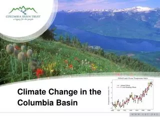
Q: Why do extremes matter?A: Users are planning for them! Columbia Basin Trust:www.cbt.org Communities Adapting to Climate Change Initiative
Indices of extremes • Specialized indices (fire, wind, rain-on-snow) • Return periods (5, 10, 25, …) – fit GEV • CLIMDEX: 27 indices • annual (monthly) resolution • e.g. # days above 90th %-ile, warm spells, annual days with precipitation > 10 mm, etc. • officially adopted by WMO → ETCCDI • similar to STARDEX • R and Fortran code available • based on daily Tmin, Tmax, and P (from Frich et al. 2002)
2050s Annual TX90p, TN10p Ratios 2.6 2.0 2.0 1.7 TX90p 0.4 TN10p 0.3 0.3 0.4
2050s Seasonal TMax, TMin Anomalies TXx 2.2 0.7 2.6 2.6 TNn 2.9 1.6 3.6 3.6
2050s Annual R95p Percent Anomalies 4 7 6 5 4 6 6 2
2050s Seasonal RX1Day Anomalies 2.8 1.6 -0.1 2.6 RX1Day -0.2 1.0 0.3 2.5
Summary • People in BC need information on climate extremes for adaptation planning • RCMs are useful for this • Mid-century: more extreme warm events, precipitation extremes • Seasonal projections are necessary • Other indices of extremes: report (soon) at www.PacificClimate.org & paper to follow
AcknowledgmentsTrevor Murdock – Project SupervisorHailey Eckstrand – GIS wizard Seth McGinnis – NARCCAP supportGerd Bürger – Analysis of extremes James Hiebert, Dave Bronaugh – Data support Thank you Comments, questions, criticism: ssobie@uvic.ca More info on PCIC: www.PacificClimate.org
Data sources • North American Regional Climate Change Assessment Project (NARCCAP ): winter season (Dec-Jan-Feb) • NCEP-DEO AMIP-II Reanalysis (R-2): M. Kanamitsu, W. Ebisuzaki, J. Woollen, S-K Yang, J.J. Hnilo, M. Fiorino, and G. L. Potter. 1631-1643, Nov 2002, Bul. of the Atmos. Met. Soc. • CRU TS2.1: interpolated station observations 50 km resolution: Mitchell and Jones, 2005: An improved method of constructing a database of monthly climate observations and associated high-resolution grids. Int. J. Climatology, 25, 693-712, Doi: 10.1002/joc.1181. • Additional observations: Environment Canada climate stations, CANGRID, UDEL, NARR2m, VIC driving data • XDS downscaling conducted at PCIC for PIEVC project
Regional Index Projections • Spatial percentiles of results • Easily quantify projection ranges
Local: RCM threshold scaling & statistical downscaling design threshold RCM threshold equal probabilities 15
Extreme warm temperature5-year event 2.1 2.4 1.6 3.6 3.4 1.8 2.1 3.7
Extreme warm temperature25-year event 5.5 4.0 3.0 10.2 ` 2.8 2.1 9.8 10.5