Download
1 / 64
640 likes | 676 Views
Tropical-Extratropical Transition. ATMS 551. A Few References.

E N D
Tropical-Extratropical Transition ATMS 551
A Few References • Sarah C. Jones, Patrick A. Harr, Jim Abraham, Lance F. Bosart, Peter J. Bowyer, Jenni L. Evans, Deborah E. Hanley, Barry N. Hanstrum, Robert E. Hart, François Lalaurette, Mark R. Sinclair, Roger K. Smith and Chris Thorncroft. 2003: The Extratropical Transition of Tropical Cyclones: Forecast Challenges, Current Understanding, and Future Directions. Weather and Forecasting: Vol. 18, No. 6, pp. 1052–1092. • Patrick A. Harr, Russell L. Elsberry and Timothy F. Hogan. 2000: Extratropical Transition of Tropical Cyclones over the Western North Pacific. Part II: The Impact of Midlatitude Circulation Characteristics. Monthly Weather Review: Vol. 128, No. 8, pp. 2634–2653. • Patrick A. Harr and Russell L. Elsberry. 2000: Extratropical Transition of Tropical Cyclones over the Western North Pacific. Part I: Evolution of Structural Characteristics during the Transition Process. Monthly Weather Review: Vol. 128, No. 8, pp. 2613–2633.
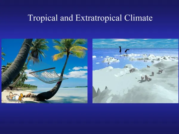
Tropical Versus Extratropical Cyclones: The Differences
Extratropical Transition • A significant number of tropical cyclones move into the midlatitudes and transform into extratropical cyclones. • This process is generally referred to as extratropical transition (ET). • During ET a cyclone frequently acquires increased forward motion and sometimes intensify substantially, so that such systems pose a serious threat to land and maritime activities. • Often poorly forecast by current day numerical models and associated with periods of poor synoptic predictability over a wide area downstream.
ET • Extratropical transition occurs in nearly every ocean basin that experiences tropical cyclones with the number of ET events following a distribution in time similar to that of the total number of tropical cyclone occurrences. • The largest number of ET events occur in the western North Pacific while the North Atlantic basin contains the largest percentage of tropical cyclones that undergo ET with 45% of all tropical cyclones undergoing ET.
Transition • Tropical cyclones transform into extratropical cyclones as they move northward, usually between 30° and 40° latitude. • Interaction with upper-level troughs or shortwaves in the westeries, and preexisting baroclinic zones is an important factor in ET. • During extratropical transition, cyclones begin to tilt back into the colder air mass with height, and the cyclone's primary energy source converts from the release of latent heat from condensation (from convection near the center) to baroclinic processes.
ET • The low pressure system eventually loses its warm core and becomes a cold-core system. • During this process, a cyclone in extratropical transition will invariably form or connect with nearby fronts and/or troughs and the size of the system will usually appear to increase. • After or during transition, the storm may re-strengthen, deriving energy from primarily baroclinic processes, aided by the release of latent heat. • The cyclone will also distort in shape, becoming less symmetric with time, but sometimes retains a tight, tropical-like core.
Satellite Sequence
Some Big Impacts of ET • Severe flooding associated with the ET of Tropical Storm Agnes [1972 • Hurricane Hazel (1954) resulted in 83 deaths in the Toronto area of southern Ontario, Canada. In the northwest Pacific, severe flooding and landslides have occurred in association with ET. • Tropical Storm Janis (1995) over Korea, in which at least 45 people died and 22, 000 people were left homeless. • In one southwest Pacific ET event (Cyclone Bola) over 900 mm of rain fell over northern New Zealand). • Another event brought winds gusting to 75 m s-1 to New Zealand's capital city, Wellington (Hill 1970 ), resulting in the loss of 51 lives when a ferry capsized.
ET Impacts • Extratropical transition has produced a number of weather-related disasters in eastern Australia, due to severe flooding, strong winds, and heavy seas [e.g., Cyclone Wanda in 1974). • Tropical systems that reintensify after ET in the North Atlantic constitute a hazard for Canada [e.g., Hurricane Earl in 1998 and for northwest Europe. The extratropical system that developed from Hurricane Lili (1996) was responsible for seven deaths and substantial economic losses in Europe. • Many of the largest NW windstorms are ET events (Columbus Day Storm, 1981 storm and others)
The Other Direction As Well! • Less frequently, an extratropical cyclone can transit into a tropical cyclone if it reaches an area of ocean with warmer waters and an environment with less vertical wind shear. • The process known as "tropical transition”-TT involves the usually slow development of an extratropical cold core vortex into a tropical cyclone
ET and Precipitation • During an ET event the precipitation expands poleward of the center and is typically maximum to the left (right) of the track in the Northern (Southern) Hemisphere. • The change in the structure of the precipitation field from the more symmetric distribution in a tropical cyclone to the asymmetric distribution during ET can be attributed to increasing synoptic-scale forcing of vertical motion associated with midlatitude features such as upper-level PV anomalies or baroclinic zones. • Ets have been associated with extraordinarily large precipitation amounts and associated flooding.
Precipitation and ET • DiMego and Bosart (1982a) diagnosed the contributions to the vertical motion during the ET of Agnes (1972) and showed how the forcing of vertical motion evolves from an almost symmetric forcing due to diabatic heating during the tropical phase to an asymmetric quasigeostrophic forcing during ET. • A majority of the precipitation associated with ET occurs poleward of the center of the decaying tropical cyclone. • Harr and Elsberry (2000) identified this as a region of warm frontogenesis north and east of the tropical cyclone center. Harr and Elsberry (2000) showed that the ascent and frontogenesis in the warm frontal region had a gentle upward slope. • This suggests that warm, moist air in the southerly flow ahead of the tropical cyclone center ascends along the gently sloping warm front, allowing the region of precipitation to extend over a large area ahead of the tropical cyclone.
ET and Predictability • ET events are often not predicted well by today’s synoptic models (e.g., GFS) • The interaction of ET’s with the midlatitude jet stream/baroclinic zone can result in the production of Rossby wave trains/packets that can have a large impact on downstream flow. • ET events are often associated with periods of poor predictability over large areas downstream of the transition.
Impacts on Forecasting Maemi Isabel Isabel Maemi Fabian Source: NCEP/EMC model verification web page The movement of a tropical cyclone into the midlatitudes often induces a large downstream Rossby-wave like response. These large-amplitude circulation features are often mispositioned, which contributes to errors in the forecast timing and interaction between the decaying tropical cyclone and the midlatitude circulation into which it is moving.
Impacts on Predictability A “plume” of increased std. dev. propagates downstream of the extratropical transition forecast position. Local maxima occur in the base of each successive trough of the ET-induced wave train. Largest variability exists over North America. TY Tokage ET Time TY Tokage http://agora.ex.nii.ac.jp/digital-typhoon/
Anomaly correlations for NOGAPS forecasts of 500-hPa heights over the North Pacific (20°–70°N, 120°E–120°W) during Aug 1996. Each panel represents a specific forecast interval, as labeled. The extratropical transition events that occurred during the month are marked in (a).
The 500-hPa height (contours) and mean sea level pressure (shaded) from the NOGAPS model for Typhoon David (1997). Top row: analyses at 0000 UTC 18 Sep (left), 0000 UTC 19 Sep (middle), and 0000 UTC 20 Sep (right). Middle row: corresponding forecasts initialized at 0000 UTC 16 Sep. Bottom row: corresponding forecasts initialized at 0000 UTC 17 Sep
Interaction With Midlatitude Troughs • Correct phasing is crucial. • If the TC is too far east with little upper support (and cold water) it dies. • If TC too west, it is west of the upper support and is facing lots of cold dry air…it dies. • Only for a critical ~5 deg swath does it have everything…upper support, ability to tap warm, moist air.
Hovmoeller plot for forecast from 9 September 2003, 12 UTC: root mean square difference (RMSD) of ensemble forecasts with perturbations averaged over 40° - 50° N for 200 hPa (left) and 500 hPa (right). The high values of RMSD spread downstream from Typhoon Maemi (black dot) at both levels. European Centre for Medium Range Weather Forecasts (ECMWF) Ensemble Prediction System EPS http://www.onr.navy.mil/obs/reports/docs/06/mmjoness.pdf
0000 UTC 10 Oct 62 TY Emma TY Freda http://agora.ex.nii.ac.jp/digital-typhoon/ Large-scale wave train associated with the digging trough behind the extratropical transition of Emma and building ridge ahead of the extratropical transition of Emma contributed to the trough over the eastern North Pacific and the movement of the ex-Freda cyclone into the Pacific Northwest. http://www.cdc.noaa.gov Emma Ex-Freda 250 hPa height anomaly 9-13 Oct 1962
The Details of ET • The physical mechanisms associated with the transformation stage of the extratropical transition of a tropical cyclone were simulated with a mesoscale model by Ritchie and Elsberry (2001, MWR). • There appears to be three steps in the transformation, which compares well with available observations.
Step 1 • During step 1 of transformation when the tropical cyclone is just beginning to interact with the midlatitude baroclinic zone, the main environmental factor that affects the tropical cyclone structure appears to be the decreased sea surface temperature. • The movement of the tropical cyclone over the lower sea surface temperatures results in reduced surface heat and moisture fluxes, which weakens the core convection and the intensity decreases.