Download
1 / 71
720 likes | 823 Views
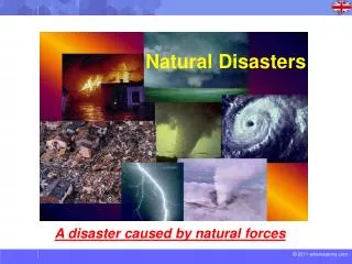
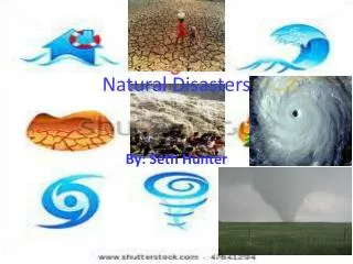
Natural Disasters. Tornadoes, Hurricanes and Earthquakes. Home Quiz Exit End . Tornadoes. A tornado is a violently rotating column of air in contact with the ground and out from a cumulonimbus cloud.

E N D
Natural Disasters Tornadoes, Hurricanes and Earthquakes Home Quiz Exit End
A tornado is a violently rotating column of air in contact with the ground and out from a cumulonimbus cloud. • Tornadoes are capable of inflicting extreme damage. Tornadoes
Tornadoes can be classified as “weak”, “strong”, and “violent”. Weak tornadoes often have a thin rope-like appearance. • About 7 out of 10 tornadoes are weak with rotating winds no greater than 110 mph. • The typical strong tornado often has a classic funnel- shaped cloud. Speeds vary from 110 to 200 mph.
Nearly 3 and 10 tornadoes are strong. Back to Quiz
Less than 2% of all tornadoes reach the 200+ mph winds. • Most violent tornadoes only produce home-leveling damage within a small area. • Less than 5% of the 5,000 affected homes in Wichita Falls, TX were leveled by this massive 1979 tornado.
The Fujita Intensity scale, or F scale, categorizes tornado severity based on observed damage to man-made structures and not on recorded wind speeds. • F0: Gale Tornado (40-72 mph)- light damage. Some damage to chimneys, and branches broken off of trees. • F1: Moderate Tornado (73-112 mph)- moderate damage. Roofs peeled off. Mobile homes are pushed off of the foundations. Fujita Intensity Scale
F2: Significant Tornado (113-157 mph)- considerable damage. Mobile homes are demolished, and large trees are uprooted. • F3: Severe Tornado (158-206 mph)- severe damage. Trains overturned, and cars are thrown. • F4: Devastating Tornado (207-260 mph)- devastating damage. Well-constructed houses are leveled. • F5: Incredible Tornado (261-318 mph)- car- sized missiles flying through the air.
The tri-state tornado outbreak of March 18, 1925 killed 689 people in Missouri, Illinois and Indiana. • Others include: May 6, 1840, 317 people killed. May 27, 1896, 255 people killed. Tornadoes on consecutive days in 1936 killed 216 people on April 5th and 203 people on April 6th. Deadliest Tornadoes
What are Earthquakes? • Earthquakes are the shaking, rolling or sudden shock of the earth’s surface.
Where do they occur? • Earthquakes happen along the fault lines in the earth’s crust. Back to Quiz
How do you know? • Earthquakes can be felt over large areas although they usually last less than one minute. • Earthquakes CANNOT be predicted, although scientists are working on it!
Most of the time you will notice an earthquake by the shaking of the ground. You may notice hanging objects swaying or wobbling items on shelves. Sometimes you may not hear a low rumbling noise or fell a sharp jolt. A survivor of the 1906 earthquake in San Francisco, CA said it was like riding a bike down a flight of stairs.
Intensity • The intensity of an earthquake can be measured. One measurement is called the Richtor Scale. Earthquakes below 4.0 on the scale usually don’t cause any damage. Earthquakes over 5.0 can cause damage. A 6.0 earthquake is considered strong and a 7.0 is considered major.
Earthquakes can often occur when tectonic plates collide. • When plates collide head-on, they push each other up and form mountains.
When one plate dives below another plate, it creates a subduction zone as the dividing plate is crushed and melted. This process often creates volcanoes as the magma (molten rock) rises up to the surface.
When two plates slide past each other, they create a transform fault, like the San Andreas Fault.
Earthquakes can happen in any of these situations. Despite the powerful forces driving plate movement, the plate spend much of the time locked in place by the friction of the plates rubbing against each other. Eventually the build up so much pressure that they snap forward. Shockwaves from the sudden movement shoot out in all directions creating an earthquake.
The two Great Plates • The two great plates, the Pacific and North American, meet in CA. The Pacific plate is moving North, creating a transform fault. Over the last 20 million years, the Pacific has moved about 200 miles north. If it continues moving as predicted, in another 20 million years, San Francisco and Seattle will become neighbors!
Because the San Andreas fault curves around Los Angeles, CA, and then into the Pacific Ocean in northern CA, the two plates cannot slide smoothly against each other.
Seismologists have been studying California’s faults for decades. They now say that the San Francisco Bay Area has a 70% chance of a major earthquake before 2030. This map shows the probability of an earthquake from each of the these faults.
The rate of earthquakes in the San Francisco Bay area abruptly dropped after the Great 1906 Earthquake.
Earthquakes can also occur within plates, although plate-boundary earthquakes are more common. Less than 10% of all earthquakes occur within plate interiors. The New Madrid earthquakes of 1811-1812 and the 1886 Charleston earthquakes occurred within the North American Plate.
The point beneath the earth’s surface where the rocks break and move is called the focus of the earthquake. The focus is the underground point of originof an earthquake. Directly above the focus is the epicenter. Back to Quiz
Seismic Waves • There are three main types of seismic waves: Primary waves, Secondary waves, and Surface waves.
Primary Waves • These are waves that travel the fastest. They arrive at a given point before any other type of seismic wave. P waves travel through solids, liquids and gases. • P waves are push- pull waves. As P waves travel, they push rock particles into the particles ahead of them which compress them. Then the rock particles bounce back. They hit the particles behind them that are being pushed forward.
Secondary Waves • Secondary waves are waves that do not travel through the earth as fast as P waves. They arrive at a given point after P waves. S waves travel through solids but not liquids or gases.
Surface Waves • These are the slowest moving waves. L waves arrive at a given point after P and S waves. These originate at the epicenter. Although they are the slowest moving waves, they usually cause more damage than P and S waves.
Seismograph • This is an image of a seismograph, an instrument used to record the energy released by an earthquake. When the needle is moved away by the motion of the earth, it leaves a wavy line.
What is a hurricane? • Violent cyclonic storm that develops in the tropical region. • Wind speeds are greater than 74 mph. Back to Quiz
Rotation and Pressure • The direction of rotation of a hurricane is counterclockwise. • The barometric pressure inside of a hurricane is low.
When is Hurricane Season? • Hurricane season is June 1st through November 31st. Back to Quiz
The Role of the National Weather Service • The National Weather Service provides weather information such as date from satellites to the people of an area. • It is also responsible for issuing watches and warnings to the media and general public.
Watch vs. Warning • Hurricane Watch: Tropical Storm poses a threat to coastal areas within 36 hours • Hurricane Warning: Tropical Storm conditions are expected in a coastal area within 24 hours.
Hurricane Conditions • Warm ocean temperatures ( >80 F) up to 60 m deep. • Little to no wind sheer. • Low pressure system at least 5 degrees North or South of the Equator. • Rotation caused by winds.
Major Fueling Source Heat energy evaporating from the ocean surface
Storm Surge • A storm surge is a large wall or dome of water that rushes into the coastline as a result od a hurricane making landfall. • Below are the areas affected by high storm surges.
What Destroys a Hurricane? • Strong VERTICLE winds • Cold Water • Movement over land -friction -Lack of moisture
Hurricane Protection • Listen to warnings • Take all warnings seriously • Follow evacuation procedures • Prepare food and water for extensive power outages
QUIZSelect your answers with the GREYsquares beside the answers
1. What are the 3 categories of tornadoes? • Weak, Strong, Intense • Low, Medium, High • Weak, Strong, Violent • Fine, Devastating, Deadly Back to Section