Download
1 / 6
60 likes | 139 Views
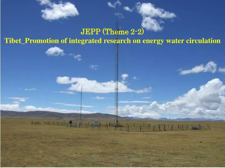
JEPP (Theme 2-2) Tibet_Promotion of integrated research on energy water circulation. Energy and Water Cycle over the Tibetan Plateau & Disaster Mitigation and Water Resources in Monsoon Asia.

E N D
JEPP (Theme 2-2)Tibet_Promotion of integrated research on energy water circulation
Energy and Water Cycle over the Tibetan Plateau&Disaster Mitigation and Water Resources in Monsoon Asia
Japan Earth observation Promotion Plan (Theme 2-2)Promotion of Integrated Observation Study of Energy/Water Circulation over the Tibetan Plateau Establishment of land base stations in data sparse area Integrated Database System A new site near D66 (Aug. 28, 2006) 3-D Visualization In addition to the operational stations, research stations in GAME/ Tibet and Camp/Tibet are updated for the longer and continuous observation. Twenty four GPS stations for precipitable water, three PBL tower and a profiler are now being constructed. State of arts information technology is applied to implement a sophisticated database system to store and to use land-based and satellite data interactively. Satellite Data Archive and Use Energy/Water cycle estimation/ prediction with data assimilation Soil water content (SSMI) Surface heat flux (FY2C) An application of integrated database system. The assimilated soil water content (upper panel) shows clear west-east contrast as compared with existing analysis (lower panel). Data Assim. Product The satellite data are collected from various polar orbit satellites. In addition the data from the Chinese geostationary satellite, FY2C, are received and archived, which are used to produce surface temperature and various land surface fluxes. Toward the better prediction and the mitigation of meteorological and hydrological hazards! Existing model
2005-2007 JEPP_TIBET GAME/CEOP Sites Satellite data archiveprocessing Integrated Data Archive 2005-2009 JICA(CAMS/CMA) (JP-CHINA joint project) GPS_precipitable water Obs.(26)PBL Tower(incl. Turbulence, 3)Wind Profiler (2) AWS(7+and other opr. AWS) Monitoring and Research Platform (MORP) by Institute of Tibetan Plateau/CAS
参考:中国科学院青蔵高原研究所 ナム湖観測塔 チョモランマベース観測塔 6500 5196 4500