Download
1 / 63
660 likes | 907 Views
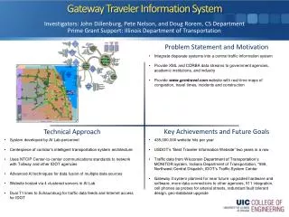
Advanced Traveler Information Systems (ATIS). ATIS. Intended to Manage travel demand Reduce traveler frustration/anxiety Increases perceived level of service Increases “serenity factor” – reduces Road Rage Improve traveler decision making Results in more efficient travel

E N D
ATIS • Intended to • Manage travel demand • Reduce traveler frustration/anxiety • Increases perceived level of service • Increases “serenity factor” – reduces Road Rage • Improve traveler decision making • Results in more efficient travel • Creates awareness of alternatives
ATIS • All of these aspects have positive benefits in the areas of • Improved safety • Energy savings • Time savings • Good public acceptance
Manage Travel Demand • Reduce (peak) demand • Reallocating demand to alternative routes • Reallocating demand to alternative modes • Reallocating demand to alternative time of day • Eliminating discretionary trips during times of bad congestion or high delay
Reduce Frustration • Knowing the size / length / duration of backups reduces travel stress • Allows action to be taken, or • Confirms that no action can/needs to be taken
Reduce Frustration • Frustration causes bad decision making • Reckless driving behavior • Short tempers • Irrational behavior
Improve Traveler Decision Making • With good information, travelers can: • Make timely decisions • Choose correctly (for themselves and their trip) on • Routing • Time of departure • Mode • To not make the trip or to alter their trip destination
Improve Traveler Decision Making • Can select less congested time / route / destination • IF that alternative is less distasteful than the original trip • Provides a sense of “self control” to traveler
Improve Traveler Decision Making • The decisions actually made are not necessarily the ones that facility operators want • Cut through traffic • Congestion forms on other routes • System optimization versus user optimization • Many travelers are reluctant to change
Summary of traffic findings • Context may matter most for traffic ATIS • Higher congestion, longer congestion delay, limited alternatives • Next in line is ATIS service quality • Few will use low quality information, other than the radio, regardless of context • In high congestion regions, users consult traffic information strategically; in low congestion regions, they use it tactically.
Summary (continued) • Weather is a traffic incident that stimulates ATIS use in all contexts • Drivers with greater time and route flexibility use ATIS more frequently • Different people prefer different access media • ATIS customers feel they save time and reduce stress
Extreme weather conditions influence ATIS demand: San Antonio web site Heavy Rainand Floods
Summary of transit findings • ATIS transit customers want information that • reduces the uncertainty associated with transit trips • increases their control over time and travel decisions • Transit information should be • conveniently located relative to trip decisions • easy to access and use • up-to-date • more user friendly and multidimensional on the web • The greatest benefit of transit ATIS may be for those who would otherwise switch to SOV, thus aiding in rider retention
Examples • LA Olympics • Seattle, I-5 reconstruction, 1985 • 1990 Goodwill Games in Seattle • I-90 Snoqualmie pass
Timing of Information Delivery • Pre-trip • En-route
Pre-Trip • Can effect • Mode • Time of departure • Route • Destination • Decision to make the trip at all
En-route • Potential effect is based on when you provide the desired information • Change route • Change mode (if P&R is viable alternative) • Give up trip / change destination • Change driving behavior (slow down)
Pre-trip & En-route • Information differs depending on what you want / expect to be done with that information • General information (congestion/accident ahead) • Routing (use alternative routes / modes – usually needs to include specific directions)
Dissemination Media • Media matched to message type, length and timing • TV (full time versus conventional news cast) • Radio • Variable/changeable message sign (VMS / CMS) • Highway Advisory Radio (HAR) • Web • Specialty devices (route guidance devices)
Dissemination Media • Other media • E-mail • Mail • Telephone (hotline – cell phone / conventional phone) • Kiosks (web based?)
Attributes of Dissemination Technologies • Availability to the public • Timeliness • Geographic coverage of message • Length of message • Cost to produce message
Attributes of Dissemination Media • Cost to operate / maintain the delivery device • User cost • Producer cost • Who controls the device? (public / private)
Traffic TV • Easy access to traffic hotspots on UW2.TV • Channel 76 on digital cable
Technologies • TV • Ubiquitous • Low cost to public (user) • Higher cost to disseminator • Short duration message • Misses details, some geographic areas • Only for pre-trip information • Generally not available on demand
Technologies • Radio • Ubiquitous • Low cost to public (user) • Short duration message • Misses details, some geographic areas • Pre-trip or en-route information • Generally not available on demand • Timeliness/accuracy of reports often questioned
Technologies • VMS / CMS / DMS • Good for en-route information • Only at locations where they can be seen (geographically constrained) • Short duration message • Messages need to be current or will be ignored • Location is important • Prior to decision point
Technologies • Highway Advisory Radio (HAR) • Limited power/range makes this a en-route technology • Longer message about a specific geographic area • Can you keep the message up to date? • Questions about how many people will turn their radios to the proper channel
Web Sites • Pre-trip information (becoming en-route with wireless web) • Ability to provide very detailed, very specific information (if that information is available) • Wide geographic area coverage is possible • Allows interaction with the customer • Not everyone has an internet connection (social equity?) • How accessible is it at home?
Private Sector Potential market for traveler information is huge Value to other private sector businesses likely to significantly exceed its value to the public sector 300 M people in US * 5% customers * $5/month = $900 M per year Few have made a successful business of it yet
Radio Traffic Services • Metro Networks, Shadow Traffic, Smart Route Systems (Wedgewood One) • Exchange air time for traffic reports • Sell airtime to advertisers
Traffic.com Owned by NavTeq The Weather Channel Motorola's VIAMOTO™ Solutions XM Satellite Radio XM NavTraffic Radio and TV stations AOL
INRIX INRIX is the leading provider of real-time, historical and PREDICTIVE traffic information offering the broadest coverage, exceptional accuracy and innovative technologies to ensure the success of our customer's navigation and traffic-enabled solutions.
Inrix • Real-Time Flow Coverage Highlights: • U.S. Metropolitan Areas: 122 • U.S. Road Miles: Over 51,000 • Real-Time Alert Miles: 103,000 • European Coverage: Over 12,000 kilometers throughout the U.K. and the Netherlands. • Historical Average Speeds Highlights: • U.S. Road Miles: Over 800,000 • Incident Coverage Highlights: • U.S. and Canadian Metropolitan Areas: 113 markets • Europe: 16 Countries
DASH • Uses both cellular radio and Wi-Fi networks to automatically and wirelessly update its maps, traffic and software • Vehicles act as probe vehicles communicating with a central database and each other.
Devices • Research indicates that people don’t want a stand alone “traffic information” device • GPS equipped cell phone, Blackberry, etc. • Requires web sites designed for mobile devices.