Download
1 / 26
260 likes | 400 Views
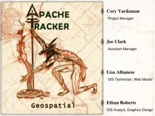
Cory Vardaman Project Manager Joe Clark Assistant Manager Lisa Albanese GIS Technician, Web Master Ethan Roberts GIS Analyst, Graphics Design. Warrant Visualization and Mapping : Progress Report. Prepared for the New Braunfels Police Department. Background.

E N D
Cory Vardaman Project Manager Joe Clark Assistant Manager Lisa Albanese GIS Technician, Web Master Ethan Roberts GIS Analyst, Graphics Design
Warrant Visualization and Mapping:Progress Report Prepared for the New Braunfels Police Department
Background Using automated GIS tool to map un-served warrants • Visualization • Data Management • Proactively pursue outstanding warrants • Planning operations • Increase safety More efficiently and effectively manage outstanding warrants
Scope Based on needs assessment conducted on February 7th: • Limited to the local area • Within the Extra-Territorial Jurisdiction • Limited to Class C Misdemeanor warrants All deliverables by the 4th of May 2012
New Braunfels ETJ The ETJ is the only area NBPD can serve warrants
Phases Phase I: Data Preparation/ File Conversion Phase II: Basic Warrant Tool Development Phase III: Advanced Tool Construction Phase IV: Tool Proofing and Refinement
Phase I: Data Collection Objective: collect samples from the CRIMES warrant database and prepare “scrubbed” warrant files for geocoding.
Batching Phase I: Data Preparation
Phase II: Basic Warrant Tool Development Objective: Develop the prototype geocoding tool design. • Pros- custom tailored to clients' needs. Streamlined for accuracy vs pre-made locators • Cons – runs the risk of being outdated if data files are not updated.
Phase II: Basic Warrant Tool Development Objective: Develop the prototype geocoding tool design. • Pros- locators are maintained by the GIS department and resides on the server. Easier to incorporate tool with existing resources on server. • Cons – less accurate in terms of street matching.
Phase II: Basic Warrant Tool Development Objective: Develop the prototype geocoding tool design. • Automate the conversion of initial and subsequent updating of warrant data into tool. • In addition to the composite address locators, a model has been built to identify zip codes outside of the New Braunfels' Extra-Territorial Jurisdiction (ETJ) and filter the records of non local warrant data.
Phase II: Basic Warrant Tool Development Objective: Develop the prototype geocoding tool design. • 100% of the six records with non-local were identified and filtered.
Phase III: Advanced Tool Construction Objective: enhancement of the geocoding tool to include background base layers, database management and map design and visualization. • Pros-Simplicity in visualization • Cons – Runs the risks of being outdated. Requires the layers to be regularly updated.
Phase III: Advanced Tool Construction Objective: enhancement of the geocoding tool to include background base layers, database management and map design and visualization. • Pros-Updated by CoNB. Provides full extent of New Braunfels in various zoom levels. Rich visualization. • Cons – more elaborate design with map layers that may not pertain to the NBPD needs.
Phase III: Advanced Tool Construction Objective: enhancement of the geocoding tool to include background base layers, database management and map design and visualization. Geodatabase • Warrant tool will be installed in a geodatabase format configuable with New Braunfels GIS servers. • replicate the workspace environment as close as we possible to make it configurable to the ArcSDE environment. • Modifications will be configured by IT or GIS personnel to make this tool accessible in ArcSDE environment.
Phase III: Advanced Tool Construction Objective: enhancement of the geocoding tool to include background base layers, database management and map design and visualization.
Phase IVTo Do • Data Recycling • Warrant Model Installed/Tested on NBPD Server • Troubleshooting • Additional Project Considerations
Phase IVData Recycling • Begins with external or internal conversion process • New active warrant files must be first correctly sourced • Various methods… • Available conversion software (Novyxis): extra cost • Existing script: extra time • Encode system produces acceptable table formats: external forces • Regular model “feeding” • “Manual automation”
Phase IVWarrant Model Installed/Tested on NBPD Server • Need for the final output available to entire NBPD • Accessed, updated, and edited through… • ArcMap • ArcCatalog • Successful Integration dependent upon… • OurWarrant File Geodatabaseand YourNBPD Server compatibility • “Hollow” tool
Phase IVTroubleshooting • Reserved for final model streamlining • Possible conflicts include… • NBPD Server and warrant model incompatibility • Feeding the model and producing inaccurate address points • Frequency, intensity, and volume of .xml files and efficient recycling • Assessing unforeseen errors
Phase IVAdditional Project Considerations • Web Mapping Service • Utilizing NBPD ArcSDE Server • Integrating warrant geodatabase online • Creating night/day base maps • Query operations
Updated Schedule • Adjustment for the extension of file conversion step • Phase II begun 3 weeks early • Phase III moved up 1 week, cut short 1 week • Phase IV increased by 1 week • Disadvantage • File conversion more difficult • Vital to model efficiency • Advantage • Allowed simultaneous development of several phases • Better integration of various model “organs”
C= Complete • IP= In Progress • TD= To Do February • Phase I: Data Preparation/Collection • .XML warrant file extraction, cleaning, conversion C • CRIMES Dispatch system “batching” C • Testing of converted files C • Data collectionC 1 2 March • Phase II: Basic Warrant Development Tool • Address locator referencing (standardized address) C • Warrant file geocoding C • Additional refinement C Updated Schedule 3 4 5 6 • Phase III: Advanced Tool Construction • Geocoded warrant file implementation IP • Creation of file geodatabaseand map document C • Model streamlining TD • Reference map design IP April 7 8 9 10 11 • Phase IV: Tool Proofing and Refinement • Model enhancement with data recycling • Warrant model installed and tested on NBPD server • Troubleshooting • Additional project considerations May
Questions… • Point of Contact: Ethan Roberts…………..…ethanroberts@txstate.edu