Download
1 / 13
140 likes | 153 Views
Ch. 10 Putting Maps Together: Map Overlay. John Van Auken. Definitions. Map Overlay Sieve Mapping Co-registration Boolean Overlay. 4 steps to Map Overlay. Determine the inputs Get the data Reference the maps to the same projection/coordinate system Overlay the maps.

E N D
Ch. 10 Putting Maps Together: Map Overlay John Van Auken
Definitions • Map Overlay • Sieve Mapping • Co-registration • Boolean Overlay
4 steps to Map Overlay • Determine the inputs • Get the data • Reference the maps to the same projection/coordinate system • Overlay the maps
Determining the Inputs • Knowledge-Driven – when we use the ideas and experience of experts in the field to determine what criteria to use • Data-Driven – use is made of any data available to suggest which criteria should be used
Getting the Data Go get it.
Referencing the Data • Translation – move the origin of the coordinates used in map B to the same point in map A • Scaling – change the scale on both X and Y axes • Rotation – when x and y are not parallel to the corresponding axes in map A, coordinates may need to be rotated to correct for this.
Referencing the Data An affine transformation is a specific class of coordinate transformation in which the only changes allowed are translation, scaling, and rotation, and where no other distortion of the coordinates may occur. Matrices can be used to accomplish co-registration using an affine transformation.
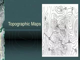
Overlaying the Maps Overlay the maps using a GIS. This is easier in a raster environment
Problems with Boolean Overlay • It is assumed that the relationships really are boolean. • It is assumed that any interval or ratio-scaled attributes are known without significant measurement error. • It is assumed that any categorical attribute data are known exactly. • It is assumed that the boundaries of the discrete objects represented in the data are certain, and recorded without any error.
Alternatives to Boolean Overlay Favorability Functions • Indexed Overlay – when you add values together to obtain a favorability score for each location. • Weights of Evidence – makes use of conditional probability….since B has occurred, what is the chance of A? • Model-Driven Overlay Using Regression – uses regression techniques to calibrate a model linking favorability to each of the other criteria thought to be involved.
Questions • What is Boolean overlay? And what are the problems associated with it? • Describe the three techniques used to co-register data. • What are 2 alternatives to Boolean overlay?