Download
1 / 31
330 likes | 385 Views
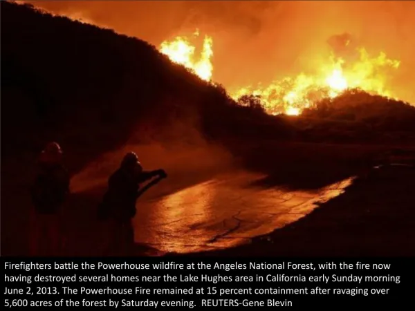
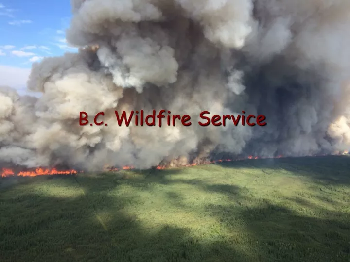
B.C. Wildfire Service. 10 year fire averages: 1 847 fires 115 464 ha 39% Human caused, 61% lightning caused The fire season in BC is generally considered to be from April through October. However, in the dry southern parts of the province the season may stretch from March into November. Fire.

E N D
10 year fire averages: 1 847 fires 115 464 ha 39% Human caused, 61% lightning caused The fire season in BC is generally considered to be from April through October. However, in the dry southern parts of the province the season may stretch from March into November. Fire
Fuel Types • Due to the wide variety of climates and terrain in the province, most FBP fuel types are represented in BC. • A number of fuels, especially the hemlock, fir , cedar mixes along the coast and in the interior wet belt, are not well represented by the FBP fuel types, so a best fit based on close examination of the fuel complex structure is required. • To represent the spruce-balsam stands in the central and northern interior the C-3 fuel type has been modified by reducing the crown base height and increasing the crown fuel load. Tables are available. Field validation continues.
Fuel Types • The C7 (Ponderosa Pine/Douglas Fir) fuel type has been revised to include an adjustable grass curing component. • the accuracy of projections made before grass, which is the primary fire carrier in this type, has fully cured. • Large tracts in the central interior are heavily infested with Mountain Pine Beetle. Studies are proceeding to determine the impact of different stages of the mortality process on fire behaviour.
Mountain pine beetle infestations recorded in British Columbia in 2014 “Shows the leading edge of the Infestation”
Fire Research Paper dealing with rate of spread in MPB Forest (1-5 years post attack) “a linear average of 2.7 times higher ROS in best fit models than expected for unaffected pine.” Publish by: Fire Ecology Volume 10, Issue 2 2014
L.A.C.E.S and the MPB Forest • L. – Lookouts – You need lookouts to monitor fire behaviour to ensure you are aware of the transition of surface fire to crown fire. Remember this can occur in a matter of seconds and these seconds can count in terms of your safety • A. - Anchor Points – You must start all action from a non flammable point. It is good to use this anchor point as a safety zones as well • C. – Communication – Talking as a group, briefings, radio communication all form part of this. Marking no work zones and safety zones and escape route are also from of communications. • E. – Escape Routes – Yes routes, you should have more than one. Remember you are in a forest of weakened trees, escape routes can be cut off by falling trees. Marked? Scouted? Timed? • S. – Safety Zones – Make sure you have a big enough safety zone, remember you are dealing with higher fire intensity than the Red Book is showing you. Remember the surrounding forest could fall or blow down with the weaken root structure. (old rule of thumb 10 times the size, in diameter, of the surrounding forest or 4 times the maximum flame height.*) A new rule of thumb may be better at 15 or 20 times the forest height? If you don’t have an area, build it!!!!! * average flame height of crown fires in conifer forests is generally 2 to 2.5 times the stand height
Final Thoughts • Use ANCHOR points in any suppression activity • Monitor the fire environment • Utilize the information that your hourly wx readings are giving you • Take hourly weather reading • Be aware of surrounding fuel types (receptive fuel beds for spotting) • Watch for any topography features (may see even quick short fire runs with topography interactions) • Areas with understory will be the most active in terms of fire behaviour • No two areas will be the same from a fuel perspective, you will be working in areas where the fuel has fell down, is falling down, or could fall down. Assess the stands before working in any area. • Remember LACES!!!! • ... And one more time ... ANCHOR POINTS!!!!!!
Weather • Weather patterns locally are strongly affected by the mountain ranges. The wettest areas will be on the westward slopes and the driest to the east. • During outflows, coastal areas can experience similar conditions along with high winds, when a high pressure system lies over the interior and a low sits off the coast. • Additional mountain influences are covered in the Topography section.
Weather • Though most weather systems move eastward from the Pacific Ocean, the southern part of the province is also subject to tropical moisture feeds that move north from the US. These increase the potential for high based lightning in the affected areas. • Additionally the area east of the Rocky Mountains is affected by drying flows from Alberta and the NWT. • Local weather patterns and anomalies should be discussed with the fire weather forecaster upon arrival at the fire center.
Weather • Fire weather forecasters are dedicated to each fire center during the fire season. • Fire weather data is collected hourly from an automated network of 290+ fire weather stations. • Daily values are also provided from 50+ MSC weather stations to fill gaps in the hourly network. • Fire specific forecast can be requested from the forecasters • Onsite feedback and hourly weather is very appreciated by the forecasters
Weather • The weather data and calculated codes and indices are posted on the website. • Quick Deploy weather stations are available if there is not a representative network station. • Belt weather kits are also available for feed back from the fireline. Most BC staff carry a kit with them.
Database Tables Canadian Forest Fire Weather Index System Temperature Relative humidity Wind Speed Rain Wind Speed Temperature Relative humidity Rain Temperature Rain Fire Weather Observations Fine Fuel Moisture Code (FFMC) Duff Moisture Code (DMC) Drought Code (DC) Fuel Moisture Codes Initial Spread Index (ISI) Buildup Index (BUI) Fire Behavior Indices Fire Weather Index (FWI) Fire Danger ARC/INFO ArcView
Links to Weather Station Map and List of Station Coordinates
Topography • Mountain dominated • Variable throughout BC • Significant impact on weather and fire behaviour
Topography Effects to consider: • Subsidence heating and drying in lee of mountains. • Channeling of winds along mountain ranges. • Funneling of winds through narrow valleys and gaps with resultant velocity increases. • Turbulence around gaps and terrain breaks. • Rapid heating of steep southerly slopes. • Upslope winds from daytime heating. • Significant downslope flows can develop at night. • Strong downslope flows below glaciers at any time.
Topography Effects to consider: • Overnight thermal belt development part way up the valley sides keeps temperatures and relative humidity's near daytime levels. • Wind sheer at the top of the inversion can lead to sudden increases in fire intensity and rates of spread as the inversion breaks and the upper winds are mixed down. Fire weather forecasters at the fire centers can provide estimates of breakthrough temperature and time at specified elevations. Local observation is crucial for validation.
Topography Effects to consider: • Temperature and RH change with elevation as a result of adiabatic cooling. • Upper slopes will have a cooler, more humid burning environment than lower slopes. As a fire progresses, spot forecasts must be requested for the appropriate elevation. • To reflect the cumulative effect on fuel moisture, the codes from the parent station should be rerun using adjusted startup values provided by the forecaster.
Fire Behaviour Forecasts and Advisories • Fire Behaviour Forecasts are issue daily. The timing may vary based on organizational requirements. The standard national format can be used. • The Operational Safe Work Standard #5 outlines the requirements for Wind Advisories, Fire Behaviour Advisories and Extreme Fire Behaviour Warnings, which are issued by the specialist in addition to the forecast if the outlined conditions are met. • Fire Centers also issue these products on a wide area basis. • Crews on your fire must be made aware that your forecasts, advisories and warnings supercede anything broadcast they hear from the fire centre on your incident.
Wildfire Service Organization The Wildfire Service organization is structured as follows: • Headquarters office located in Victoria • Provincial Wildfire Coordination Centre. • 6 regional Fire Centers: • Coastal, located in Parksville • Kamloops, located at the Kamloops airport • Cariboo, located at the Williams Lake airport • Southeast, located at the Castlegar airport • Prince George, located in Prince George • Northwest, located in Smithers
Wildfire ServiceOrganization • Each fire center is divided into Fire Management Zones run by a Zone Protection Officer. There are 35 zones in the province. • 3 person initial attack crews and 20 person unit crews (sustained action) are based seasonally around the zones. • The provincial Rapattack base is located in Salmon Arm. Crews and helicopters will be repositioned to secondary bases as required. • A Parattack team and jump ship are based at the Fort St John airport. • The Provincial Airtanker Centre is located at the Kamloops airport. This office coordinates the positioning of air resources around the province.
Wildfire Service Organization • Fire equipment depots are located in Chilliwack and Prince George. • ICS The Incident Command System has been implemented to manage fire events in BC. • The Fire Behaviour Specialist reports, as a technical specialist, to the Plans Section Chief.
Access to WMB Information • BC Wildfire Service public website: http://bcwildfire.ca/index.htm • Protection internal website: https://gww.nrs.gov.bc.ca/flnr/wmb?pl=mb-flnr-wildfire_man • Fire weather and CFFDRS information is accessible from the internal website. • Necessary systems access will be granted on arrival.