Download
1 / 98
990 likes | 1.22k Views
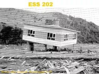
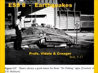
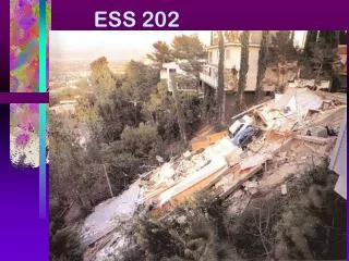
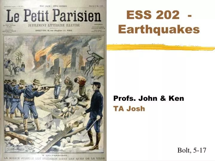
ESS 202 - Earthquakes. Profs. John & Ken TA Josh. Bolt, 5-17. Overall outline. Plate tectonics Earthquakes Structure of the the Earth Measuring intensity Seismometers, magnitude Where are west coast faults? Some famous quakes More Tsunamis Rest of quarter - Hazards of quakes.

E N D
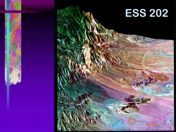
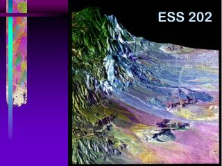
ESS 202 - Earthquakes Profs. John & Ken TA Josh Bolt, 5-17
Overall outline • Plate tectonics • Earthquakes • Structure of the the Earth • Measuring intensity • Seismometers, magnitude • Where are west coast faults? • Some famous quakes • More Tsunamis • Rest of quarter - Hazards of quakes Light at the end of the tunnel
Plan for this lecture • Faults on the west coast
You are here Pacific and North American plates are main players Press, 20-12
Where are faults, exactly? • We’ll swing down the coast • Alaska • British Columbia, Oregon, Washington • California • Wasatch Fault Zone • Utah, Idaho, Montana, Wyoming (Yanev,Appendix A)
North America map Show Movie #01 USGS Prof. Paper, 1-2
Subduction under Alaska & Aleutian Is. • 8 cm/yr of plate convergence • almost strike-slip in Aleutian Is. • Site of large underthrusting earthquakes • 1964 Alaska Earthquake MW=9.2 • Volcanic arc & eruptions
Alaska - Pacific boundary Not subduction! Embarrassing. (UT Austin) Strike-slip
Alaska • Most dangerous faults in US • 8 quakes over M=8 in last 100 years • Sparsely populated • Main fault is subduction thrust • Only surfaces on ocean floor • Many secondary faults • Also has volcanoes, tsunamis
1899-1979 Alaska quakes 6.7 & 8 quakes in 2002 Stars - M > 7.5 Triangles - 6.5 to 7.5 Yanev, p. 175
Tectonic Settingof N. America • Old stable interior • East coast “passive margin” • West coast “active margin” • Pacific - N. Am. plate interactions • Transform motion at SAF • Subduction under Alaska & Aleutian Is. • Juan de Fuca - N. Am. interactions • Subduction under Northern California, Oregon, Washington, and British Columbia
US Topography Topographic action mark tectonic activity
Continental collision iscause of Appalachian Mts Press, 20-6c
Rifting Now Europe US Passive margin
USA seismicity • Notice that all the action is in the West • most dramatic topography in the West • Yosemite, Cascade Mts., Big Sur coast, etc. • few earthquakes in the East • Some faults as far east as Yellowstone • No action to west in Pacific plate either • Hawaii is special case - hot spot volcano
Geology of western US - Fabric related to deformation
Western boundary of North American Plate • Type of boundary depends on orientation • Plate boundaries move and change in time • Past 30 My saw major changes & development of San Andreas Fault • From 80 to 30 My Farallon plate subducted under west coast. • Juan de Fuca & Cocos plates are remnants of Farallon plate
Details: US and Mexico coast • Three little plates subducting offshore Oregon, Washington, and B. Columbia • Juan de Fuca Plate • Gorda Plate • Explorer Plate • Spreading ridge splitting Gulf of California • Separating Baja from N. America • Oblique because ridges are combined with transform faults • Cocos Plate subducting to the south
Exoticterrainplacement Accretion of fragments to continent
Exotic terrains Western N. Am (Cordillera) assembled from small pieces over past 200 My
Changes in west coast • A mid-ocean ridge subducted • Before that, just subduction on coast • First hit near LA 25 Mya • San Andreas fault system started then • As ridge is subducting, two triple junctions are moving apart on coast • Mendocino Triple Junction moving north • NA-Pacific-Juan de Fuca junction • NA-Pacific-Rivera junction off Baja California
Note present San Andreas fault Show movie #02
Oregon-Washington • M 9 every 1000 years, last in 1700 • Recent quakes • M 7.0 in 2000, 6.5 in 1965 in Seattle • M 7.1 in 1949 in Olympia • Main fault is subduction zone • Also volcanoes (like Mt. St. Helens) • Not adequately prepared • We’ve looked at these faults before • But biggest surface offshore
Cascadia subduction zone • 4 cm/yr convergence rate
Pacific - Juan de Fuca spreadingSubduction of J. de F. under N. Am. Iacopi, 27 Note: Plate motions Triple Junctions
Cartoon view Show movie #09
Oregon-Wash.Close-up Note: Volcanoes San Andreas Triple Junctions Mt. Hood From Portland Yeats, 5-2
Subduction under Pacific Northwest • 4 cm/yr of plate convergence • like small convection cell - up at ridge down at subduction zone • Site of great underthrusting earthquakes • None in historic record • But evidence for magnitude 9 quake in 1700 • Tsunami sands in buried marsh • Tsunami in Japan in 1700 • Volcanic arc & eruptions • Mt. St. Helens, Mt. Rainier, Mt. Shasta
Cascadiacross-section Oregon-Washington X-sect Cascade Mts Olympic Mts Ridge Keller, 7-5
Tsunami sand associated with the 1700 earthquake covering a Native fire pit on the banks of the Salmon River in Oregon. Fire-cracked rocks, charcoal and ashes delineate the fire pit that was dug into the sandy beach.
Last 30 Mya of west coast tectonics Cape Mend.
Quakes in California • The highest concentration is near the big faults; San Andreas, Cape Mendocino • Other areas also have many little quakes • Mammoth Mts. - 1000’s of quakes per year • Coso Hot Springs - geothermal activity • Probably no area in California is safe from occasional little quakes
California • Last 150 years, 2-3 quakes of M8 • Main fault is strike-slip, on land • San Andreas fault zone • Easy to map in detail • Many secondary faults • Some offshore, most farther East
QuakesandSan Andreasfault Mammoth Coso
San Andreas Fault • Right-lateral slip - LA moving northwest • 3.5 cm/yr • Segments • 1906 San Francisco quake • Creeping section (gradual aseismic slip) • Parkfield segment • 1857 Fort Tejon quake • Southern segment • Big Bend • causes N-S compression in So. Cal. “Big ones” M ~ 7.9
Activefaults andsegments Big bend
Officialfaults Special Studies Zone Act of 1972 (Alquist-Priolo Act) San Andreas, Garlock, SoCal and Bay Area branches Yanev, p. 42
Fault zones and Faults • The ideal fault: San Gabriel Fault Photo Matt D’Allessio
Complication #1 • Faults can splay (split near surface)
Northern California • San Andreas • Runs through Point Arena, Point Reyes, San Francisco, San Jose, Watsonville • East Bay Faults • Calaveras-Hayward-Rodger’s Creek • Some farther east • Offshorefaults?