Download
1 / 34
370 likes | 669 Views
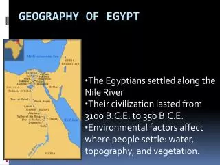
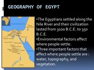
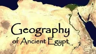
Geography of Ancient Egypt. Geography of Ancient Egypt. Geography of Ancient Egypt. Geography of Ancient Egypt. Nile River. 4,000 miles long Two Nile Rivers: White and Blue Niles in Ethiopia and Central Africa Flow affected by “Cataracts”-speed up the flow by narrowing. Nile River.

E N D
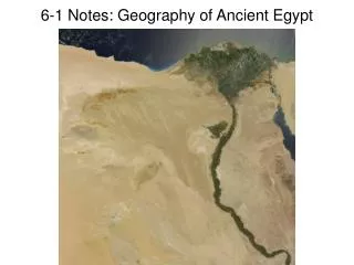
Nile River • 4,000 miles long • Two Nile Rivers: White and Blue Niles in Ethiopia and Central Africa • Flow affected by “Cataracts”-speed up the flow by narrowing
Nile River • Floods annually between June and October-average flood depth of 45 feet • Flood leaves rich deposits of soil on the banks • Nickname: “Gift of the Nile
Nile River • Fertile strip on average only 12 miles • Only major river which flows northward • Divides Egypt into: • Southern part = “Upper Egypt” • Northern part = “Lower Egypt”
Nile River • Egyptians learned to build sophisticated irrigation systems to maximize the use of the Nile • Mouth of the Nile forms a wide delta as it enters the Mediterranean Sea
Geography of Ancient Egypt NORTH Delta - the fan-shaped area at the mouth or lower end of a river formed by eroded material that has been carried downstream and dropped in quantities larger than can be carried off by tides or currents Open access to Lower Egypt
Geography of Ancient Egypt WEST Northern Sahara Desert No passage
Geography of Ancient Egypt EAST Sinai Peninsula Desert Passable only along the coast
Geography of Ancient Egypt SOUTHEAST Red Sea Trade passage
Geography of Ancient Egypt SOUTH Eastern Sahara Desert Nubia 6 stages of cataracts or rapids
Geography of Ancient Egypt Cataracts 6 locations Stop river travel
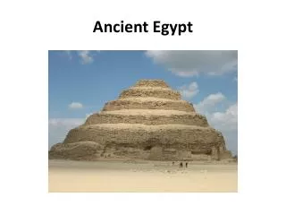
Topography • Land has ample stone for building large monuments • No wood or other building products • Lower Egypt was a savannah teeming with wild animals
Climate of Egypt • Frost-free climate allowing for year round farming • Receives only ½ inch of rain per year on the average • Temperatures are hot, up to 140 degrees in the summer
Climate of Egypt • Non-existent humidity = preservation of artifacts • Winds blow to the south from the Mediterranean assisting in travel up the river