Download
1 / 23
240 likes | 403 Views
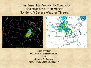
Using Ensemble Probability Forecasts And High Resolution Models To Identify Severe Weather Threats. Josh Korotky NOAA/NWS, Pittsburgh, PA and Richard H. Grumm NOAA/NWS, State College, PA. Overview.

E N D
Using Ensemble Probability Forecasts And High Resolution ModelsTo Identify Severe Weather Threats Josh Korotky NOAA/NWS, Pittsburgh, PA and Richard H. Grumm NOAA/NWS, State College, PA
Overview • This study illustrates the operational value of combining diagnostic and probabilistic information from higher resolution models and SREF forecast products to better understand the nature of severe weather potential • SREF probability forecasts are examined for a vigorous severe weather event that occurred across much of the central Mississippi and lower Ohio Valleys on 2 April 2006 • Probabilities of exceedance for Convective Available Potential Energy (CAPE), Storm-Relative Helicity (SRH), mean shear, and the Energy Helicity Index (EHI) are examined • Single and combined probabilities of MUCAPE, effective shear, and 3 hr. convective precipitation are also considered
Overview • A forecast strategy is proposed which utilizes: • Ensemble data for assessing the likelihood of a severe weather event and the confidence level of NWP forecasts • Climatological anomalies for evaluating the historical context of a model forecast • High resolution model data for determining the timing, evolution, mode, and intensity of forecast convection, including important mesoscale structures and relevant forcing mechanisms
SREF Configuration • EMC runs a 21 member multi-model, multi-analysis mesoscale SREF system with enhanced physics. The SREF is run four times daily at 03, 09, 15, and 21 UTC, with forecasts to 87 hours • The current SREF configuration contains 10 NAM-Eta members, 5 Regional Spectral Model (RSM) members, and 6 WRF members
Introduction • A strong cold front brought severe weather to much of the central Mississippi and lower Ohio Valleys on 2-3 April 2006 • There were 871 severe weather reports and 85 tornadoes. 29 people lost their lives in this deadly early-spring tornado outbreak
SPC Day one Outlook04/02/06 UTC valid 0402/12 UTC – 0403/12 UTC
SPC SREF Forecasts0402/09 UTC Valid 04(02-03)/(21 – 00) UTC • Single and combined SREF probabilities - David Bright • http://www.spc.noaa.gov/exper/sref/
04/02/09Z valid 0402/21 UTC 04/02/09Z valid 0403/00 UTC Prob Effective Shear ≥ 40 kts, Mean Effective Shear ≥ 40 kts (yellow) Prob Effective Shear ≥ 40 kts, Mean Effective Shear ≥ 40 kts (yellow) Prob Conv Precip ≥ .01 in x Prob MUCAPE ≥ 1000xProb Eff Shr > 40 kts Prob Conv Precip ≥ .01 in x Prob MUCAPE ≥ 1000xProb Eff Shr > 40 kts
04/02/09Z valid 0402/21 UTC 04/02/09Z valid 0403/00 UTC Prob Supercell Composite 3, Mean Supercell Composite = 3 (yellow) Prob Supercell Composite 3, Mean Supercell Composite = 3 (yellow) Prob Sig Tor 3, Mean Sig Tor = 3 (yellow) Prob Sig Tor 3, Mean Sig Tor = 3 (yellow)
SPC SREF Summary • The SREF single and combined probabilities illustrate an environment favoring supercells and tornadoes across the lower and central Mississippi Valley
SREF and Consensus Forecast Departure from Climatology21Z01APR2006 valid 00Z03APR2006 • SREF Probabilities, composite probabilities, climate anomalies; Rich Grumm • http://nws.met.psu.edu/ensembles/index.html • http://eyewall.met.psu.edu/ensembles/
SREF init: 21Z01APR2006 valid 00Z03APR2006 Mean MSLP and Anomaly (shaded) a. b. SREF init: 21Z01APR2006 valid 00Z03APR2006 Mean PWAT and Anomaly (shaded SREF MSLP and PWAT Anomalies21Z01APR2006 valid 00Z03APR2006 • SREF forecasts indicate a strong surface cyclone, with a central pressure > 2 SD below normal over the upper Mississippi Valley • In the warm sector, moist air is surging poleward; PWAT anomalies are forecast to be 2 to 3 SDs above normal
SREF init: 21Z01APR2006 valid 00Z03APR2006 Mean CAPE (shaded) and EHI a. b. SREF init: 21Z01APR2006 valid 00Z03APR2006 SR-Helicity (shaded);1.5 km Shear (103) & vectors Mean CAPE (shaded) and EHI SREF CAPE, SRH, EHI, Shear21Z01APR2006 valid 00Z03APR2006 • Mean CAPE forecast 1200-2500 Jkg-1 and EHI values 1-3 from Illinois southward across much of the lower Mississippi Valley • Mean SRH in the warm sector 300-400+ m2s2 from Indiana to Wisconsin, generally along and north of a strong warm front • SRH 200-300 m2s2 extends southward into the lower Mississippi valley along and east of the cold front • 1.5 km mean (normalized) shear is .009-.010+ s-1 (~30 kt) across the Mississippi Valley Mean SRH (shaded) and 1.5 km Shear≥ .006 s-1
a. SREF NARR 21Z01APR2006 valid 00Z03APR2006 Prob CAPE > 2000 Jkg-1; Mean CAPE ≥ 1200 Jkg-1 SREF 09Z01APR2006 valid 00Z03APR2006 Probability CAPE > 1000 Jkg-1 b. Prob CAPE ≥ 2000 m2s2 (shaded) and Mean CAPE ≥ 1200 J/kg SREF CAPE Probabilities21Z01APR2006 valid 00Z03APR2006 • Exceedance probabilities indicate CAPE will exceed 2000 J/kg from TX to southern IL • …CAPE will likely exceed 1000 J/kg across much of the Mississippi Valley Prob CAPE ≥ 1000 J/kg
SREF NARR 21Z01APR2006 valid 00Z02APR2006 Probability 1.5km shear > .006 s-1 a. SREF 09Z01APR2006 valid 00Z03APR2006 Probability SRH > 200 m2s2 b. Prob 1.5 km shear ≥ .006 s-1 (shaded) and mean shear ≥ .006 s-1 SREF Shear and SRH Probabilities21Z01APR2006 valid 00Z03APR2006 • Mean shear will likely exceed .006 s-1 across entire outlook region …with mean values .012 - .018 s-1 • SRH will likely exceed 200 m2s2 across entire warm sector Prob SRH ≥ 200 m2s2
SREF Summary • SREF forecasts established a high likelihood of severe weather across much of the lower and central Mississippi Valley on 2 April 2006 • Probability forecasts indicated an environment favoring supercells, and SREF probabilities indicated a high degree of agreement among the ensemble members
NCEP Operational NAM-WRF Graphics • 00 UTC and 1200 UTC: • http://www.emc.ncep.noaa.gov/mmb/mmbpll/nampll12_fullcyc_2mbtop/index.html • 0600 UTC and 1800 UTC: • http://www.emc.ncep.noaa.gov/mmb/mmbpll/opsnam_offtime/index.html
NAM-WRF and SREF NAM-WRF Dew point valid 0403/00 UTC SREF Probability of the 2m Dew Point > 60o Fvalid 0403/00 UTC • SREF: Greater than 90% probability of the surface dew point > 600 F across central and southern Mississippi Valley • NAM-WRF illustrates details and magnitude of warm sector moisture content
NAM-WRF Best CAPE • CAPE forecast 2000-3000J/kg along and ahead of the cold front
NAM-WRF Best LI • Best Li reveals addition structure of the unstable warm sector • NAM-WRF highlighted important forcing mechanisms in a forecast of significant low-level frontogenesis and moisture flux convergence along the frontal features (not shown)
Conv Pcp Rate - 36 H Forecast valid 0403/00 UTC Instant Pcp Rate - 36 H Forecast valid 0403/00 UTC NAM-WRF Instant and Convective Precipitation • NAM-WRF instant and convective precipitation shows convective potential along banded frontal structures and grid scale precipitation northwest of the surface cyclone
a. b. NAM-WRF Simulated Radar Reflectivity • Although it is not generally possible to make direct comparisons between actual and simulated radar, the simulated radar can reveal the nature of model-derived mesoscale forcing • The simulated radar indicates banded frontal and pre-frontal structures which correspond rather well with the actual radar, even though the actual radar shows much greater reflectivities in the convection • This information can be very useful to an analyst trying to understand how moisture, instability, and vertical wind shear are forecast to interact in a severe storm environment.
Summary • Ensemble data indicated the likelihood of a severe weather event with a high potential for supercells and tornadoes across the mid Mississippi Valley on 2-3 April 2006. Probability forecasts indicated a high degree of agreement between the 21 SREF members… increasing confidence in the forecast • Climate anomalies indicated the event would be associated with a an anomalous surface cyclone containing an anomalously moist warm sector • High resolution model data helped fill in the details of the mode, evolution, and intensity of forecast convection, and highlighted important mesoscale structures, including relevant forcing mechanisms