Download
1 / 65
670 likes | 1.04k Views
JIATF South 2012 Hurricane Brief. AGENDA. Introduction Jeff Narwold/Chad Robinson Cmd Hurricane Officer/ Asst Hurricane Officer Hurricanes 101 LT Eric Metcalf Staff Meteorology & Oceanography

E N D
JIATF South 2012HurricaneBrief UNCLASSIFIED
AGENDA Introduction Jeff Narwold/Chad Robinson Cmd Hurricane Officer/ Asst Hurricane Officer Hurricanes 101 LT Eric Metcalf Staff Meteorology & Oceanography Officer JIATFS Hurricane Jeff Narwold/Chad Robinson Planning & Preparedness Orlando Orientation LCDR Andrew Campen (Alt JOC, AEC) UNCLASSIFIED
Topics of Discussion… • Categories and Characteristics… • Readiness, Hurricane Info, Forecasting Initiatives and Tools… • 2011 Hurricane Season… UNCLASSIFIED
Tropical Cyclone Formation • Favorable Conditions • Warm water (>78 deg) to 150 ft • Conditionally unstable atmosphere • Moist air ~ 16,000 ft • 300 nm or more from Equator • Pre-existing disturbance • Low vertical wind shear UNCLASSIFIED
. TROPICAL CYCLONE:“Symbols you may see” • 1. Tropical Easterly Wave 3. Tropical Storm • 2. Tropical Depression 4. Hurricane UNCLASSIFIED
TROPICAL (EASTERLY) WAVE • No significant winds or seas • (<20 kts) • No well defined surface circulation • Identified by areas • of low level convergence (e.g. • T-storms) on charts or satellite imagery UNCLASSIFIED
. TROPICAL DEPRESSION (Formative Stage) • Winds < 39 mph (20-33 kts) • Tropical wave develops aweak cyclonic circulation UNCLASSIFIED
TROPICAL STORM(Immature to Mature Stage) • Winds 39 - 73 mph (34-63 kts) • Closed formation expands withspiral bands becoming better organized UNCLASSIFIED
HURRICANE (Mature Stage) • Winds > 74 mph (> 64 kts) • Radius of strong winds may exceed 350 nm • Gale Force Winds extend furthest in the right front quadrant UNCLASSIFIED
HURRICANE CATEGORIES SAFFIR - SIMPSON SCALE • Predicts potential hurricane damage based on the amount of storm surge and wind speed • The severity of damage is dependent on hurricane’s angle of approach and slope of the coastline • Most dangerous when coincident with high tides UNCLASSIFIED
HURRICANE CATEGORIES August 29, 2004 Hurricane Gaston • CATEGORY I • (Minimal) • Winds 74 - 95 mph, • (64-82 kts) • storm surge4 - 5 ft above normal water level. • (Hurricane Gaston 2004) UNCLASSIFIED
HURRICANE CATEGORIES September 4, 2004 Hurricane Frances CATEGORY II (Moderate) Winds 96 - 110 mph, (83-95 kts) storm surge6 - 8 ft above normal. (Hurricane Frances 2004) UNCLASSIFIED
HURRICANE CATEGORIES September 25, 2004 Hurricane Jeanne CATEGORY III (Extensive) Winds 111 - 130 mph, (96-113 kts) storm surge9 - 12 ft. (Hurricane Jeanne 2004) UNCLASSIFIED
HURRICANE CATEGORIES August 13, 2004 Hurricane Charley CATEGORY IV (Extreme) Sustained winds of 131 - 155 mph, (113-135 kts) storm surge13 - 18 ft above normal. (Hurricane Charley 2004) UNCLASSIFIED
HURRICANE CATEGORIES • CATEGORY V • (Catastrophic) • Windsabove 155 mph, • (>135 kt) • storm surgegreater than 18ft above normal. • (Hurricane Ivan 2004) September 13, 2004 Hurricane Ivan UNCLASSIFIED
TROPICAL CYCLONECHARACTERISTICS FEEDER BANDS spiral energy towards the Eye Wall where most of the violent weather occurs UNCLASSIFIED
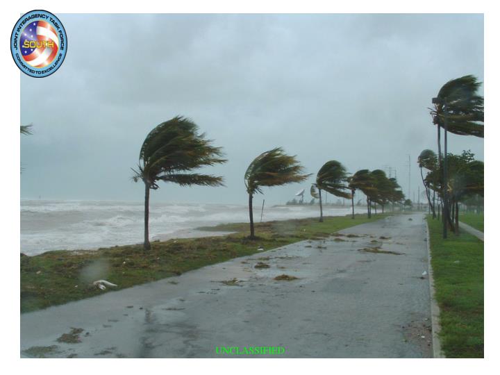
Tropical Cyclone Weather Phenomena • TORNADOES / SEVERE THUNDERSTORMS Embedded in T-storms normally form with landfall of Tropical Cyclone • WINDS Flying debris/missile hazards Total destruction of poorly constructed structures • TORRENTIAL RAINS/FLOODS Excess of 6 inches in less than 8 hrs possible UNCLASSIFIED
Steep coastline Shallow coastline • Storm Surge Most damaging aspects of a hurricane “WALL OF WATER” • The rise of seas in advance of, or with the hurricane. UNCLASSIFIED
North Roosevelt surge during Wilma… UNCLASSIFIED
UNCLASSIFIED Key Haven surge during Wilma…
JIATFS Hurricane and Weather links UNCLASSIFIED
Key West Elevations UNCLASSIFIED
Tropical Cyclone Conditions of Readiness (COR’s) • TC CONDITION V– Seasonal COR set here during the hurricane season. Destructive force winds (50 kts / 58 mph) are expected within 96 hours. (1 June through 30 November in the Atlantic Basin) (15 May through 30 November in the Eastern Pacific) • TC CONDITION IV- Destructive force winds are expected within 72 hours • TC CONDITION III- Destructive force winds are expected within 48 hours • TC CONDITION II- Destructive force winds areexpectedwithin 24 hours • TC CONDITION I- Destructive force winds areimminentwithin 12 hours.. * DESTRUCTIVE FORCE WINDS ARE DELINEATED BY REGIONAL INSTR UNCLASSIFIED
Tropical Cyclone Warning (Sample Graphic) Warnings issued every 6 hours 03Z 09Z 15Z 21Z 72 hr position 96 hr position 48 hr position 120 hr position 36 hr position 24 hr position 35 kt 12 hr position 50 kt 65 kt Danger Area 35 kt wind error radius Advisory valid position UNCLASSIFIED
Hurricane Models UNCLASSIFIED
Organizational Relationships • JIATF South COS • NAS Key West CO • Coast Guard SECTOR Key West CO • JIATF South COS • NAS Key West CO • Coast Guard SECTOR • Key West CO • Dependents • Local Population Hurricane Conference Call (Every 6 Hours) National Hurricane Center Military Weather Offices State Planners Coordination Conference Call: Monroe County Emergency Management State Emergency Management NAS Key West CO (and the Hurricane Officer) Local Government Officials Military Evacuation Decision Makers JIATF South COS NAS Key West CO Coast Guard SECTOR Key West CO Monroe County Emergency Management State Emergency Management UNCLASSIFIED
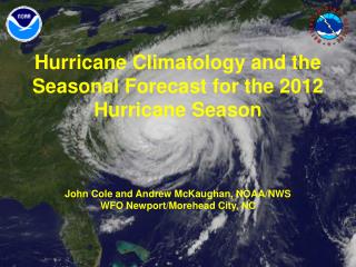
What does the future hold? Long-term statistics show: • Seven hurricanes strike the U.S. every 4 years • Three major (Cat 3 or greater) hurricanes cross the U.S. coast every 5 years • There are still other sites especially vulnerable to disaster… • - Houston/Galveston - Southwest Florida • - New Orleans (again) - Tampa Bay • - Southeast Florida - Florida Keys (again) • - New York City/Long Island - New England NOAA seasonal forecasts indicate we will continue a period of above normal hurricane activity UNCLASSIFIED
Average number of storms per season (1950 to 2010) 9.6 Tropical Storms 5.9 Hurricanes 2.3 Major Hurricanes Tropical Cyclone History Key West (7) Mayport (3) Norfolk (2) Legend EVAC SORTIE Fay Fay Ike Wilma Dennis Rita Wilma Lee Charley Ivan Michelle Isabel UNCLASSIFIED
2012 Atlantic Basin Seasonal Forecast UNCLASSIFIED
2012 Latest Official Warnings... CLASS: http://www.nlmoc.navy.smil.mil/cgi-bin/main.pl?tropical UNCLAS: http://www.nhc.noaa.gov/ Voice Recording: 293-2306 Staff Meteorologist/Oceanographer: LT Eric Metcalf – 293-5766 (Cell) 904-568-5058 Staff Forecaster Gapped billet UNCLASSIFIED
HURRICANE PLANNING PLAN & PREPARE NOW…. NO REGRETS LATER! UNCLASSIFIED
HURRICANE PLANNING Hurricane Folder • Hurricane Info Handout • NAS Shelter Guide • Pet Info • Monroe County Info • American Red Cross Info • Orlando Lodging • Re-entry stickers UNCLASSIFIED
HURRICANE PREPAREDNESS Plan & Get Ready NOW! • Prepare YOUR shelter and evacuation plans • Complete your Personal Hurricane Data Sheet • Keep vehicle gas tank at least 1/2 full • Conduct a household inventory • Buy insurance • Identify items to bring inside • Instructions to turn off gas/water UNCLASSIFIED
HURRICANE PREPAREDNESS Build Hurricane Kit • Food • Bottled Water • First aid kit • Clothing & bedding • Tools & supplies • $$$$ • Special items (meds, baby supplies, uniform, etc) UNCLASSIFIED
HURRICANE PREPAREDNESS Traveling With Your Pet • Make arrangements to evacuate your pets • Microchip your pet (mandatory for base housing residents) • Collars with updated ID and leashes • Proper traveling carriers • Food & water • Veterinary records • Identify and reserve lodging that allows pets • DO NOT LEAVE YOUR PETS BEHIND! UNCLASSIFIED
HURRICANE PREPAREDNESS Hurricane Directorate Representatives: CG: LCDR Don Bryant J5: George Christow J1/J8: SFC Adrian Canas J6: LCDR Andrew Campen J2: LT Alexis Lelekis CSG: CPO Anibal Bello J3: LT Eric Metcalf CTG 4.2: SrA Alise Brazell J4: LT Paul Huttenmaier Command Hurricane Officer: Mr Jeff Narwold Asst Command Hurricane Officer: Mr Chad Robinson JIATF South Orlando Numbers: Toll-free: 877-848-3082 and 877-244-9074 Regular: 407-648-6071 and 407-648-6073 Evacuation Web Site: www.usarso.army.mil/hurricane UNCLASSIFIED
HURRICANE PREPAREDNESS • JIATF South’s Hurricane Plan • Objectives: • - Ensure safety of staff members/families • - Sustain the mission • Category 1-2: • - Be flexible -- may shelter or evacuate • Category 3-5: • General evacuation; Sheltering only if storm prevents movement • Command will initiate decision-making actions at H-96 • Information will be disseminated via AutoDialer • AutoDialer displays US Govt 305-293-5800 • Cell may not display; Add to contact list UNCLASSIFIED
HURRICANE PREPAREDNESS Sheltering Event • The CO-NASKW may order all military and civilian personnel and their dependents residing in base housing only to evacuate to shelters in case of a CAT 1 or 2 storm • The Commanding Officer’s order to shelter shall be distributed to NASKW departments and tenant commands via the NASKW Emergency Manager • The NASKW Emergency Manager, Shelter Officers and Security will ensure that shelter check-in is accomplished in an orderly and safe manner UNCLASSIFIED
HURRICANE PREPAREDNESS NAS Shelters • Boca Chica buildings 638, 639, 648, 649 & 727; Truman buildings 437, 438 & • 439, -- will open 24 hours prior to arrival of destructive winds • Review (NASKWINST 3440.1B) Shelter Rules and Check-in Procedures • https://www.cnic.navy.mil/Key West/Relocation/DutyinRegion/ClimateWeather/KEYWEST_071025005 • Bring your hurricane kit (enough food, clothing, toiletries, medication, etc. • for a minimum of 3 days) • Naval Branch Medical Clinic will have staff stationed at each shelter • Personnel with pets should arrange to board their pets with kennels, however, • they can be stored in the NAS designated pet shelter, Bldg A-931 if in a PROPER • CARRIER UNCLASSIFIED
HURRICANE PREPAREDNESS Evacuation Event • Decision to evacuate is made by the CO-NASKW, in conjunction with Monroe County and State of Florida officials • Decision is based on: projected storm track, forward speed, and anticipated intensification UNCLASSIFIED
HURRICANE PREPAREDNESS Preparing JIATF South for Evacuation • As required, the COS will direct the command to minimal manning levels to allow the staff to prepare for the on-coming hurricane • Complete Directorate checklists • Deploying teams identified by each Director will be alerted • - Teams may be accompanied by their families to thedeployed site • COS may order Evacuation as early as H-48 • - All members should leave the Keys byH-36 UNCLASSIFIED