Download
1 / 35
360 likes | 544 Views
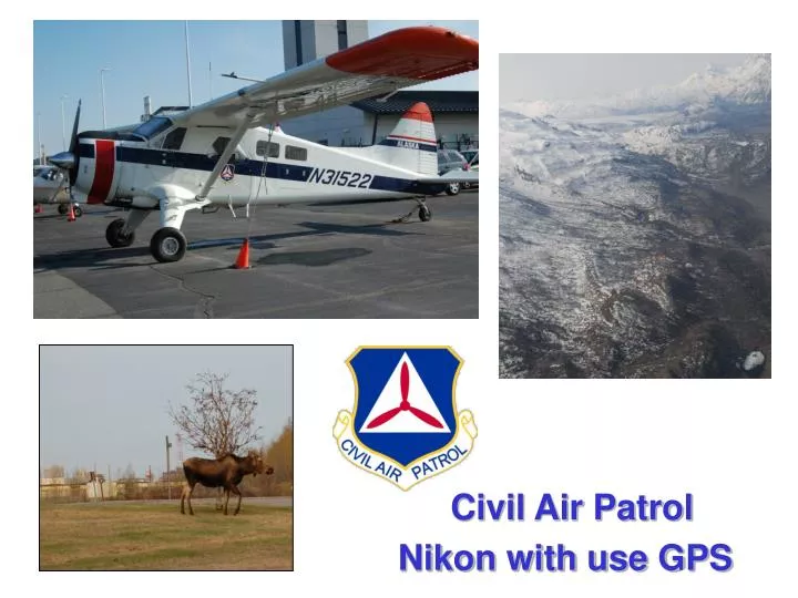
Civil Air Patrol. Nikon with use GPS. Our Lesson Today. We are here today to learn about some new equipment for shooting aerial photography, and how to set up this equipment.

E N D
Civil Air Patrol Nikon with use GPS
Our Lesson Today We are here today to learn about some new equipment for shooting aerial photography, and how to set up this equipment. This system uses a high-resolution digital camera attached to a handheld GPS which automatically embeds each picture with the location, altitude, and time – thus relieving the aircrew of that responsibility. The only function the equipment can’t do for us is identify which way the camera is pointing when the picture is shot. And in most cases, this is clear from the picture, can be identified by the crew, or can be determined with available tools like Google Earth. This system has been extensively tested in the Texas Wing and Group5 of the Texas Wing for over two years. Recently, it was operationally proven during Hurricane Dolly and Hurricane Ike recovery efforts. We hope our lessons learned can jumpstart your own efforts with this system.
Our Lessons Today • The Equipment Necessary • How To Configure The Equipment • How To Connect It All Together • How To Test For Correct Operation • Some Recommendations For Its Use
Pieces of the Puzzle What equipment do we need? • Nikon D200 Camera 10.2 Megapixel Digital Single Lens Reflex (DSLR) Camera • Nikon MC-35 Serial Port Adapter Adapts a 9-pin computer serial connector to the Nikon Camera • Garmin etrex-H model handheld GPS Provides Latitude/Longitude/Altitude/UTC Time Information • Garmin Serial Data Cable (also known as computer adapter cable and can be obtain from aftermarket suppliers) This cable connected the Garmin GPS to Nikon MC-35 Adapter
Nikon D200 • The Nikon D200 DSLR is a 10.2 mega-pixel digital camera with many advanced features useful to our CAP aerial photography.
Nikon D200 • The most useful feature is the external data interface port. Nikon sells a MC-35 adapter. After-market companies also sell adapters.
Nikon D200 • The Nikon D200’s information screen on top shows the current camera settings/status and the GPS connection status.
Nikon MC-35 Adapter • Nikon’s MC-35 Serial Port Adapter converts a 9-pin serial computer connector to the round Nikon interface connector.
Garmin etrex-H GPS • The Garmin etrex-H GPS has a high-sensitivity receiver with WAAS built in. Battery life is projected at 18 hours use. There is no built-in memory to load additional maps or user waypoints, but these functions aren’t required for aerial photography. • Even inside a house, this etrex-H was able to pick up enough satellites (with WAAS correction) to pinpoint a location to within 10 feet!
Garmin Serial Data Cable • Garmin and aftermarket companies sell a Serial Data Cable that can connect their GPS to a computer, or in our case – to the Nikon MC-35 and Nikon D200. • The serial cable from Garmin is six feet long which is sufficient to reach from the GPS atop the aircraft’s front panel to the back seat where the photographer usually sits.
Putting It All Together There are three parts to connecting this equipment and getting it functioning: 1. Correctly configure the GPS to speak the same “language” as the camera. 2. Connecting the data cables between the equipment. 3. CHECK THE ENTIRE SETUP FOR CORRECT OPERATION!
Putting It All Together • First check to insure all batteries are charged or fresh. Nothing is as frustrating as batteries dying half-way through a sortie!The Nikon D200 battery should be charged before EVERY sortie.The GPS should get new batteries at least every 10 hours of operation and a spare set should be carried on every sortie – just in case! • Turn off all equipment!While the Nikon D200 and Garmin GPS might not be affected if powered on while connecting and disconnect the cables – who wants to risk damaging a $2,000 plus camera?Second – the Nikon D200 will not detect the GPS unless the connections are already made and the GPS is turned on BEFORE the D200 is turned on. This means the D200 is the last device turned on. And if the GPS dies, the D200 is turned off/on to reset after turning the GPS on again.
Configuring the GPS • The first time the Garmin etrex-H GPS is used, it should be checked for correct data Input/Output format (language to talk to the camera) • The five buttons to navigate/configure the Garmin etrex-H are: • Top right = the QUIT/PAGE button. • Lower left = the ENTER/MARK button. • Pair of two at top left = the UP/DOWN buttons. • Large, flat button at lower right = the ON/OFF/BACKLIGHT button.
Configuring the GPS • First step in configuration:Use the PAGE button to scroll through the screens until you reach the MENU screen.Use the down button to get to the SETUP selection and press the ENTER button. NOTE: The GPS battery condition is displayed at the bottom of this screen. But don’t trust it as more than a guide. If the battery icon display shows ½ or more depleted – replace them before the next sortie!
Configuring the GPS • Second step in configuration:Use the down button to scroll down to the INTERFACE selection.Press the ENTER button. NOTE: The GPS battery condition is displayed at the bottom of this screen. But don’t trust it as more than a guide. If the battery icon display shows ½ or more depleted – replace them before the next sortie!
Configuring the GPS • Third step in configuration:If the GPS is correctly set to “NMEA OUT” setting – nothing further is needed. This is the correct Input/Output to communicate with the Nikon D200. If the I/O is set to anything other than “NMEA OUT”, follow the instruction on the next slide.
Configuring the GPS • Fourth step in configuration:If the GPS is not set to “NMEA OUT” in the Interface Screen - press the ENTER button, use the UP or DOWN buttons to scroll to “NMEA OUT”, and press ENTER again to select it.
Configuring the GPS • Configuration complete.With the GPS correctly set to “NMEA OUT”, use the QUIT/PAGE button to go back to the SATELLITE page. • When sufficient satellites have been locked on by the GPS – the screen will show “READY TO NAVIGATE” and the possible positional error.
Connecting the Equipment • The first connections should be the MC-35 to the Garmin data cable.Screw down the lockdowns on the data cable. If this cable is strung across a cockpit, vibrations or a slight tug will cause it to separate when not screwed together! Don’t over-tighten, just snug the screws.
Next the GPS • Slide the data cable onto the Garmin GPSThe connector is keyed, so it can’t be connected wrong.The connector is tight, and some force may be necessary at first.
Finally the Nikon D200 • Insert the MC-35 plug into the D200 portThe connector is also keyed, and can’t be inserted incorrectly.After fully seating the connector, screw down the threaded lock ring.
Power Up and Test Power up sequence: • First the GPS:Hold down the power button on lower-right for a few seconds until the GPS screen comes to life. Wait for the satellite page to come up showing reception of sufficient satellites for positional data. • Then, the Nikon D200 camera:Rotate the power lever to ON. The camera’s top screen should become active showing the current settings and camera data.
Power Up and Test If the batteries are good, the connections right, and the GPS configuration correct – you should see a GPS indicator symbol on the camera’s top screen. NOTE: If the GPS symbol is flashing – it means the GPS hasn’t locked onto enough satellites yet. But the camera IS receiving data from the GPS. Be patient – its coming!
Power Up and Test If you don’t get the GPS indicator symbol: • First try powering the camera off and on.We don’t usually have problems, but once in a while – the camera has to be turned off and back on again before it recognized the GPS. • If that doesn’t work:Turn off all the equipment,Separate all cable connections,Reconnect the cables,Try turning on the camera again.
Final Test The last and most important test: How can we check if the camera is recording the GPS data in each picture?? With all the equipment still connected and on: • Take a picture (of anything) • Check the picture on the camera’s back screen to insure it has GPS data stored
Final Test • Display the picture using the PLAY button:
Final Test 2. Scroll up through data screens to the GPS Data screen. There may be many screens of data to scroll through, depending on the camera’s configuration – some are shown below:(Note: the GPS data screen will not even be there if the camera isn’t getting data from the GPS!)
Final Test 3. And here’s the GPS data screen:
Final Test As you can see, the GPS data screen provides Latitude, Longitude, Altitude (in meters), and UTC time for each photograph.
Entire Set Up Here is the compete set up ready for pictures:
Wrap Up Suggestions • Run both tests BEFORE departing on a sortie. You don’t want to discover you have a problem AS you get into your target area! • The camera person should check the GPS symbol on the D200 top screen often while shooting. If it disappears (indicating no GPS data), its easy to circle back for 5 to 10 pictures. Its not as easy if the GPS data has been off for a while. So, check frequently!
Wrap Up Suggestions • Take a LOT of photos on each sortie. Forget the old 5-10 photos per target training. With the camera recording location, altitude, and time into each picture – the recording function is automatic.During the hurricane Dolly and Ike recovery efforts, we shot 300-700 pictures per sortie! • Store the camera with the cables and GPS still attached. Fewer chances of problems if everything is already connected.
Wrap Up Suggestions • Keep a inexpensive filter on the front of the lens. Its easier to replace a $7.00 filter than the $400 lens! And keep proper lens cleaning supplies handy. Don’t use Kleenexes, napkins, paper towels, or your shirt tail! • Practice with the camera as much as possible. Sign the camera out to members for a time so they can review the manual and practice. Nothing beats knowing how to reset mis-configured controls while flying!
Wrap Up Suggestions • We also suggest the receiving unit spend a little money for a few extra accessories: • Purchase a backup camera battery. Cost will be about $50. But it could save a lot if you are on a sortie and the camera’s battery runs out. • Purchase a Compact Flash Card reader/adapter and keep it with the camera. Some of these adapters that plug into a USB port can be purchased for as little as $5.00. But they are essential if you have to copy the pictures from the CF card to a computer at a field location. Without it, you might not be able to complete a mission! • Purchase a Compact Flash memory card at least 4 Gigabytes storage. Many sorties during Hurricane Dolly and Ike recovery efforts created more than 2Gigabytes of pictures. With a smaller card – we would have been forced to return to Mission Base without completing our sortie’s tasks.
Summary • Today, we’ve learned about new equipment to shoot high-quality aerial photography with location information embedded right in each photograph. • We’ve learned how to configure, connect, test, and use the equipment. • We’ve learned how to check our results after taking the pictures. • And we’ve talked about some suggestions for storing, managing, and using this equipment.