Download
1 / 20
200 likes | 206 Views
BALTIMORE Community Indicators Roundtable. Sustainability #VitalSigns16. History of BNIA-JFI. Advanced information systems with integrated and recurrently updated information on neighborhood conditions in their cities “Democratization of Data” Overcome the resistance

E N D
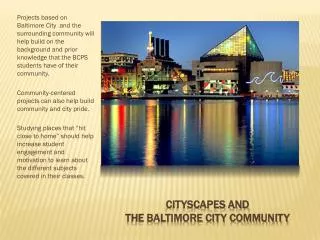
BALTIMORECommunity Indicators Roundtable Sustainability #VitalSigns16
History of BNIA-JFI • Advanced information systems with integrated and recurrently updated information on neighborhood conditions in their cities • “Democratization of Data” Overcome the resistance of local public agencies to sharing data • Baltimore one of the first cities • Now 36 partners • Moved to the Jacob France Institute in 2007
Community Based Indicators • Neighborhood context influences how activities and policies take hold • Bits of information that, when combined, generate a picture of what is happening in a local system • They provide insight into and ongoing monitoring of the overall direction of a community Rhonda Phillips, Community Indicators 2003
Choosing Indicators: Guiding Principles • Data is accessible and from a valid, reliable source • Baseline measures can be tracked over time • Key indicator “gets to the heart” of a broader concept • Indicator is actionable (i.e. communities can work to change the trajectory of a measure) • Coordinating indicators with existing/parallel processes envisioning Baltimore’s future
Acquiring Data Reliable Routinely- updated Key Staff Privacy Technical Spatial
Community Statistical Areas (CSAs) • Based on U.S. Census geographic areas (Census Tracts) • 200 Tracts merged together to form 55 Communities • Allows for easier visualization of patterns and trends across the city
Vital Signs, 2000-2010 Chapters • US Census & American Community Survey • Housing & Community Development • Children and Family Health & Wellbeing • Crime and Safety • Workforce & Economic Development • Sanitation • Urban Environment & Transit • Education & Youth • Neighborhood Action & Sense of Community
Vital Signs, 2011-2016 Chapters • Demographics/US Census • Housing & Community Development • Children and Family Health • Crime and Safety • Workforce & Economic Development • Sustainability • Education & Youth • Arts & Culture
Development of Vital Signs Sustainability Chapter • 2009 – Baltimore City adopted the Baltimore Sustainability Plan (29 goals across 7 topics) • Cleanliness, Pollution Prevention, Resource Conservation, Greening, Transportation, Education Awareness, Green Economy • Vital Signs Indicators included into the Annual Sustainability Report • 2011 – HUD Sustainable Communities Regional Planning Grant • 6 federal principals of livability • Baltimore added 7th – protection of waters in the Chesapeake Bay • Movement by residents/communities to sustainable behaviors • Increase in public transit, tree plantings, use of public and private space, and reducing energy use
Sustainability • Percent of Population that Drove Alone to Work • Percent of Population that Carpool to Work • Percent of Population that Uses Public Transportation to Get to Work • Percent of Population that Walks to Work • Percent of Employed Population with Travel Time to Work of 0-14 Minutes • Percent of Employed Population with Travel Time to Work of 0-14 Minutes • Percent of Employed Population with Travel Time to Work of 15-29 Minutes • Percent of Employed Population with Travel Time to Work of 30-44 Minutes • Percent of Employed Population with Travel Time to Work of 45 Minutes and Over • Rate of Dirty Streets and Alleys Reports per 1,000 Residents • Rate of Clogged Storm Drain Reports per 1,000 Residents • Percent of Area Covered by Trees • Number of Community Managed Open Spaces • Median Daily Water Consumption • Percent of Residences Heated by Utility Gas • Percent of Residences Heated by Electricity • Percent of Households with No Vehicles Available • Percent of Homes Weatherized • Percent of Population (Over the age of 18) Who are Registered to Vote • Percent Population (Over the age of 18) Who Voted in the General Election
Vitality in Neighborhoods = Umami? • What did we know? • Baltimore is the cultural and historic center of the region • Arts and Entertainment Districts: • Station North (est. 2002), Highlandtown (est. 2003) and Bromo Tower (est. 2012) • Research on Measuring Vitality • Arts opportunities providing spaces and events for social interaction of increasingly diverse residents (Ann Markusen) • Talent, Tolerance, Technology -- Creative Class (Richard Florida) • Presence, Participation, Support -- Urban Institute’s Arts and Culture Indicators Project
Arts & Culture • Number of Persons with Library Cards per 1,000 • Number of Event Permits Requested per 1,000 Residents • Public Art per 1,000 Residents • Number of Businesses that are Arts-Related per 1,000 Residents • Total Employment in Arts-Related Businesses • Rate of Businesses in the Creative Economy per 1,000 Residents • Number of Employees in the Creative Economy • Number of Public Murals
Connecting to Sustainability Plan • Energy Use and Education • Climate Change • Urban Agriculture • Natural Systems • Recycling and Reuse • Water Quality • Neighbors What Data Sources Exist to Measure these at the Neighborhood Level? What Indicators are Actionable at the Neighborhood Level?
In 2015 UN member states adopted 17 sustainable development goals
SDGs: A global aspiration the world commits to achieving by 2030
Connecting to Sustainable Development Goals What Data Sources Exist to Measure these at the Neighborhood Level? • Justice • Criminalization of Poverty • Living Wage • Sustainable Production What Indicators are Actionable at the Neighborhood Level?
THANK YOU Questions? Comments?