Download
1 / 71
710 likes | 820 Views
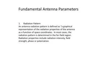
automated measurement of local ties and antenna parameters Proof-of-concept demonstration. Benno Schmeing University of Bonn, IGG. Contents. Introduction Motivation Objectives GGAO local site Chosen Approach Design of the monitoring system Measurement procedure Mathematical model

E N D
automated measurement of local ties and antenna parameters Proof-of-concept demonstration Benno Schmeing University of Bonn, IGG
Contents • Introduction • Motivation • Objectives • GGAO local site • Chosen Approach • Design of the monitoring system • Measurement procedure • Mathematical model • Analysis • Results • Calibration • Simulation • Measurement results
Motivation • for VLBI 2010 + GGOS 2020 • reduce working hours needed for determination of local ties • shorten monitoring interval here: proof-of-concept for VLBI antenna at GGAO
Objectives • Monitoring of VLBI antenna‘s • Reference point • Axis offset • Orientation of azimuth and elevation axes • Requirements: • Accuracy < 1mm • Automatic operations • Ability to include additional sensors, e.g. GPS, SLR
GGAO • 4 different geodetic sensors: • GPS • VLBI • SLR • DORIS • Geodetic network consisting of several piers and ground markers • We will concentrate on the VLBI antenna:
Design of the monitoring system? • How to identify antenna dish movement? • 360° prism marks one discrete point of the dish • total station determines prism’s movement • How to embed antenna parameters into (local) reference frame, e.g. to get local ties? • coordinates of piers and ground markers define local reference frame • Additionally possible: GPS sensors set up on the points • How to control antenna movement? • connection to Field System computer • Field System puts movement commands into practice
Design of the monitoring system? • How to control station? • using implemented interface (Lemo-RS232 interface with GSI commands) • How to achieve needed accuracy? • calibration of 360° prism’s orientation-dependent errors • correct atmospheric influence on total station measurements • eliminate instrument errors using the right measurement procedure
Design of the monitoring system • 360° prism mounted on antenna
Design of the monitoring system • Total station(s) on piers around the antenna
Design of the monitoring system • TCA specifications: (from: http://leica.loyola.com/products/total-stations/images/tps2000_lg.jpg; 09/14/2009)
Design of the monitoring system • TCA specifications: • angle measurement accuracy: 0.15 mgon (due atmosphere influence etc reachable accuracy is somewhat lower) • distance measurement accuracy: 1 mm + 1ppm • measurement distance (ATR): 5 … 500 m • measurement time: ~ 3 sec
Design of the monitoring system • Laptop as control unit for total station and antenna
Design of the monitoring system controls antenna movement, measures weather measures to antenna antenna positions, weather information directions + distances marker positions, control commands antenna control commands
Design of the monitoring system • Measurements controlled by Laptop (with Matlab) • Field System controls antenna movement and returns antenna position • Field System provides atmospheric conditions • Total station measures marker position • Data structure • Based on ASCII files • Files for … … network point coordinates and accuracy … calibration results … measurement schedules … measurement results
Design of the monitoring system Example: antenna measurement plan
Design of the monitoring system Example: network measurement plan
Measurement procedure • set up total station • leveling • determine approximate orientation + position • target prisms on other network points • ‘network measurement plans’ • provides data for exact determination of orientation (and position) • target prism on VLBI antenna at different azimuth and elevation positions • ‘antenna measurement plans’ • measuring the marker positions at different antenna azimuth and elevation positions
Measurement procedure • set up total station: • levelling • determine orientation and position
Measurement procedure • Set up total station: • levelling • determine orientation and position
Measurement procedure • Network measurements: • measure directions and distances to other network points • observations
Measurement procedure • Antenna measurements: • measure directions and distances to antenna in different positions • observations
Measurement procedure • Antenna measurements: • measure directions and distances to antenna in different positions • observations
Measurement procedure • Antenna measurements: • measure directions and distances to antenna in different positions • observations
Measurement procedure • Antenna measurements: • measure directions and distances to antenna in different positions • observations
Measurement procedure • Antenna measurements: • measure directions and distances to antenna in different positions • observations
Measurement procedure • Antenna measurements: • measure directions and distances to antenna in different positions • observations
Measurement procedure • Antenna measurements: • measure directions and distances to antenna in different positions • observations
Traditional approach • circle fitting: • separate antenna rotations around azimuth and elevation axis • estimation of circles described by antenna movement • reference point is projection from elevation axis onto azimuth axis
Traditional approach • circle fitting: (Johnston: The 2003 Yarragadee (Moblas 5) Local Tie Survey, GEOSCIENCE AUSTRALIA , RECORD 2004/19 )
Mathematical model • new approach [Loesler2008a, Loesler2008b]: • set of rotations and translations • describing transformation from antenna-fixed into local coordinate system • transformation parameters describe antenna characteristics
Mathematical model • a,b … marker coordinates in telescope system • E,OE… rotation around elevation axis (+orientation) • ecc … axis offset (eccentricity) • A,OA… rotation around Azimuth axis (+orientation) • PR … antenna’s reference point • a, b … correction for non-orthogonality of axes • g … correction for inclination
Mathematical model Observations: • Marker positions : x, y, z (by total station) • Antenna positions : A, E (by Field System) Parameters: • “antenna” : PR, ecc, a, b, g, OA • “marker” : a, b, OE
Mathematical model Observations: • Marker positions : x, y, z (by total station) • Antenna positions : A, E (by Field System) Parameters: • “antenna” : PR, ecc, a, b, g, OA • “marker” : a, b, OE
Analysis • data record for local network observations: • position and target ID • horizontal + vertical direction and distance to target • instrument settings (distance corrections, serial no.) • time tag • information about atmospheric conditions • data record for observations of VLBI antenna: • local network observables plus • antenna position (azimuth + elevation)
Analysis previous measurements network measurement Hz,V, Sd point coordinates + covariance matrix coordinate estimation using weak datum + weather data antenna measurement Hz,V, Sd antenna parameter estimation: loesler algorithm coordinates of the marker on the VLBI antenna in the local system azimuth + elevation of antenna antenna parameters
Analysis previous measurements network measurement Hz,V, Sd point coordinates + covariance matrix coordinate estimation using weak datum + weather data antenna measurement Hz,V, Sd antenna parameter estimation: loesler algorithm coordinates of the marker on the VLBI antenna in the local system azimuth + elevation of antenna antenna parameters
Analysis antenna measurement
Analysis antenna measurement Separate coordinate estimation Hz, V, Sd + weather data marker coordinates in current instrument reference frame azimuth + elevation of antenna Separate antenna parameter estimation Antenna parameters in different reference frames Comparison of reference frame-independent parameters
Calibration • TCA 2003: • additive constant • Field System: • measurement accuracy • prisms for network points: • additive constant • 360° prism used as marker • additive constant • orientation-dependent change of reference point
Calibration • TCA: • additive constant • Field System: • measurement accuracy (azimuth and elevation positions) • prisms for network points: • additive constants • 360° prism used as marker • additive constant • orientation-dependent change of reference point
Calibration • TCA: • additive constant • Field System: • measurement accuracy • prisms for network points: • additive constant • 360° prism used as marker • additive constant • orientation-dependent change of reference point
Calibration • TCA: • additive constant • Field System: • measurement accuracy • prisms for network points: • additive constant • 360° prism used as marker • additive constant • orientation-dependent change of reference point