Download
1 / 44
440 likes | 515 Views
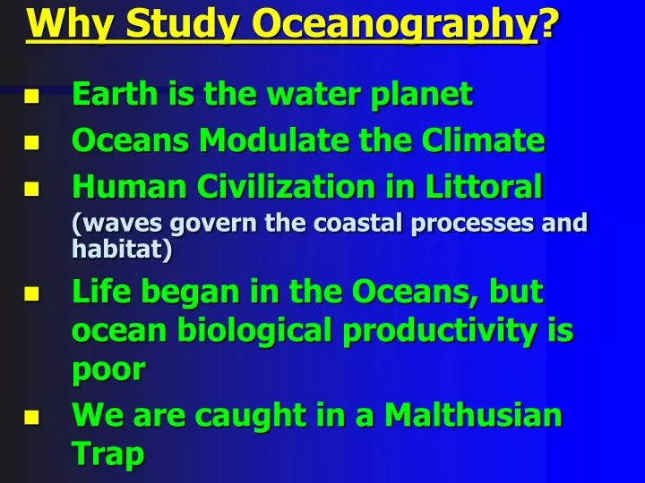
Why Study Oceanography ?. Earth is the water planet Oceans Modulate the Climate Human Civilization in Littoral (waves govern the coastal processes and habitat) Life began in the Oceans, but ocean biological productivity is poor We are caught in a Malthusian Trap.

E N D
Why Study Oceanography? • Earth is the water planet • Oceans Modulate the Climate • Human Civilization in Littoral (waves govern the coastal processes and habitat) • Life began in the Oceans, but ocean biological productivity is poor • We are caught in a Malthusian Trap
Earthrise over Smythii impact basin with Schubert impact crater on horizon. Views like this during Apollo missions made it clear that Earth is part of a planetary system rather than an isolated sphere, subject to the same bombardment that battered the surface of the Moon. (Apollo 11 AS11-44-6551)
Earth, the “Third Rock from Sun” is also called the “Lonely Planet” because, to our knowledge as yet, earth is the only planet with evidence of life and it is water that creates this uniqueness.
NASA - Topex / Poseidon Oceanography Mission Ends The joint NASA/Centre National d'Etudes Spatiales Topex/Poseidon oceanography satellite ceased operations after nearly 62,000 orbits of Earth. The spacecraft lost its ability to maneuver, bringing to a close a successful 13-year mission. Topex/Poseidon data have helped in hurricane and El Nino/La Nina forecasting, ocean and climate research, ship routing, offshore industries, fisheries... http://www.youtube.com/watch?v=OvE22AUl-_w
This uniqueness comes from two cycles that define the Earth ... • hydrological cycle; • and • plate tectonics.
Evaporation 60,000 km3 Precipitation 95,000 km3 Run-off: 35,000 km3 Evaporation 320,000 km3 Precipitation 285,000 km3 Ocean Storage 1,370,000,000km3 • A conceptual look at the hydrological • cycle. Notice three aspects of it: • Evaporation exceeds precipitation over the oceans, but precipitation exceeds evaporation on land. • Currently, atmosphere transfers by precipitation all the water it receives by evaporation. • Run-off carries excess water as also rock materials from land to to oceans. Sediments
Mount Annapoorna, 26,545 ft (8,091 m) Present is the key to the past, i.e., the geological processes today are the same as they have always been.
Venus Earth Mars
The World Ocean Area (106 km2) Volume (106 km3) Mean Depth (km) Pacific Ocean Atlantic Ocean Indian Ocean 165.2 82.4 73.4 4.282 3.926 3.963 707.6 323.6 291.0
Ocean Storage 3 1,370,000,000 km Evaporation 60,000 km3 Precipitation 95,000 km3 Evaporation 320,000 km3 Run-off: 35,000 km3 Precipitation 285,000 km3 A conceptual look at the hydrological cycle
A trio of frames from Polar's Visible Imaging System (VIS), taken 6 seconds apart on December 31, 1998, captures an object rapidly descending toward northern Europe. Because the camera's filter isolates emission from hydroxyl (OH) radicals, the incoming object must have contained abundant water.
The Oceans • cover ~71% of earth’s surface and have an average depth of ~3.8 km; • carry most (80-97.5%) of the hydrospheric water supply; • evolved ~4 Ga ago, in an event that created the atmosphere, the hydrosphere and the biosphere;
The Earth • evolved ~4.7 Ga ago, together with the rest of the Solar System, from a hydrogen-helium dust cloud; • is largely spherical, with ~6371 km average radius, an equatorial bulge and polar flattening; • is a multilayered body, with core, mantle and the crust; • is unique in having water; and • has a hemispherically asymmetric distribution of land and oceans.
Continental mountains (10.3%) ) % 2 9. 2 ( Ocean ridges (22.1%) D N Continental platforms (18.9%) A L Continental shelf and slope (11.4%) Ocean basin floors (29.8%) ) % 8 0. 7 ( N A E C O Continental rise (3.8%) Island arcs, trenches, guyots etc. (3.7%)
2 Surface Area (million km ) 5 10 15 20 25 90 N o Whole Earth 60 N o Land 30 N o Oceans Latitude 0 o 30 S o 60 S o 90 S o
Whole Earth Earth’s Crust Universe HydrogenHelium Oxygen Carbon Nitrogen Silicon Neon Magnesium Iron Sulphur Aluminum Calcium Nickel Sodium Argon Chromium Phosphorous Manganese Chlorine Potassium Other elements HHe O C N Si Ne Mg Fe S Al Ca Ni Na Ar Cr P Mn Cl K 29.8 15.6 13.9 33.3 1.5 1.8 2.0 0.2 1.9 74.50023.840 0.8200 0.3750 0.0910 0.0830 0.0550 0.0570 0.1040 0.0380 0.0066 0.0074 0.0092 0.0033 0.0030 0.0032 0.0009 0.0011 0.0006 0.0003 46.6 27.7 2.1 5.0 8.1 3.6 2.8 2.6 1.5 The whole earth is richer in Fe, Mg and Ni, and poorer in Si, K and Al, than what is found on the earth’s surface. Crust Mantle Rocky Outer core Core Metallic Inner core Whole Earth density = 5.5 gm/cm3 Density of the crust = 2.7 gm/cm3
rpole req r = 6371 km) 10 m - 30 m Earth has an equatorial bulge and polar flatenning, the equatorial radius (req) being ~21 km greater than the polar radius (rpole) . The radius (r) of an equivalent sphere is 6,371 km. Equivalent sphere Based on satellite mapping, the earth is now known to be truly pear-shaped, in that, added to facts of earth’s equatorial bulge and polar flatenning, the south pole is ~40 m closer to the earth’s center than the north pole.
How much water in the hydrosphere ? An average person needs ~300,000 gallons of water per year (1 metric ton = 263 gallons), including 250,000 gallons for growing food. Indeed, nations with <150,000 gallons annual per capita water availability face severe limits to economic growth. Hydrospheric mass in trillion metric tons Including all the land and marine sedimentary formations worldwide* Excluding the coastal marine sediments Oceans Pore water in sediments Glacier and polar icecaps Surface water (rivers, lakes) Atmospheric moisture 1,370,000 300,000 25,000 300 13 80.8% 17.7% 1.5% 0.018% 0.0008% 1,370,000 10,000 25,000 300 13 97.5% 0.7% 1.8% 0.02% 0.0009% * Based on Karl Turekian: GLOBAL ENVIRONMENTAL CHANGE (Prentice Hall, 1996)
A panoramic view of the Martian surface, as seen by the Pathfinder