Download
1 / 37
370 likes | 529 Views
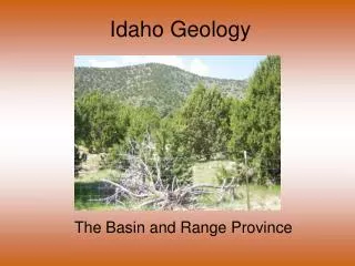
Idaho Geology. The Plateau Regions. Parts of the greater volcanic Columbia Plateau of Washington. The Clearwater Plateau is the second region of Idaho formed like the Columbia Plateau. Clearwater Plateau. Area drained by the Clearwater River, including the Palouse Hills.

E N D
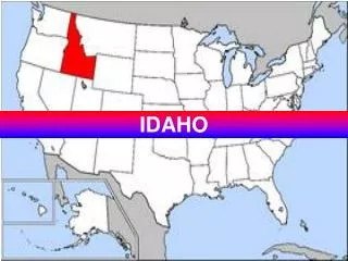
Idaho Geology The Plateau Regions
Parts of the greater volcanic Columbia Plateau of Washington
The Clearwater Plateau is the second region of Idaho formed like the Columbia Plateau Clearwater Plateau
Area drained by the Clearwater River, including the Palouse Hills
Tall rolling hills and gently sloping prairies A lot of it is ideal for farming for many reasons
Clearwater and tributaries like the Potlatch WA ID Post Falls Moscow Potlatch River Dworshak Clearwater River Clarkston-Lewiston Snake River
The Clearwater joins the Snake at the western edge of Idaho Snake River on border Clearwater joining from the east
Much of the region formed by wind and water erosion. Covered by a thick layer of rich topsoil of eroded volcanic material mixed with clay-like glacial sediment blown in from Puget Sound (loess). This makes up the Palouse Hills.
Wheat farms of the Palouse with rich water-holding soil called loess
Clearwater Climate • Fairly mild • Summer temp. averages 89 degrees with cool evenings • Winter temp. averages 26-31 degrees • Precipitation 20+ inches (25-55 in higher elevations) • 4-6 month growing season! (the Banana Belt)
The grasslands originally covering much of the region have now been generally replaced by domesticated grasses (wheat, oats, barley) and legumes (alfalfa, peas, lentils) • Crop rotation and fallow fields help offset the loss of nutrients and water
At higher elevations through the plateau and as the plateau in the east rises to meet the Rockies, evergreen forests are found. These are mainly………
3rd Volcanic region in Idaho Owyhee-Bruneau Plateau
Mountains Poison Creek Hills Jump Creek Hills French John Hills Owyhee Mts.
Rivers Bruneau River Salmon Falls Creek Owyhee River Jarbridge River
Owyhee-Bruneau becoming a plateau through uplifting forces. This is the main difference between it and the Snake River Plain Lava layers from the many preceding fissure flows
2000-5000 feet above the SRP; some peaks rising to 8000 feet
Why is it so dry? WA, OR, CA ID Rainshadow Effect
Climate • Extreme and semi-arid • Precipitation 13-20 inches • Summer average temp. = 88 degrees • Winter average = 12 degrees
O-B Summary • Hostile environment and climate • Ranching is main industry • Low population density (more cows and sheep than people) • Few towns • Murphy is the county seat of Owyhee County (pop. 600)