Download
1 / 35
350 likes | 483 Views
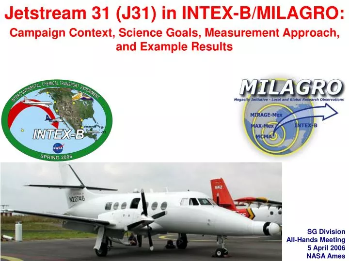
Jetstream 31 (J31) in INTEX-B/MILAGRO: Campaign Context, Science Goals, Measurement Approach, and Example Results. SG Division All-Hands Meeting 5 April 2006 NASA Ames. Jetstream 31 (J31) in INTEX-B/MILAGRO: Campaign Context, Science Goals, Measurement Approach, and Example Results.

E N D
Jetstream 31 (J31) in INTEX-B/MILAGRO:Campaign Context, Science Goals, Measurement Approach, and Example Results SG Division All-Hands Meeting 5 April 2006 NASA Ames
Jetstream 31 (J31) in INTEX-B/MILAGRO:Campaign Context, Science Goals, Measurement Approach, and Example Results Phil Russell, Lead PIInstrument PIs: Jens Redemann, Brian Cairns, Peter Pilewskie, Sebastian Schmidt, Charles Gatebe, Michael King, Warren Gore, Rose Dominguez Project Office: Michael Gaunce, Sue TolleyFlight Ops: Ben Hovelman and the rest of the J31 Team SG Division All-Hands Meeting 5 April 2006 NASA Ames
Campaign Context: In March 2006, INTEX-B/MILAGRO studied pollution from Mexico City and regional biomass burning, including sources, transport, transformations, and effects. MILAGRO included many measurements in and downwind of Mexico City, 5 A/C based in Veracruz, MX and 1 in Houston, TX.
Campaign Context: In March 2006, INTEX-B/MILAGRO studied pollution from Mexico City and regional biomass burning, including sources, transport, transformations, and effects. MILAGRO included many measurements in and downwind of Mexico City, 5 A/C based in Veracruz, MX and 1 in Houston, TX. J31 Overview: For INTEX-B/MILAGRO the J31 was equipped to measure solar energy and how that energy is affected by the above pollution and Earth's surfaces.
Because solar energy drives Earth's climate, the J31 suite of measurements helps show how changing atmospheric and surface properties can change the climate
SCIENCE GOALS,J31 in INTEX-B/MILAGRO: Aerosol, Water Vapor, Cloud, & Surface Properties and Radiative Effects • Characterize the distributions, properties, and effects of aerosols and water vapor advecting from Mexico City and biomass fires toward and over the Gulf of Mexico • Aerosol Optical Depth And Extinction Spectra (354-2138 nm) • Water Vapor Columns and Profiles • Aerosol Radiative Impacts: In Clear Sky (Direct Effect) & Via Clouds (Indirect Effect) • Test the ability of Aura, other A-Train & Terra sensors, & airborne lidar to retrieve aerosol, cloud, and water vapor properties • Characterize surface spectral albedo and bidirectional reflectance distribution function (BRDF) to help improve satellite retrievals • Quantify the relationships between the above and aerosol amount and type Mexico City Veracruz
J31 in INTEX-B/MILAGRO: Instrument Locations AATS-14 SSFR POS RSP NavMet CAR
J31 Science Objectives by Sensor1. Independent of other J31 sensors AATS • Characterize horizontal & vertical distributions of aerosol optical depth (AOD) and extinction spectra (354-2138 nm), water vapor columns and density • Validate A-Train & Terra products (CALIPSO, OMI, MODIS, POLDER, TES, AIRS, MISR) • Test closure with remote and in situ sensors on other platforms, including airborne lidar • Test chemical transport models using AOD & extinction profiles • Assess regional aerosol radiative effects SSFR • Retrieve cloud droplet radius, optical depth, and liquid water path • Compare with satellite retrievals (MODIS) and remote & in situ sensors on the surface and other aircraft (incl. microwave, radar, optics, etc.) • Compare spectral irradiance from SSFR to that from 3-d model using MODIS input • Provide surface spectral albedo to help improve satellite aerosol retrievals • Determine column solar radiative boundary conditions for modeling studies
J31 Science Objectives by Sensor1. Independent of other J31 sensors RSP • Estimate direct and indirect effects of aerosols on radiative forcing of climate • Evaluate aerosol and cloud retrieval algorithms for the NASA Glory mission Aerosol Polarimetry Sensor. • Validate aerosol and cloud products from A-train & Terra (MODIS, MISR, POLDER on Parasol, OMI, CLOUDSAT) CAR • Measure bidirectional reflectance distribution function (BRDF) for variety of surfaces (e.g., urban center, ocean, cloud, uniformly vegetated soil) at different sun angles & altitudes • Retrieve BRDF and aerosol properties by combining CAR with AERONET • Validate satellites and inter-compare with in-situ measurements (size distribution, SSA, albedo, etc.)
J31 Science Objectives by Sensor2. Objectives that combine data from 2 or more J31 sensors AATS-SSFR • Derive aerosol radiative forcing from simultaneously measured radiative flux and AOD gradients • Study effect of over-cloud AOD on cloud property retrievals by SSFR and satellites • Study Influence of aerosols on cloud radiative forcing: AATS-14 extinction above cloud • Derive spectra of aerosol absorbing fraction (1-SSA) from spectra of radiative flux and AOD in thick pollutedlayers RSP-AATS • Validate RSP retrieved spectral optical depth • Atmospheric correction of low altitude measurements to provide accurate surface polarized BRDF
J31 Science Objectives by Sensor2. Objectives that combine data from 2 or more J31 sensors RSP-AATS-SSFR • Evaluate remote sensing methods (RSP + lidar) for determining the aerosol radiative forcing profile against the measured spectral optical depth and radiative flux profile CAR-AATS • Retrieve BRDF and aerosol optical properties simultaneously from combined data sets: CAR, AATS, and AERONET. CAR-AATS-RSP • Extend CAR retrieval algorithm to include RSP, AATS, AERONET.
To accomplish these goals and objectiveswe had: • 19 Days (3-21 Mar) • 45 Flight Hours
To accomplish these goals and objectiveswe had: • 19 Days (3-21 Mar) • 45 Flight Hours • A/C & Instruments performed very well • A/C available to fly every day • Instruments had very high data capture rates
J31 Science Flights out of Veracruzin MILAGRO/INTEX-B (cont'd)
J31 Example Results • Jens Redemann: AATS • Chris Hostettler: AATS-HSRL-HiGEAR Comparison • Brian Cairns: RSP • Sebastian Schmidt, Peter Pilewskie: SSFR
AATS-14 on the J31 in INTEX-B/MILAGRO:Science Goals, Objectives, and Required Flight PatternsJens Redemann, Phil Russell, John Livingston, Roy Johnson, Nicholas Truong, Beat Schmid, Qin Zhang and the J31 team
March 10, MISR local mode and MODIS-Terra coincidence over the Gulf of Mexico, the retrieval maps show MODIS-Terra results and J-31 flight track
March 10, 2006 - MODIS-Terra coincidence over the Gulf of Mexico MODIS AATS-14 MODIS/AATS 470 / 453 550 / 519 870 / 864 2140 / 2139
March 6, MISR local mode over Mexico City MISR 70 deg aft. Courtesy of Ralph Kahn, MISR team
March 6, variability in aerosol and CWV during MISR local mode over Mexico City
J31 Example Results • Jens Redemann: AATS • Chris Hostettler: AATS-HSRL-HiGEAR Comparison • Brian Cairns: RSP • Sebastian Schmidt, Peter Pilewskie: SSFR
One King Air/HSRL Goal: Evaluate/validate the HSRL retrieved profiles of aerosol extinction
Evaluate/validate the retrieved profiles of aerosol extinction • Compare aerosol extinction/optical thickness with AATS14 on J-31 • AATS14 data courtesy of Russell, Redemann, Livingston
Comparison of HSRL extinction/AOT with other instruments • Comparison of aerosol extinction/optical thickness with AATS14 on J-31 and HIGEAR on C130 • AATS14 data courtesy of Russell, Redemann, Livingston • HIGEAR data courtesy of Tony Clarke Spiral location for J31 & C130
J31 Example Results • Jens Redemann: AATS • Chris Hostettler: AATS-HSRL-HiGEAR Comparison • Brian Cairns: RSP • Sebastian Schmidt, Peter Pilewskie: SSFR
RSP on J31: Science Objectives RSP • Evaluate aerosol and cloud retrieval algorithms for the NASA Glory mission Aerosol Polarimetry Sensor. • Validate aerosol and cloud products from A-train & Terra (MODIS, MISR, POLDER on Parasol, OMI, CLOUDSAT) RSP-AATS • Validate RSP retrieved spectral optical depth • Atmospheric correction of low altitude measurements to provide accurate surface polarized BRDF Mexico City surface photographed by RSP camera on J31 flight
RSP on J31: Example Results RSP • Urban surfaces are bright, heterogeneous and filled with man-made objects • How well do simple conceptual models work? • Surface reflectance is bright • Polarized reflectance is not. Polarized surface reflectance quite grey.
RSP on J31: Example Results (cont'd) RSP • Atmospheric signal large compared to surface • Surface quite grey • implies aerosol retrievals should be of comparable accuracy to other retrievals over land (i.e. optical depth within 0.03, refractive index, single scattering albedo for optical depths greater than 0.3)
J31 Example Results • Jens Redemann: AATS • Chris Hostettler: AATS-HSRL-HiGEAR Comparison • Brian Cairns: RSP • Sebastian Schmidt, Peter Pilewskie: SSFR
SSFR Solar Spectral Flux Radiometer on J31 F F sebastian.schmidt@lasp.colorado.edu jpommier@mail.arc.nasa.gov peter.pilewskie@lasp.colorado.edu
SSFR Solar Spectral Flux Radiometer on J31 Example: MARCH-10 (A.M. flight) – Time Series – leveled data as archived NOTE: Archive includes time series of 9 wavelengths in VIS and NIR, and two broadband (350-700 nm and 350-2200 nm) for the upward and the downward sensor. SURFACE ALBEDO FOR T0, T1, T2: We hope to get a Ci free day to provide this product META DATA: We have photos monitoring the general situation. Where could we post that kind of information? below layer above layer sebastian.schmidt@lasp.colorado.edu jpommier@mail.arc.nasa.gov peter.pilewskie@lasp.colorado.edu