Download
1 / 17
1.03k likes | 2.77k Views
The Use of Remote Sensing for Soil Mapping: A Review. Ronald Vargas Rojas and Christian Omuto Nairobi, 12 th June, 2007. WHAT’S SOIL?. B. “Soil is the material composed of mineral particles and organic remains that overlies the bedrock and supports the growth of rooted plants”.

E N D
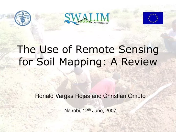
The Use of Remote Sensing for Soil Mapping: A Review Ronald Vargas Rojas and Christian Omuto Nairobi, 12th June, 2007
WHAT’S SOIL? B “Soil is the material composed of mineral particles and organic remains that overlies the bedrock and supports the growth of rooted plants” Soil varies along the different landscapes A-B A
HOW SOIL IS FORMED? Soil Forming Factors, Jenny’s equation: S = f (cl, o, r, p, t) S = soil cl = climate o = organisms (plant, animal and humans) r = relief p = parent material t = time
WHAT IS SOIL? 4th dimension is time Y “Soil is considered an heterogeneous fourth dimensional body that is continuous along the landscape”. X Z
SOIL VARIABILITY: horizontal Soil is spatially variable in terms of x, y, z………. Is it really soil what we are looking at? Geographic space or spatial variability
SOIL VARIABILITY: vertical A Btss Soil development through horizonation. Bg
WHAT DO WE MAP? Soil individual vs. Soil continuum Soil as soil body (pedon). A soil unit (mappable) polipedon. Discrete Model of Spatial Variation (polygon based). Soil is a continuous resource in the geographic space. Continuous Model of Spatial Variation (grid)
WHAT IS A SOIL MAP? • A soil map should show the location, distribution and pattern of soils in the landscape. • Needs of soil spatial data has increased for different applications.
SOIL MAPPING METHODS Conventional soil mapping DMSV, polygon based mapping Soil classes are mapped Soil survey + finding soil-landscape relationship (photointerpretation of aerial photographs or satellite images). + soil profile description + soil classification + soil mapping Baranja, Croatia (source: Tomislav Hengl, Msc thesis, ITC)
SOIL MAPPING METHODS Digital soil mapping (pedometrics) CMSV, grid mapping (pixels). Implementation of Jenny equation in quantitative terms. Spatial approach. Different tools (geostatistics, digital terrain analysis, remote sensing, fuzzy logic, decision trees, etc) . Mapping mainly soil attributes. Range of organic carbon (%) for the topsoil. Minasmy, 2006.
Radio Energy increases Microwave Object IR VIS UV X-Ray Gamma PRINCIPLES OF REMOTE SENSING The principle of remote sensing RS – Collection of information about an object without physical contact with it. - Digital measurements of electromagnetic energy reflected/radiated by an object. EM radiations are used EM Spectrum Components of RS Transmission Target Sensor Obstruction Energy source -Constant speed -Carry energy
Sensing windows % R Wavelength RS radiations can be: Sensor RS Characteristics & potentials in soil mapping Sun • Polarized • Reflected • Diffracted • Attenuated • Absorbed Sky • .. and they influence • spatial resolution • spectral resolution Earth TAXONOMY OF RS SYSTEMS Passive systems Active systems Solar Thermal Microwave X-ray/Gamma VIS/IR Non-imaging IR Microwave Radiometry X-ray Laser & M/NIR Spectrometry Radar Microwave Gamma Imaging IR Microwave Radiometry A. Photo VIS/IR imaging Radar/SAR Sounding UV sounding IR Microwave Sounding Lidar
Sensor Sun Sky Earth Potentials and limitations of RS for soil mapping What RS can see • Top of the clouds • Land cover • Land surface • Soil particles/properties Potential uses from the above detectable features • Land cover, biomass, global circulation, soil surface • Sea/ocean surface, soil moisture, etc. Important opportunities Limitations • Integration with pedometrics • Integration with ground sampling • Integration of products from different types of RS • Estimation of the Jenny’s factors • Below-clouds atmospheric dynamics • Atmospheric attenuation, resolution, • Penetration (vegetation and soil depth)
Main applications of RS in soil mapping • Optical Systems Land cover (biomass estimation) Soil cover or surface Soil erosion features from high resolution images • Radar systems Digital terrain data Assessment of soil moisture • Thermal systems Little investigated, but mainly for soil pore structure • Geophysical systems Lithology and mineralization
Radar SRTM (DEM), GPS (position) How have researchers used RS in mapping soils? • Infrared spectroscopy Janik et al. (1998); Aust. J. Exp. Agr.38: 681-696. Shepherd and Walsh (2002): SSSAJ: 66: 988-998 Eshel et al. (2004): SSSAJ: 68: 1982-1991 VIS/NIR/MIR/NMR (laboratory, field??) for prediction of soil properties • Thermal remote sensing Sullivan et al. (2004): RS & Mod. Ecos. & Sus. 5544: 566-275 Petersen et al. (1987): RSE: 23: 253-271 Mapping soil moisture, temperature, and texture • Microwave RS Engman et al. (1996). Geos. & RS. 2(27):1058-1060 Bindlish et al. (2006). RSE. 103: 127-139 Mapping soil moisture • Optical remote sensing Chabrillat et al. (2002). RSE. 82: 431-445 (Hyperspec) Palacios-Orueta & Ustin (1998): RSE 65: 170-183 (AVIRIS) Mapping soil cover, land cover….. • Gamma radiometry Wilford et al. (2001). AGSO J. geol & Geosp. 17: 201-216 Taylor et al. (2002). Expl. Geophys. 33: 95-102 Mapping land surface profile, DEM • Fusion techniques Ricchetti (2001): IJRS, 22, 2219-2230 Combining solar bands and microwave/RADAR
CONCLUSIONS: is RS a useful tool for soil mapping? RS tools are very useful for soil mapping in both approaches (conventional and DSM). The idea of using optical RS for mapping soils directlyis not possible since soil development is in depth and we could see that satellite images just reflect the soil surface or land cover. RS and Pedometrics are directly linked in generating ancillary data layers for mapping soils. Thus, they have huge potential in soil mapping. Conventional mapping can greatly benefit from RS, especially nowadays where many different satellite images and aerial photographs are available with different spatial, spectral, and temporal resolutions. Different unexplored fields of RS are under research and definitely promising tools for mapping soils in the near future. The conventional soil mapping activities are critiqued for being slow and expensive. Modern soil scientists are therefore trying to develop methodologies and tools to expedite the process. However, we can conclude that RS is a good tool but direct contact with the object cannot be replaced, specially when dealing with a complex system such as soils.