Download
1 / 25
250 likes | 334 Views
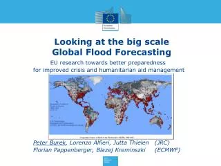
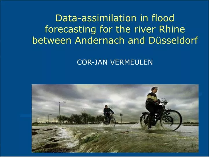
Data-assimilation in flood forecasting for the river Rhine between Andernach and Düsseldorf. COR-JAN VERMEULEN. Introduction. 238 recorded floods in Europe between 1975 and 2001. Deaths per events. Flood events. Introduction.

E N D
Data-assimilation in flood forecasting for the river Rhine between Andernach and Düsseldorf COR-JAN VERMEULEN
Introduction 238 recorded floods in Europe between 1975 and 2001
Deaths per events Flood events Introduction
FloodMan:Near real-time flood forecasting, warning and management Introduction Huge investments in flood prevention, flood early warning, flood mitigation measures and flood management
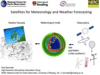
Introduction • Data-assimilation of hydrological and hydraulic parameters for flood forecasting • Independent of the computer models used • Use of in-situ and satellite data • Pilot:Rhine river, Germany
Data-assimilation • Combining model estimates with measured data • Including measure of uncertainty for estimates
Flood forecasting system • Rainfall-runoff Model (HBV) • Water Transport Model • Hydraulic Model (Sobek) • Data-assimilation
Hydro-meteo database Hydrologicalmodel Filtered model parameters Data-assimilation runoff prediction Hydraulicmodel Filtered water levels and flows Data-assimilation Prediction of water levels and flows Data-assimilation actual measurements
Weather forecast Hydrologicalmodel Forecast tributaries Hydraulicmodel Flood forecast Forecast
Flood forecasting system • Data-assimilation hydrological model • Sensitivity and uncertainty analysis • Adaptation soil moisture content • Adaptation upper zone • All sub basins treated equally • Use adaptation factors in forecasting
Data- assimilation Flood forecasting system • Data-assimilation hydraulic model • Sensitivity and uncertainty analysis • Adaptation roughness main channel • Adaptation lateral discharges • Desired accuracy • Until calculated water levels at Bonn and Cologne “agree” with measurements • Use adaptation factors in forecasting
Conclusions data-assimilation in-situ data • Large calculation time (10 minutes for a day) • Relatively small changes parameters indicating: • well calibrated hydraulic model • robust data-assimilation algorithm • Forecast pattern remains similar • Average accuracy around 5 cm in water levels
Role of satellite data • Use of satellite data in deducing water levels • Additional information is to be used in data-assimilation of hydraulic model • Satellite ‘measurements’ are, compared to in-situ measurements: • less accurate, but • more detailed
Possible role of satellite data • No real flood maps based on EO-data available for Rhine river, Germany • Synthetic flood maps, using hydraulic model and a digital terrain model • Introducing inaccuracies (‘noise’) by modelling errors in: • geo referencing; and • classification
Conclusions using flood maps • Results depend on quality of satellite data • high resolution • low noise • Flood maps to water levels • Area’s instead of cross-sections • stretches long enough (5 – 10 km) • straight river sections • gentle slopes, no steeps banks • Opportunity • comparison of flood extent calculated and satellite data.
Conclusions FloodMan • The flood forecasting system is robust and ready to serve under operational conditions; • In the pilot small improvement in the flood forecast accuracy; • Forecast including measure of uncertainty: useful for decision making. • Use of satellite data is promising, especially for river systems with few gauging stations • BUT high resolution satellite data needed
Further work • Flood forecast systems with data-assimilation on hydrological and hydraulic model are implemented • Different data-assimilation algorithms • Data-assimilation to combine rainfall radar data with in-situ measurements • Use of satellite data to determine flood extent in case of dike breach for: • estimate width and depth of dike breach • estimate discharge at dike breach
Sobek Actualisation HBV Flood maps Questions ? Evacuation data-assimilation Forecasting