Download
1 / 40
400 likes | 466 Views
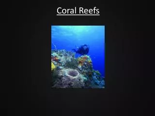
Modeling Threats to Coral Reefs and Economic Impacts. Lauretta Burke World Resources Institute (WRI). P - S - R. Pressure. State. Response. Threats can change condition and productivity. Threats Overfishing Sewage Discahrge Increased Sediments and Nutrients Mangrove Removal.

E N D
Modeling Threats to Coral Reefs and Economic Impacts Lauretta Burke World Resources Institute (WRI)
P - S - R Pressure State Response
Threats Overfishing Sewage Discahrge Increased Sediments and Nutrients Mangrove Removal Change in Coral condition LCC Diversity Coral extent Coral growth Threats can change condition and productivity Change in Productivity • Fish Production • Visual appeal from divers • Shoreline Protection
Fish Productivity Fish Catch Fishing Costs Changes in Good / Service
Visual Appeal to Divers Some divers go to other destinations Some divers do fewer dives Some retire Changes in Good / Service
Shoreline Protection Services (Will take longer to observe) May result in increased routine erosion Less protection during big storms Changes in Good / Service
Assumptions required for these links • Physical • Economic
Assumptions required for Fisheries • Productivity for different reef quality levels (based on synthesis of literature) 2. Hand over to economists to evaluate implications of change in price and In fishing costs.
Assumptions required for Dive Tourism • Diver “balk rate” due to change in reef condition (based on published and unpublished dive industry surveys and synthesis of expert opinion)
Why model threats to reefs? • Raise awareness about threats to coral reefs • Establish linkages between human activity and coral condition • Develop a standardized indicator of threat to coral reefs from human activities • Promote sharing and improvement of information through data integration and distribution
Spatial Threat Analysis • Scale Dependent • More detailed data yield more precise results
Threat Analysis Approach • Define threats (or categories) • Identify contributing factors • (Stressors and physical factors) • Consider how to operationalize indicators of threat • Data availability • Rules / model • Calibration and Validation of model results
Examples • Reefs at Risk – Coastal Development • Reefs at Risk – Watershed-based Threat • Population Pressure Indicator for Tobago • Land cover and watersheds in Tobago
Threat: Coastal Development • Dredging, land filling and reclamation • Mining of sand and coral • Runoff from construction • Sewage discharge • Impacts from tourism Replace photo
Coastal Development Analysis Method • Proxy Indicators Mapped “Stressors” Airports Dive Centers Cities Towns
Coastal Development Analysis Method • Proxy Indicators • Distance from development features Threats Estimated Medium High Estimated Threat From Coastal Development
Coastal Development Analysis Method • Proxy Indicators • Distance from development features • Coastal Population Pressure Reefs Classified Reefs Threatened by Coastal Development Low Medium High
Low Medium High Finding: COASTAL DEVOPMENTthreatens an estimated one-third of Caribbean coral reefs. Estimated threat
Threat: Sediment and Pollution from Inland Sources • Land clearing • Poor agricultural practices • Fertilizer and pesticide runoff
Watersheds are critical units for analysis and management Elevation Puerto Rico
Watersheds are critical units for analysis and management Watersheds & Rivers Puerto Rico
Watersheds are critical units for analysis and management Pour points Puerto Rico
Model Overview • Watershed-based Analysis • Relative erosion rates are estimated for all land areas • Relative erosion rates (and sediment delivery) are summarized by watershed • Sediment dispersion estimated from river mouths
Analysis Method Relative Erosion Potential – • USDA’s Revised Universal Soil Loss Equation (RUSLE) • Combines four factors into single index • slope • precipitation • soil characteristics • land cover type
Analysis Method Relative Erosion Potential – • USDA’s Revised Universal Soil Loss Equation (RUSLE) • Combines four factors into single index • slope • precipitation • soil characteristics • land cover type
Low High Land Cover Type Effects Erosion Rates Relative Erosion Rate Land Cover Type
Relative Erosion Potential – four factors used Land Cover Type Slope Soil Porosity Precipitation
Relative Erosion Potential (REP) Mean REP by watershed
Relative Sediment Delivery Sum of REP for watershed, adjusted by watershed size, is assigned to the river mouth
Sediment Dispersion Plumes estimated based on sediment delivery and distance from the river mouth
Reefs Classified by Sediment Threat Low Medium High
Low Medium High Finding: SEDIMENT AND POLLUTION FROM INLAND SOURCES threaten more than one-third of Caribbean coral reefs. Estimated threat
Population Pressure - simple, but meaningful indicator
Scenarios • Open