Download
1 / 20
200 likes | 315 Views
The 2020 Redistricting Data Program. (and the role of the Boundary and Annexation Survey). Redistricting Data Program. Outline Data Products Update Influence of Boundary and Annexation Survey on the Redistricting Data Program Boundary and Annexation Survey resources.

E N D
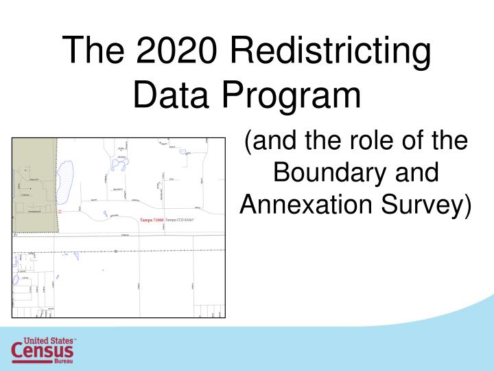
The 2020 Redistricting Data Program (and the role of the Boundary and Annexation Survey)
Redistricting Data Program • Outline • Data Products Update • Influence of Boundary and Annexation Survey on the Redistricting Data Program • Boundary and Annexation Survey resources
Data Products (Shapefiles) • 113th Congressional District and new State Legislative District Shapefiles • BAS Partnership Shapefiles – available now • TIGER Line Shapefiles – early 2013 • 2010 Demographic Profile Shapefiles • Based on 2010 TIGER/Line – available now (does not contain the 113th CDs or new SLDs)
Data Products (Maps) • National CD Wall Map • 1st Quarter 2013 • Individual CD Wall Maps • early 2013 through Summer 2013 • Individual SLD maps • Summer 2013 • State CD wall maps • Fall of 2013
Data Products (Relationship Files) • Congressional and State Legislative Districts • by American Indian Area • by Census Tract • by County / County by District • by County Subdivisions • by Place • by School • by Urban/Rural Population and Land Area • by Zip Code Tabulation Area (ZCTA)
Data Products (Tabulations) • 113th Congressional District Summary File • Re-tabulation of the Summary File 1 for the newly redistricted Congressional Districts • June 2013 • American Community Survey • 113th Congressional Districts • ACS 1-year, 3-year, 5year releases (2012 data) • End of 2013 • State Legislative Districts • ACS 5-year release only (2012 data) • End of 2013
Data Products (Web) • Updated and consolidated RDO webpage www.census.gov/rdo - Available Now • Consolidated 2010 Census page • 113th Congressional and new State Legislative Districts page • American Fact Finder redesign (coming Jan. 2013) • More intuitive • Tailored for different levels of data user • 4 “Pathways”
Data Products (Web) • American Fact Finder Pathways • Community Facts • Quick and direct • Guided Search • Step by step • Advanced search • Current full option search • Download • Consolidated source for large downloads
How On-Going Census Programs Affect RDP and the Final Tabulation Geography MAF/TIGER Geographic Database MAF/TIGER Base Data for Decennial Programs Decennial Programs (Voting Districts; Block Boundary Suggestion Project; Participant Statistical Areas; etc.) On-going Census Programs (Boundary and Annexation Survey; School District Review Program; GSS Initiative; etc.) MAF/TIGER 2020 Tabulation Blocks
RDP input to BAS • Still in planning stages • 2015 to 2016 (Informal Review) • Redistricting liaisons can report BAS changes to Census BAS team and they will contact local BAS officials and perform necessary research. NOTE: BAS and Tribal BAS are centralized from Census Headquarters • 2017 to 2018 (Possible formal phase) • Redistricting liaisons can report BAS changes to Census BAS team and they will contact local BAS officials and perform necessary research. • 2019 • Redistricting liaisons must contact local BAS official and ask them to report changes to Census BAS team. • 2020 • In addition to the standard BAS materials, Boundary Validation Program materials will be available for review. Redistricting liaisons must contact the local BAS official or the jurisdiction’s highest elected official and ask them to report changes to Census BAS team. NOTE: Changes must have been effective as of January 1st 2020
RDP input to BAS • Requires coordination at all levels of government. • Reporting changes will likely require group consultation between the BAS Team, RDP Liaison, and local BAS Official. • BAS Team will “close the loop” on reported changes • Attention early in the decade creates a virtuous cycle in which work later becomes easier. • Authority for change must follow BAS rules and state and local legal framework
RDP input to BAS • Opportunity to review BAS updates occurs multiple times a year. • Through partnership shapefiles on the BAS website each December • Through the new TIGER/Web application • http://tigerweb.geo.census.gov • Quality Measure Pilot – As described in the 2013 Federal Register Notice for BAS, the BAS Team is conducting a pilot on the use of cadastral data in the assessment, improvement, and maintenance of legal boundaries. • https://federalregister.gov/a/2012-20579
BAS Dates • December 2012/January 2013 • Annual response E-mail/Fax are sent to participants. • January 1st, 2013 • Annexations must be effective by this date in order to be submitted during the 2013 BAS. • February 15, 2013 • Participants must notify the Census Bureau by this date if they would like to receive materials in return for the March 1st return deadline. • April 15th, 2013 • Participants must notify the Census Bureau by this date if they would like to receive materials in return for the May 31streturn deadline.
BAS Deadlines • March 1st, 2013 • Boundary annexation information received by the Census Bureau by this date will be included in the Population Estimates Program and the American Community Survey. • May 31st, 2013 • Boundary updates information received by the Census Bureau by this date will be included in the 2014 BAS materials.
BAS Resources • BAS Workshops • New Incorporations • Annexation Data • Contact Phone: 301-763-1099 Or Email: geo.bas@census.gov (Please provide your name, organization, address, telephone number, and the purpose of your request.)
2012 Boundary and Annexation Survey (BAS): County Consolidation Agreements
2012 Boundary and Annexation Survey (BAS): State Agreements • 2012 BAS State Agreements • Alaska1 • Georgia2 • Kentucky1 • Maine1 • Massachusetts1 • Michigan2 1 – State reports all changes to the annual BAS 2- State reports list of local governments with changes to the annual BAS. This list is used to target those local governments.
Census Redistricting Data OfficeU.S. Census Bureau Cathy McCully – Chief catherine.clark.mccully@census.gov James Whitehorne – Assistant Chief james.whitehorne@census.gov 301-763-4039