Download
1 / 21
210 likes | 213 Views
This study examines the challenges in predicting convective storms in the coastal-urban area of New York City-Long Island, including the climatology of convective storms, the impact of tornadoes, decay versus non-decay of convective systems, and future changes in convective frequency. The research utilizes radar, lightning, and climate model data to analyze storm frequency, mesoscale boundaries, surface circulation, and environmental factors contributing to storm development.

E N D
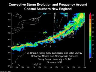
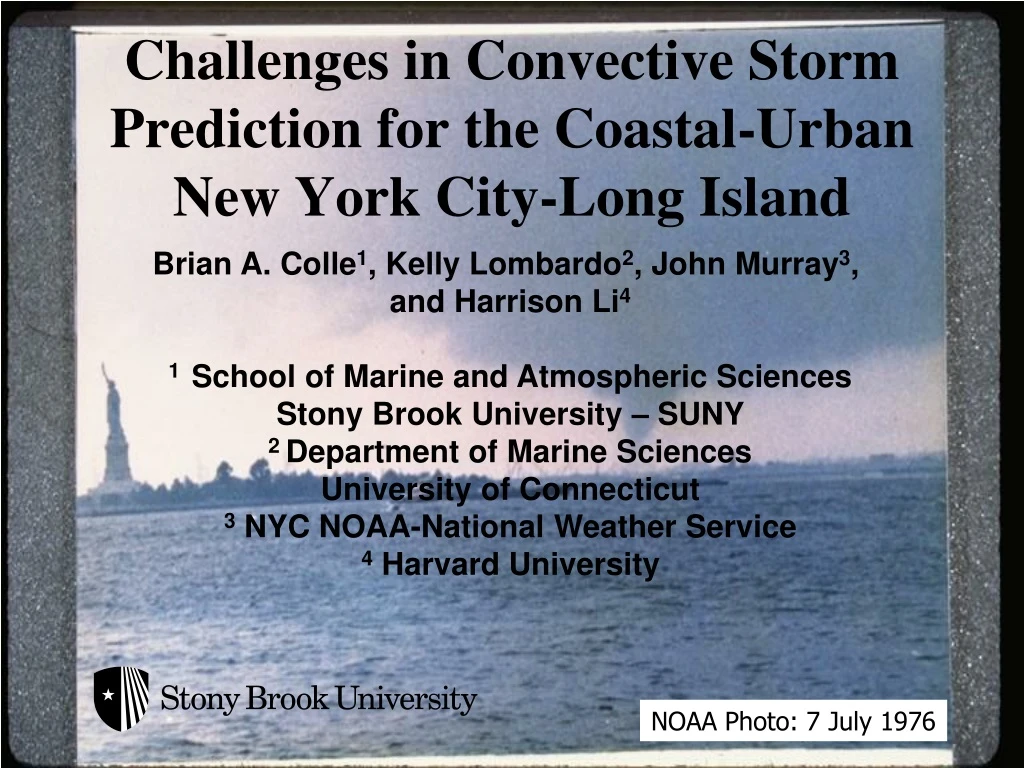
Challenges in Convective Storm Prediction for the Coastal-Urban New York City-Long Island Brian A. Colle1, Kelly Lombardo2, John Murray3, and Harrison Li4 1 School of Marine and Atmospheric Sciences Stony Brook University – SUNY 2 Department of Marine Sciences University of Connecticut 3 NYC NOAA-National Weather Service 4 Harvard University NOAA Photo: 7 July 1976
Outline • Motivation:Northeast US convective storm climatology and coastal tornadoes. • NYC early AM EF2 tornado 7 August 2007. • Decay versus non-decay quasi-linear convective systems near the SNE coast. • Future changes in convective frequency using CMIP5 data and linear discriminate analysis (LDA).
Spatial Distribution of Northeast U.S. Convective Storms During the Warm Season(1996-2007) (Murray and Colle MWR 2011) Radar Frequency > 45 dBZ (in percent) Lightning Frequency (per km2) Cloud to Ground Lightning Composite Reflectivity X X Storm frequency per 15-min interval (shaded in percent) for a composite reflectivity 45 dBZ and cloud-to-ground lightning from April through September of 1996–2007.
45 dBZ Frequency per Warm Season for 5 Boxes Across Northeast U.S. 1 2 3 4 5 3 2 1 4 5
Tornado Climatology for NYC and Long Island (1950-2010): Colle et al. (2012) UTC
New York Daily News 1 2 * * * 8 August 2007 NYCEF2 Tornado 1022-1050 UTC (Colle et al. 2012) * * * * * Brooklyn Staten Is.
3: 1300Z 8/7 August 7-8 2007 Storm Reports 4 0600Z 8/7 4: 1600Z 8/7 2 6 7 1 3 1000Z 8/8 1300Z 8/7 5: 2300Z 8/7 6: 0600Z 8/8 7:1000Z 8/8
0300 UTC 8 August 2007 950 winds, thetaE, Frontogenesis 700 mb Q-vector Low-mid level frontogenetical forcing and ascent increases during the evening hours over PA K/100km/3hr *10-1
X 500 Z, 800:600 lpse 500 Z, 800:600 lpse 6 August 1200 UTC 7 August 1200 UTC 400 hPa 600 hPa 800 hPa 500 Z, 800:600 lpse Pittsburgh, PA 7 August 1200 UTC 8 August 1200 UTC
EML, Rapid Low-level Destabilization, and Increasing Shear in a Few Hours 1500 J/kg 0830 UTC 8 Aug 0500 UTC 8 Aug RUC 0300 UTC vs 0900 UTC EWR ACARS 03Z 03Z
Role of Mesoscale Boundaries and Surface Circulation 1013 UTC 8 Aug 2007: DIX radar Surface: 1000 UTC 8 Aug 2007 X
Benefit of TDWR Radar TJFK 1030 UTC DIX 88-D 1030 UTC
Evolution of Linear Convective Systems Near the Coast • Warm Season Linear Events (2002-2007) • Categories: • DECAY (32 cases): Decays at the coast • SLOW DECAY (19 cases): Decay from coast to 100 km offshore. • MAINTAIN (9 cases): Little change in linear system at least 100 km offshore. • definition for decay: • Clear weakening trend in the line for at least 30 minutes. For most cases, the continuous line became < 50 dBz, although some cells were still > 50 dBZ. • Use coastal point at ~0.75o ahead of the center of the convective line to construct NARR composite (closest 3-h period before decay time).` Maintain: 5/31/02 MAINTAIN 6/1/02 See Lombardo and Colle (2012;2013) for Climo and WRF process study DECAY 7/23/02 Decay: 7/23/02
Comparisons of MUCAPE (for parcel in lowest 180 hPa) and 0-3 km Shear max 75% 25% min SLOW DECAY SLOW DECAY MAINTAIN DECAY DECAY MAINTAIN
900-800 hPa Frontogenesis and 900 hPa Temp Adv DECAY SLOW DECAY SLOW DECAY MAINTAIN MAINTAIN DECAY
Changes in April-Sept Days With Environments Favoring Convective Storms Using Linear Discriminate Analysis and CMIP5 RCP8.5 (Li and Colle 2016) Use: PW58: Daily precipitable water using 850, 700, 500 hPa TDIFF58:Daily temp(850 hPa) – temp (500 hPa) w =daily average omega 500 and 700 hPa Li and Colle (2014) using 88D radar and NARR: 8.20 × 10⁻⁵(CAPESHEAR) + 0.0589(PRWTR) – 5.94(OMEGA) > 2.35 Li And Colle 2014: 1996-2007 used to train LDA R^2 = 0.43 versus convective storm days validated using radar
Historical Annual Storm Days Using 7 CMIP5 Models and NARR/CFSR Average w vs Storm Days PW58 vs Storm Days
Future Annual Convective Environment Days and PW58 Using 7 CMIP5 Future Storm Env. Days PW58 Changes
Future Warm Season Convective Environment Days (SW PA vs E Long Island) Region 1 (SW PA) Region 2 (E LI)
w change (shaded and contoured) Average CMIP5 Changes (2066-2095 minus 1976-2005) PW58 change (percent change shaded) Vertical shear 500-850hPa percent change
Summary • There is a diurnal progression of convective storm frequency from the interior NE (early afternoon) to the coastal ocean (at night). • NYC-Long Island tornadoes are most frequent during late summer (August) and can occur from very early AM to early evening (0900-0000 UTC). • 7-8 August 2007 NYC tornado occurred along a mesoscale boundary, with destabilization from an EML + diabatic cooling, a nose of higher thetaE along the coast, and a LLJ. • Using a statistical approach on daily CMIP5 data, there is a 20-40% increase in convective storm frequency over the NE. Large moisture uncertainty and did not include CIN.