Download
1 / 16
160 likes | 164 Views
This workshop discusses the EPS-SG mission, its objectives, and key performances in providing continuous long-term datasets for operational meteorological forecasting and global climate monitoring. It also highlights the collaboration between ESA, CNES, and DLR in developing key instruments for the mission.

E N D
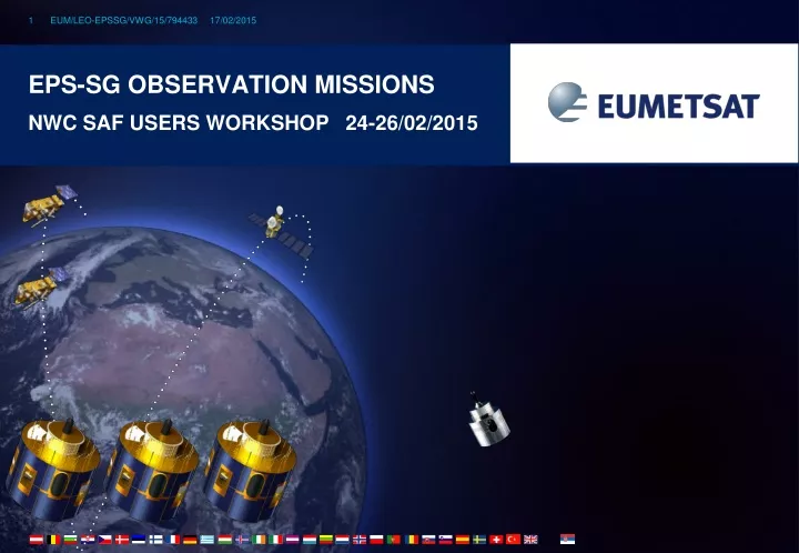
EPS-Sg Observation Missions NWC SAF Users Workshop 24-26/02/2015
EPS-SG • Continuity of the EUMETSAT Polar System Services beyond 2020 • Provision of continuous long-term datasets in support of operational meteorological and environmental forecasting and global climate monitoring • EPS-SG will be part of the NOAA/EUMETSAT Joint Polar System • Service in the mid-morning orbit • EPS-SG will fulfil the European contribution to the GOS as concerns the space-based observations from polar orbits • EPS-SG will rely on international cooperation for the development and on national contributions for key instruments • ESA: development of the space segment • CNES: development IASI-NG • DLR: development of METimage
Observation missions NWP: Numerical Weather Prediction; NWC: Nowcasting; CM: Climate Monitoring
Objectives Temperature/humidity profile at high vertical resolution Clouds, trace gases (O3, CO, CH4, CO2,...) Sea/land/ice surface temperature Aerosols, Volcanic Ash Implementation Development of Fourier Transform Spectrometer IASI-NG by CNES Key performances spectral range: 645 – 2760 cm-1 spectral resolution: 0.25 cm-1 radiometric calibration: 0.25 K stability: 0.1 K radiometric noise: 0.045 – 1.1 K pixel size: 12 km spatial sampling: 25 km cross-track scan Hyper-spectral infrared sounding: IASI-NG IASI – NG (New Generation) • Breakthrough • Doubling of radiometric and spectral resolution of IASI for the benefit of weather forecast and atmospheric composition • 75% more information in temperature profiling, particularly PBL • 30 % more information in water vapour profiling • Quantification of trace gases which are currently only detected • Vertical resolution of trace gases instead of columnar amounts only
Objectives Hi-res cloud products, incl. microphysics Aerosols Polar AMVs Vegetation, snow, fire Sea/ice/land surface temperature Support to sounding missions Implementation Development of METimage by DLR Key performances 20 channels: 0.443 – 13.345 µm absolute calibration: 5% (short-wave) 0.5 K (long-wave) radiometric sensitivity: SNR 60 – 500 (short-wave) 0.05 – 0.2 K (long-wave) spatial sampling: 500 m cross-track scan Optical imaging: METimage • Breakthrough • Far more spectral channels than AVHRR for the benefit of measuring more variables • Higher spatial sampling (500 m): • more complete coverage through greater likelihood to measure surface variables in partly cloud conditions • Better radiometric resolution for more accurate quantification of many variables
Objectives Temperature/humidity profiles in clear and cloudy air Cloud liquid water total column Imagery: precipitation Implementation ESA development Key performances 24 channels: 23.8 – 229 GHz absolute calibration: 0.5 K radiometric noise: 0.2 – 1.6 K footprint size: 17 – 40 km cross-track scan Microwave sounding • Breakthrough • Addition of a quasi-window channel at 229 GHz (recommended by ITSC-11) • Cirrus cloud informationgiving a better humidity retrieval performance • Addition of sounding channels • + 2 channels at 53-54 GHz • + 2 channels at 183.31 GHz • More information on temperature and water vapour profiles
Objectives ocean surface wind vectors soil moisture snow equivalent water sea-ice type Implementation ESA development Key performances C-band carrier frequency VV + VH polarisation measurement range: 4 – 40 m/s Radiometric resolution: 3% spatial resolution: 25 km dual swath: 550 km each Scatterometry • Breakthrough • Increase of spatial resolution to 25 km • Better approach of coast lines • Increase of swath width to >1100 km • Enhanced coverage • Addition of VH polarisation • Covers higher wind speeds without saturation, will benefit observation of tropical and extra-tropical storms
Objectives Refractivity profiles at high vert. resolution Temperature / humidity profiles PBL top and tropopause height Ionospheric electron content Implementation ESA development Key performances tracking of GPS and Galileo satellites optional: GLONASS and COMPASS RO on two satellites: > 2600 occultations per day bending angle accuracy: 0.5 µrad or 0.2% Radio occultation sounding • Breakthrough • Tracking of GPS and Galileo satellites to double the number of occultation measurements, optionally also GLONASS and Beidou • Equipment of both Metop-SG satellites with RO
Objectives of a new mission precipitation and cloud products water vapour profiles and imagery sea-ice, snow, sea surface wind Implementation ESA development Key performances 18 channels: 18.7 – 183 GHz dual polarisation (V, H) up to 89 GHz V polarisation at higher frequencies radiometric accuracy: 1 K radiometric sensitivity: 0.6 – 1.2 K Footprint size: 10 – 50 km spatial sampling: 7 km conical scan Microwave imaging: MWI RSS (2011) mm Cloud Liquid Column • Breakthrough: 18 channels • Continuity of key microwave imager channels for weather forecast • Inclusion of dedicated sounding channels (118.75 GHz) • Enhanced precipitation measurements through inclusion of dedicated sounding channels • Extended suite of 183.31 GHz channels • water-vapour and cloud profiling
Objectives of a new mission Cloud products, in particular ice clouds Snowfall detection and quantification Water-vapour profiles and imagery Implementation ESA development Key performances 11 channels: 183 – 664 GHz single polarisation (V) for all channels dual polarisation (V, H) at 243 and 664 GHz radiometric accuracy: 1 – 1.5 K radiometric sensitivity: 0.6 – 1.9 K Footprint size: 15-16 km spatial sampling: 7.5 km conical scan Ice cloud imaging: ICI NASA: Aura/MLS • Breakthrough: 11 channels • Establishes operational ice-cloud imaging mission • Support of weather forecast, hydrology, and climate monitoring
Objectives of a new mission Aerosol – optical thickness, particle size, type, height, absorption Volcanic Ash Cloud phase, height, optical depth Surface albedo Implementation ESA development Key performances 12 channels: 0.41 – 2.13 µm 3 polarisations: 0°, 60°, -60° up to 14 views radiometric bias: 3% SNR: 200 spatial sampling: 4 km push-broom scan (2200 km swath) Multi-viewing Multi-channel Multi-polarisation Imaging: 3MI Kaufman et al. (2002) • Breakthrough: • Enhanced spatial sampling (4 km) • Improves separation of cloudy areas • 12 spectral channels (9 polarised), extending into the UV and SWIR • Better aerosol characterisation • Higher angular resolution (14 views) • Better phase function characterisation
Objectives Ozone profile and column Columns of CO2,SO2, NO2, H2O, CO, CH4 Aerosol optical depth Columns of BrO, HCHO, OCHCHO Volcanic Plumes Implementation Copernicus Sentinel-5 to be embarked on Metop-SG ESA development Key performances spectral range: 0.27 – 2.385 µm spectral resolution: 0.25 – 1 nm radiometric calibration: 1 – 2% SNR: 120 - 1500 spatial sampling: 7 km Cross-track scan Nadir-viewing UVNS sounding: Sentinel-5 Nadir viewing UV/VIS/NIR/SWIR sounding XXXX X • Breakthrough • Drastically increased spatial sampling (7 km) • for the benefit of air quality monitoring • Extended spectral range into the near and shortwave infrared regions • to measure aerosols as well as methane and carbon monoxide in the PBL
Synergy of observation missions • Observation missions are • highly complementary • Co-registration of measurements will allow to optimise the information extraction • Synergy to be considered in payload distribution of a dual satellite configuration • Essential co-registrations • IAS – VII – UVNS • MWI - ICI • Desired co-registrations • IAS – MWS • VII – 3MI • IAS – UVNS – 3MI • MWI – SCA
Global and Regional Missions (1/7) Timeliness requirements Global Mission: To send L1b global (worldwide) products to end users within end-to-end breakthrough timeliness of 60 min (50th percentile) to 70 min (100th percentile ) Regional Mission: To send L1b regional (sensed over Europe / N. Atlantic) products to end users within end-to-end breakthrough timeliness of 20 min (50th percentile) to 30 min (100th percentile) *
EPS-SG in-orbit configuration • Two-satellite configuration • Metop-SG-A: METimage, IASI-NG, MWS, 3MI, RO, Sentinel-5 • Metop-SG-B: SCA, MWI, ICI, RO, Argos-4 • Overall Lifetime: 21 years (3+3 satellites) • Metop-orbit at 09:30 LTDN • Phasing of satellites • ~90° between SG-A and SG-B • ~180° between satellites of the same type • Earliest launches: SG-A in June 2021, SG-B in December 2022