Download
1 / 18
180 likes | 191 Views
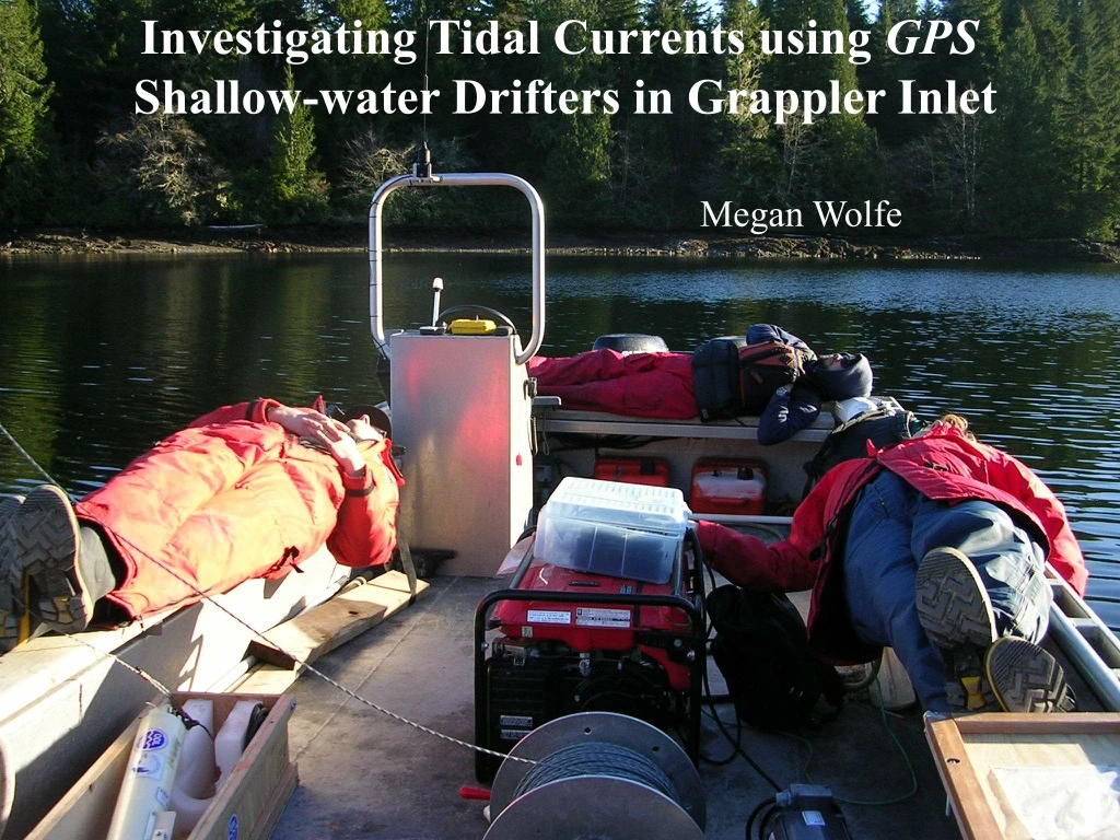
Investigating Tidal Currents using GPS Shallow-water Drifters in Grappler Inlet. Megan Wolfe. Megan Wolfe. Table of Contents. The Question The Question Revised Design and makings of the drifters Problems encountered Analysis and Discussion up to Date. The Question.

E N D
Investigating Tidal Currents using GPS Shallow-water Drifters in Grappler Inlet Megan Wolfe Megan Wolfe
Table of Contents • The Question • The Question Revised • Design and makings of the drifters • Problems encountered • Analysis and Discussion up to Date
The Question • Team B’s layer of Ice • Very thin layer of fresh water distributed throughout Grappler Inlet • Wanted to determine how the tidal currents effected the distribution of the fresh water layer in Grappler Inlet
Revising the Question • Problem! • Thin fresh water layer was too thin!! - Fresh layer was only 3-10cm • Could not design a drifter that would rest in the top 3-10cm which would not be influenced by the wind. • Investigating the tidal currents throughout Grappler Inlet at 3 different depths: Surface, 1m, and 2m.
Design of the Drifters Two parts of a Drifter -The drifter -And the drogue • Three Drifters built using everyday materials -Duct Tape -Styrofoam -plastic bags -rocks: used to balance drogue • New and improved tracking: GPS units 2m Surface 1m
1m 2m Surface
Experimental Problems • Bulky design of drifters • Shore encounters • Low tide -shallow waters -change in tide during experiment
Analysis and Discussion • A look at all three of the drifter paths • CTD temperature and salinity readings • Separate out and focus on individual drifters paths • GPS accuracy
Big map Grappler Inlet with Drifter Destination Big map 48.836 48.835 48.834 48.833 Latitude N 48.832 48.831 48.83 1m Drifter Surface Drifter 2m Drifter Colored Dots Represents areas where CTD readings were taken 48.829 -125.13 -125.125 -125.12 -125.115 -125.11 Longitude E
CTD Temperature and Salinity • Temperature at surface is cooler due to fresh water layer/ice layer, peaks around 1m and decreases with depth • Comparing Salinity and Temperature, Salinity seems to increase with depth, opposite to what the temperature is doing
Surface Surface Drifter Latitudinal Distance Traveled over Time 300 250 200 150 Distance traveled Latitudinally (meters) 100 50 0 -50 -100 -150 0 50 100 150 Time (min) • Comments • During outgoing tide, not much movement: Ice hindrance • Incoming tide: Lots of movement, traveled farthest, but wind present
1m Drifter Distance Traveled Latitudinally by 1m Drifter vrs. Time 200 100 0 -100 Distance Traveled Latitudinally (meters) -200 -300 -400 0 50 100 150 Time Traveled (mins) Zoomed in on White Box Zoomed in on Black Box: Standard Deviation = 1.347m
2m Drifter Distance Traveled Latitudinally by 2m Drifter vrs. Time 150 100 50 0 Distance Traveled Latitudinally (meters) 2m -50 -100 -150 0 20 40 60 80 100 120 140 160 Time Traveled (mins) Zoomed in white box Zoomed in Black box: Standard Deviation = 2.6832m
GPS Error • Six classes of GPS Error • Ephemeris data: Transmitted location errors of the satellite • Satellite clock: Errors in the transmitted clock, • Ionoshpere: Errors due to the corrections of pseudorange caused by ionospheric effects • Troposphere: Errors due to the corrections of pseudorange caused by tropospheric effects • Multipath: Errors caused by reflected signals entering receiver antenna • Receiver: Errors in the receiver’s measurements of range caused by thermal noise, software accuracy, and inter-channel biases
Comparing GPS Accuracy • Determining GPS accuracy • 2m drifter: low tide coming to the rescue • Comparison with other GPS accuracy tests • Compact, low-cost GPS near shore drifter:Center for Water Research, U. of Western Australia Power Spectra of the residuals: Difference between the recorded position from the mean time- averaged position. The standard deviation of the position from the mean was 1.3m in Easting direction and 1.6m in the Northing direction
Determining GPS Accuracy • 2m Drifter ran a ground: became stationary for 40mins. • A good estimation of GPS accuracy • Standard Deviation = 1.8864m
Drifter Improvements • Effects due to wind stress • - Less surface area exposed • Lack of materials and resources • Design of a smaller, compact • GPS drifter that contains ‘off the shelf’ components Design of a smaller, compact GPS drifter that contains ‘off the shelf’ components Costs:$350 plus an estimated 8hrs of preparation
References • A Compact, Low-Cost GPS Drifter for Use in the Oceanic Nearshore Zone, Lakes, and Estuaries,Journal of atmospheric and oceanic technology [0739-0572] Johnson yr: 2003 vol: 20 iss: 12 pg: 1880 • A GPS-Tracked Surf Zone Drifter,Journal of atmospheric and oceanic technology [0739-0572] Schmidt yr: 2003 vol: 20 iss: 7 pg: 1069