Download
1 / 70
740 likes | 1.07k Views
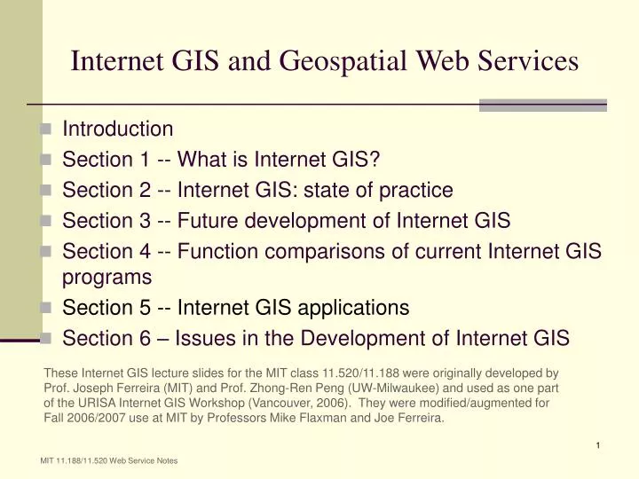
Internet GIS and Geospatial Web Services. Introduction Section 1 -- What is Internet GIS? Section 2 -- Internet GIS: state of practice Section 3 -- Future development of Internet GIS Section 4 -- Function comparisons of current Internet GIS programs Section 5 -- Internet GIS applications

E N D
Internet GIS and Geospatial Web Services • Introduction • Section 1 -- What is Internet GIS? • Section 2 -- Internet GIS: state of practice • Section 3 -- Future development of Internet GIS • Section 4 -- Function comparisons of current Internet GIS programs • Section 5 -- Internet GIS applications • Section 6 – Issues in the Development of Internet GIS These Internet GIS lecture slides for the MIT class 11.520/11.188 were originally developed by Prof. Joseph Ferreira (MIT) and Prof. Zhong-Ren Peng (UW-Milwaukee) and used as one part of the URISA Internet GIS Workshop (Vancouver, 2006). They were modified/augmented for Fall 2006/2007 use at MIT by Professors Mike Flaxman and Joe Ferreira. MIT 11.188/11.520 Web Service Notes
Session Objectives • Become familiar with some existing Internet GIS applications in city, county and state governments. • Examine Some National & International GIS Services which provide useful “base data” • Look critically at services/methods being proposed MIT 11.188/11.520 Web Service Notes
Types of Internet GIS Applications • Data Sharing and disseminations; • Raw GIS data, requires installed software & expertise to use • Geospatial Information Sharing and publishing • Often includes cartographic representations • Can produce single purpose human-readable images • Web Data Services • Produce machine-readable geospatial information • Distributed Analysis Functions (GIS Anywhere); • Interoperable GIS Web Services (GIS Anyone Anywhere). MIT 11.188/11.520 Web Service Notes
Computing Platforms: The Road Map Mobile GIS Accessibility Internet GIS Desktop GIS Mainframe GIS Time MIT 11.188/11.520 Web Service Notes
Computing Platforms: Layering & Market Share Shifts (not replacement) Mobile GIS Location Based Services Accessibility Internet GIS Interactive Exploration Desktop GIS Creation, Analysis &Geospatial Content Authoring ServerGIS Spatial Data Infrastructures Time MIT 11.188/11.520 Web Service Notes
Computing Architecture Issues: Internet GIS Interfaces • Single User Interfaces • Isolated User • User as Part of Enterprise GIS • User as Part of Cybershere • Groupware • Multiple users, one location • Multiple distributed users MIT 11.188/11.520 Web Service Notes
Computing Architecture Issues: Openness to… • Modification of System • Use / Repurposing of Data • Comment / Markup of Data • Data Editing MIT 11.188/11.520 Web Service Notes
Computing Architecture Issues: Openness to… • Modification of System • Closed / Proprietary • Semi-open / Public API • Open Source – noncommercial use only • Open Source – allowing commercial uses MIT 11.188/11.520 Web Service Notes
Computing Architecture Issues: Openness to • Repurposing of Data • Flattened image or graphics (picture of a map) • Georeferenced Imagery • Layer visibility control • Layer symbolization control • Examples • Re-use of Google Earth imagery (only allowed in their context) • Map layers with fixed opaque backgrounds MIT 11.188/11.520 Web Service Notes
Computing Architecture Issues:Types of Geospatial Data • Vector Features • Raster (Gridded) Data • Geo-associated Database Records • Imagery • Metadata • Perspective Views • Geotagged Photos • Streaming Position Data MIT 11.188/11.520 Web Service Notes
Computing Architecture Issues:Standards for Geospatial Data • For many years, proprietary data formats most common • Two issues • Vendor interest in capturing/maintaining users • Efficiency in operation • Often by having data formats mirror internal structuring • Vendors provide “value added” in software, but then need means to “persist” data associated with those features MIT 11.188/11.520 Web Service Notes
Computing Architecture Issues:Standards for Geospatial Data • Many government standards attempted • Some “de facto” such as USGS Digital Elevation Models (DEM), TIGER line files • Some more formal – National Spatial Data Transfer Standard • Generally ended up being either • Too specific • Too unweildy • Lead to Public/Private Partnership Approach • Resulting in Federal Geographic Data Committee • Increased interest in open interoperability standards MIT 11.188/11.520 Web Service Notes
Computing Architecture Issues:Standards for Geospatial Data • Vector Features • “Simple Features” specification (2D points, lines, polys) • Geographic Markup Language (GML) • Raster (Gridded) Data & Imagery • GeoTIFF (geographically tagged TIFF images) • JPEG2 (includes GML metadata) • Geo-associated Database Records • SQL + Simple Features • Metadata • Federal Geographic Data Committee Standards (FGDC) MIT 11.188/11.520 Web Service Notes
Computing Architecture Issues:Standards for GeoData Transfer • Rendered Maps • Web Mapping Service (WMS) • Vector Features • Web Feature Service (WFS) for Read-Only • Web Feature Service – Transactional (WFS-T) for Read/Write • Raster (Gridded) Data & Imagery • Web Coverage Service (WCS) • Perspective View • Web Terrain Service (WTS) [– bad name!] MIT 11.188/11.520 Web Service Notes
Client/Server • System that divides processing between client (desktop) and server. • Client (desktop) requests data, server only transmits the result of the request, not the entire file. MIT 11.188/11.520 Web Service Notes
Application Presentation Logic Data Components of Client/Server Systems • Client, • Middleware (optional - the glue) • Server. MIT 11.188/11.520 Web Service Notes
The Client The Client has three functions: • Presents an interface to the user. • Formats requests for data. • Displays data it receives from the server. MIT 11.188/11.520 Web Service Notes
The Server • Provides shared resources, such as databases or applications, that can be connected to multiple clients. • It has three functions: • receives the structured requests from the clients; • processes them; • sends the results back to the client; MIT 11.188/11.520 Web Service Notes
The Middleware • Middleware is software that connects dissimilar applications and enables them to communicate and exchange data. • Middleware sometimes used to translate between different communication protocols • Also used to enhance scalability (many more clients can be served simultaneously) through load balancing and other smart features • WebLogic or TomCat are examples of middleware. MIT 11.188/11.520 Web Service Notes
Internet GIS Applications in Urban Planning • Planning information dissemination • Comprehensive planning information • Zoning information • Property and census data • Public participation in the planning process • Scenario analysis • Online feedback • Economic Development site selection MIT 11.188/11.520 Web Service Notes
Internet GIS Applications in Transportation • Real-time advanced traffic information system. • Real-time traffic congestion management. • Automatic trip planning. • Transportation and land use integration. • Public participation in transportation planning process. • Real Time Traffic - http://traffic.houstontranstar.org/layers/ MIT 11.188/11.520 Web Service Notes
Los Angeles – online traffic reporting Observations Financing and Corporate Structure • Website of local CBS TV/Radio station: http://cbs2.com/traffic • Traffic data from SmartRoute Systems (formed in 1988) • Via Smartraveler Service: http://www.smartraveler.com • Owned (since 2000) by Westwood One • A national radio content company • Using Maptuit Corporation web services • Specializes in fleet tracking and management • And Navteq road data • Road basemap data and navigation tools • With various advertisements using Google services MIT 11.188/11.520 Web Service Notes
Los Angeles – online traffic reporting Observations (#2) • Various client traffic applications built from • Core set of data and tools • Road map, incident data, routing, advertising • Via realtime chaining of many services • To overlay new incidents or congestion icon on basemap • To display context and time-sensitive ads • Complex layering of public/private services • Complex partnerships and financing MIT 11.188/11.520 Web Service Notes
US EPA: Enviromapper • Online mapping website • http://www.epa.gov/enviro/html/em • Basic mapping via ArcIMS website • choose layers, zoom, identify • Overlay ‘framework’ layers and EPA administrative data • Roads, political boundaries, census data, … • EPA’s data: AIRS, TRI, Superfund, ... MIT 11.188/11.520 Web Service Notes
Accessing Data and Geospatial Services Behind the Scenes • Enviromapper is very useful, but ‘read only’ • AIRS, TRI… data already in Oracle • So are Census, USGS, and other datasets • Data could be accessed via other protocols and tools • If site is built from chained web services • Can focus on data services instead of datasets • Use OGC’s WMS and WFS protocols for interoperability • Then, many customized client applications could share the same data sets without duplication MIT 11.188/11.520 Web Service Notes
First, a Simple Example – MIT OrthoTools • Orthophotos via plain vanilla web browser • MIT Ortho Server (now 10 years old!) • Main page: http://ortho.mit.edu • ‘Seamless’ interface: • http://ortho.mit.edu/nsdi/seamless6.cgi • Server-side perl scripts slice and dice orthos to fit size/scale of view window • Requesting only the ortho snippet: • http://ortho.mit.edu/nsdi/seamless8.cgi?zoom=8&x0=237000&y0=902000&action=pan&pwidth=400&pheight=300&x=123&y=169 MIT 11.188/11.520 Web Service Notes
Accessing MIT OrthoServer from ArcMap • MIT OrthoServer as a web service • Send URL with parameters • Receive PNG, JPG, or Tiff image for desired location • Write ArcMap extension ‘dll’ that • Adds ortho ‘button’ to ArcMap menu • Sends appropriate URL based on ArcMap view • Slips returned JPG under ArcMap view window • Idea: Preserve only one copy of orthos - on server • Throw away local copy • Can always retrieve and use when needed MIT 11.188/11.520 Web Service Notes
Next: add in ArcWeb Services • ESRI offers many proprietary web services… • Must be registered for ArcWeb Services from ESRI: • Sign up for trial evaluation • http://www.arcwebservices.com • In ArcMap (or ArcExplorer) click ‘Add Data’ select GIS Servers, then ArcIMS servers, then log in • Select FEMA_Flood service from the menu MIT 11.188/11.520 Web Service Notes
Using ArcWeb Services • Requires user registration with ESRI • Accessible from clients that use ArcIMS protocols (ESRI’s flavor of XML = AXL) • Free ArcExplorer 9.1can access ArcWeb services • Save from ArcExplorer into arcexplorer_flood1.axl • Saved file is AXL text file • At 9.1 ArcGIS has WMS connector built-in • Can turn sublayers on/off, but no legend color or transparency control • No WFS support MIT 11.188/11.520 Web Service Notes
Saved AXL FileUsing ArcExplorer to access FEMA_Flood web services <?xml version="1.0" encoding="UTF-8"?> <ARCXML version="1.1"> <CONFIG> <ENVIRONMENT> <LOCALE country="CA" language="en" variant="" /> <UIFONT color="0,0,0" name="SansSerif" size="12" style="regular" /> <SCREEN dpi="96" /> </ENVIRONMENT> <MAP> <PROPERTIES> <ENVELOPE minx="-71.24827637959767" miny="42.25863121969604" maxx="-70.98993634926948" maxy="42.45238624244218" name="Initial_Extent" /> <MAPUNITS units="decimal_degrees" /> </PROPERTIES> <WORKSPACES> <IMAGESERVERWORKSPACE name="mapper_ws-0" url="http://www.arcwebservices.com/servlet/com.esri.esrimap.Esrimap" service="FEMA_Flood" /> </WORKSPACES> <LAYER type="image" name="FEMA_Flood" visible="true" id="0"> <DATASET name="FEMA_Flood" type="image" workspace="mapper_ws-0" /> </LAYER> </MAP> </CONFIG> </ARCXML> MIT 11.188/11.520 Web Service Notes
Generalizing this Web Service Idea • Make service interoperable using Open Geospatial Consortium (OGC) standards • Standard URL request parameters • Standard XML response (using GML) • WMS and WFS protocols • We will examine several current examples • MassGIS • Google mashups • Middleware tools to tweak and chain services MIT 11.188/11.520 Web Service Notes
MassGIS – Web Service Example • ‘End User’ websites • Home page for MassGIS: http://mass.gov/mgis/ • Data layers and download info: http://mass.gov/mgis/database.htm • ‘Oliver’ online mapping java application: http://mass.gov/mgis/mapping.htm • Web Services underneath: http://mass.gov/mgis/websrv.htm • Winner of 2005 URISA ESIG award • Access via WMS and WFS protocols: http://www.opengeospatial.org/resource/cookbooks • ArcMap and ArcExplorer example (in exercise) • Example URL requesting WMS image (street map): http://maps.massgis.state.ma.us/mapaccess/main.jsp?dpi=120&request=GetMap&layers=MHD+Roads&styles=Class&srs=EPSG:26986&bbox=233500,900000,236500,902500&width=640&height=480&format=image/png&service=wms MIT 11.188/11.520 Web Service Notes
Boston Globe Article:Mashup of Election Campaign Contributions • Website on Boston.com • http://www.boston.com/news/special/bigarticles/campaign_finance/page2.html?p1=email_to_a_friend • Live Google ‘mashup’ webpage (for Back Bay): • http://boston.faneuilmedia2.com/gov/detail_map.html?from=top&zip=02116&z=13 • View source and look for: • http://maps.google.com/maps?file=api&v=2.60&key=AB... • Rest is javascript to interact with Google maps and overlay/identify entries in local election contribution database maintained by consultant (Faneuil Media, Inc.) • Note: you can ‘pan’ the map or click on dots for further info • Google mashup protocols are proprietary but open • Google earth protocols use ‘KML’ – a variation of OGC’s GML MIT 11.188/11.520 Web Service Notes