Download
1 / 1
10 likes | 104 Views
Agricultural Ecology Program: Understanding sources and sinks of nutrients and sediment in the upper Susquehanna River basin. The Chesapeake Bay. Management of Nutrients and Sediments.

E N D
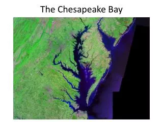
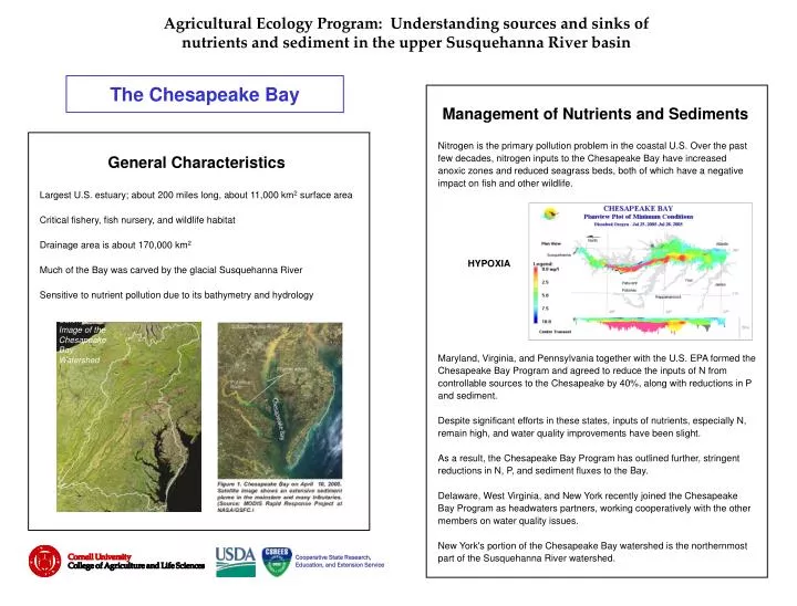
Agricultural Ecology Program: Understanding sources and sinks ofnutrients and sediment in the upper Susquehanna River basin The Chesapeake Bay Management of Nutrients and Sediments Nitrogen is the primary pollution problem in the coastal U.S. Over the past few decades, nitrogen inputs to the Chesapeake Bay have increased anoxic zones and reduced seagrass beds, both of which have a negative impact on fish and other wildlife. Maryland, Virginia, and Pennsylvania together with the U.S. EPA formed the Chesapeake Bay Program and agreed to reduce the inputs of N from controllable sources to the Chesapeake by 40%, along with reductions in P and sediment. Despite significant efforts in these states, inputs of nutrients, especially N, remain high, and water quality improvements have been slight. As a result, the Chesapeake Bay Program has outlined further, stringent reductions in N, P, and sediment fluxes to the Bay. Delaware, West Virginia, and New York recently joined the Chesapeake Bay Program as headwaters partners, working cooperatively with the other members on water quality issues. New York's portion of the Chesapeake Bay watershed is the northernmost part of the Susquehanna River watershed. General Characteristics Largest U.S. estuary; about 200 miles long, about 11,000 km2 surface area Critical fishery, fish nursery, and wildlife habitat Drainage area is about 170,000 km2 Much of the Bay was carved by the glacial Susquehanna River Sensitive to nutrient pollution due to its bathymetry and hydrology HYPOXIA USGS Satellite Image of the Chesapeake Bay Watershed Cooperative State Research, Education, and Extension Service