Download
1 / 20
200 likes | 356 Views
Planned Cities on the Indus. Chapter 2 section 3 Page 42. Review- chapter 2 section 2. Which country is the Nile River located in? Egypt Which sea does the Nile river empty into? The Mediterranean What do Upper Egypt and Lower Egypt refer to? elevation. More review.

E N D
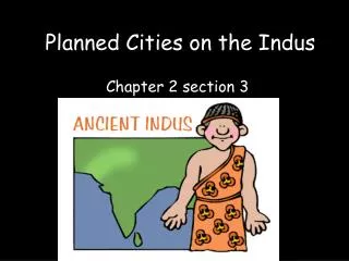
Planned Cities on the Indus Chapter 2 section 3 Page 42
Review- chapter 2 section 2 • Which country is the Nile River located in? • Egypt • Which sea does the Nile river empty into? • The Mediterranean • What do Upper Egypt and Lower Egypt refer to? • elevation
More review • Who built the pyramids? • Peasants • Kings were also considered gods and were called? • Pharaohs • How many days and months was the Egyptian calendar based on? • 365 days, 12 months
Geography of South Asia • In India, another civilization developed around 2500 B.C. • Don’t know much about it’s orgins, or why the civilization declined • But do know that many characteristics of the Indian culture today can be traced to early civilization
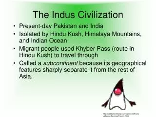
Geography of South Asia • A large wall of mountains separate South Asia from rest of the continent • Some geographers refer to this area (India, Pakistan, Nepal, Bangladesh) as a subcontinent
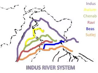
Fertile plain formed by 2 rivers- the Indus and the Ganges (GAN-jeez) • 2 rivers and lands they water make up large area stretching 1500 miles across India called the Indus-Ganges Plain • Southern part of India is a peninsula- thrusting into the Indian Ocean
Monsoons • Seasonal winds dominate India’s climate • October-May, winter monsoons blow dry air from northeast across country • In June, winds shift, and spring monsoons bring moisture from the ocean
Environmental Challenges • Indus River, like the Nile and Tigris, had yearly floods • Spread deposits of rich soil over a wide area • But the floods were unpredictable, and sometimes the Indus river changed its course • Wet and dry seasons of monsoons posed problems
The Problem with Rain • If too much rain, floods swept away whole villages • If too little rain, plants withered in the fields and people went hungry
Worlds tallest mountain to the north, and large desert provided natural barriers from invasion • River allowed valley people to develop trade with different peoples, including the Mesopotamians
Civilization Emerges on the Indus • Indus valley larger area than Mesopotamia or Egypt • Nobody is sure how settlement began in India, can’t decipher writing system, but there is evidence of agriculture and domesticated sheep and goats dating to 7000 B.C. • By 3200 B.C. people were farming in villages along the Indus River
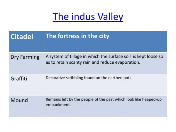
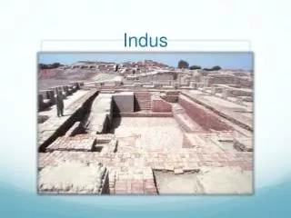
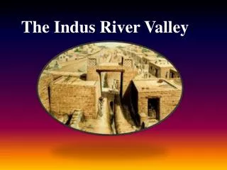
Planned Cities • 2500 B.C. people in Indus Valley were laying bricks for India’s first cities • Found the ruins of more than 100 settlements along the Indus • Laid out cities on a precise grid system • Featured a fortified area called citadel, holding major buildings of a city • Had separate residential districts
Toilets back then • Early engineers created sophisticated plumbing and sewage systems • See page 44
Culture and Trade • Social divisions not that great judging by uniform housing • Clay and wooden toys suggest a comfortable society that could afford to produce non essential items
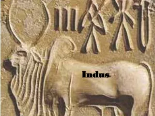
Religion • Religious artifacts reveal links to modern Hindu culture • Religious figures found relate to: mother goddess fertility images worship of cattle representations of Shiva
Indus Seals • Stamps and seals made of carved stone were used by merchants to identify goods • Shows us that Indus people conducted long distance trade
Mysterious End • 1750 B.C. quality of buildings declined and cities fell into decay • No one is sure why • Some historians think : *Indus River changed course and floods no longer fertilizing the field * people overused the land, overgrazed, over farmed, over cut, etc * Residents may have abandoned the city after a natural disaster or an attack