Download
1 / 53
540 likes | 716 Views
Management and Interpretation of Data Under a Triad Approach. OSWER, OSRTI, TIFSD Technology Information & Integration Branch Jean Balent, balent.jean@epa.gov , 703.603.9924 Stephen Dyment, dyment.stephen@epa.gov , 703.603.9903 Michael Adam, adam.michael@epa.gov , 703.603.9915.

E N D
Management and Interpretation of Data Under a Triad Approach OSWER, OSRTI, TIFSD Technology Information & Integration Branch Jean Balent, balent.jean@epa.gov, 703.603.9924 Stephen Dyment, dyment.stephen@epa.gov, 703.603.9903 Michael Adam, adam.michael@epa.gov , 703.603.9915 1
Housekeeping • Please mute your phone lines • press *6 to mute #6 to unmute your lines at anytime • Do NOT put this call on hold • We will ask for your feedback today. You do not need to wait for Q&A breaks to ask questions or provide comments • To report technical problems, please use the ? Icon at the top of your screen • You can move forward/backward in the slides by using the arrow buttons 2
Brownfields Technology Support Center (BTSC) • Basis for this presentation is on a BTSC Publication: • Management and Interpretation of Data Under a Triad Approach – Technology Bulletin (EPA 542-F-07-001) http://www.cluin.org/download/char/epa542f07001.pdf 3
Overview of Seminar 1. Introduction to the Triad approach 2.Answers to frequently asked questions: How do Triad practitioners plan for data management and interpretation? Who prepares the dynamic work strategy (DWS) and data management plan, and what are the essential elements of the data management plan? How are data collected and used in a Triad investigation? What types of tools are used to manage, interpret, and communicate data? How do Triad practitioners balance the need for data review with the need for rapid data turnaround? 3. Three examples of data management Milltown Redevelopment Site, Milltown, New Jersey Metal Etching Site, Freeport, New York Underground Storage Tank (UST) Sites, South Dakota 4.Sources of additional information on a data management program in support of a Triad project 5. Q/A with instructors 4
Introduction to Triad Approach • Triad is a three-pronged approach for improving decision-making and streamlining environmental cleanup projects. • Draws on advancing science, technology, and practitioner experience to develop strategies for making site work more defensible, resource-effective, and responsive to stakeholder concerns. • Data management is an essential cross-cutting component to the three elements of the Triad approach 6
Introduction to Triad Approach • Systematic Project Planning • provides the overarching framework for project planning, contracting, and stakeholder communication • Dynamic Work Strategies • dynamic (flexible) planning documents that includes is a defined decision logic that members of the field team can follow as they collect and evaluate data. • Real-time Measurement Technologies • allow data to be collected or analyzed at a much greater density or rate than is typically obtained through a conventional methods • drives the Dynamic Work Strategy 7
Introduction to Triad Approach • The primary tool that guides a Triad project is the conceptual site model (CSM). • a planning tool that organizes what is known about a site and helps the project team identify what more must be known to make defensible project decisions. • unifies existing data into a concise description of a site’s physical setting, contaminant release, transport mechanisms, and exposure points that describe the problem. • a working hypothesis of site conditions that will be refined and improved over the course of the project 9
More Information • Triad Resource Center www.triadcentral.org • Visitors will find: • 30 detailed profiles related to the Triad approach as applied to various sites across the US • 15 items in the Triad Reading Room • A complete glossary of important terms and acronyms • And much more! 10
FAQ 1: How do Triad practitioners plan for data management & interpretation? • Triad investigations are dynamic! • Dynamic Work Strategy (DWS) • is developed before mobilization and guides the investigation • may identify # of initial sampling locations, subsequent locations based on predetermined criteria, driven by collection and interpretation of real-time data • must have a parallel data management strategy that allows real-time data interpretation and decision-making by project stakeholders • Planning documents must include a data management plan • detailed discussion of data management procedures, • equipment (software and hardware), • lines of communication, • reporting guidelines, • time frames 12
FAQ 2: Who prepares the dynamic work strategy (DWS) & data management plan? • Preparation of the DWS and data management plan is usually the responsibility of the core technical team • should not be prepared until stakeholder input and concerns are obtained during systematic planning meetings • A successful data management strategy depends on input from those who will be generating and using the data: • vendors/contractors, • geoscientists, • chemists, • risk assessors and • other technical specialists 13
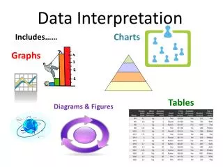
FAQ 2: What are the essential elements of the data management plan? • Origin of data streams • Formats, tools to collect • Data pathways and communication • Assign responsibility for all aspects of data management • Level and timing of quality assurance and quality control (QA/QC) • May need to develop QC protocols customized to site-specific needs • Data analyses (visualization and statistical) • Have clear understanding of tools that will be used to process data and help make decisions 14
FAQ 2: What are the essential elements of the data management plan? • Data stream integration • Be careful of mixing data sets • Correspondence between data and the decisions they support • Use table or matrix to define linkage between data and decisions • Data archive and repository • Approach to create and maintain records • Use appropriate methods to collect correct documentation 15
FAQ 3: How are data collected and used in a Triad investigation? • Drive decision-making in the field • ensure that the data are readily available as the investigation is being conducted (internet access may be critical) • Real-time methods may yield immediate graphical results 16
FAQ 4: What types of tools are used to manage, interpret, & communicate data? Decision Support Tools (DSTs) = interactive software tools used to answer questions, solve problems, and support or refute conclusions. • Help with data acquisition, spatial data management, modeling, and cost estimation • bring data management & interpretation capabilities as close to collection activities & decision-making as possible • Resource: DST matrix(http://www.frtr.gov/decisionsupport/) • assist Triad practitioners in selecting a DST to meet project objectives • detailed information for 25 publicly available DSTs 17
FAQ 4: What types of tools are used to manage, interpret, & communicate data? • Example: Scribe (http://www.ertsupport.org/scribe_home.htm) • Free software tool developed by the USEPA's Environmental Response Team (ERT) to assist in the process of managing environmental data • Captures sampling, observational, and monitoring field data (Soil Sampling, Water Sampling, Air Sampling and Biota Sampling) • Can import electronic data including Analytical Lab Result data (EDD) and Sampling Location data such as GPS. • Scribe supports handheld extensions, Scriblets, to capture and import sampling and monitoring data collected on handheld PDAs • Scribe.NET provides a method of storing and sharing Scribe projects among stakeholders 18
FAQ 4: What types of tools are used to manage, interpret, & communicate data? • Example: Spatial Analysis and Decision Assistance (SADA) (http://www.tiem.utk.edu/~sada ) • Free software that incorporates tools from environmental assessment fields into an effective problem solving environment • Integrated modules for visualization, geospatial analysis, statistical analysis, human health risk assessment, ecological risk assessment, cost/benefit analysis, sampling design, and decision analysis. 21
FAQ 5: How to balance the need for data review with need for rapid data turnaround? • Triad practitioners use many techniques to maintain data quality while expediting processing, reviewing, and reporting field data • Before designing sampling program around a real-time sampling/analysis technique, test it during a demonstration of methods applicability (DMA) 24
FAQ 5: How to balance the need for data review with need for rapid data turnaround? • DMA • initial site-specific performance evaluation for a method, a series of related methods, or a data collection tool • consists of using the real-time technology on a limited suite of samples while sending paired samples to an off-site laboratory for standard laboratory analysis for the same analytes or parameters • results are evaluated using statistical methods such as regression analysis 25
FAQ 5: How to balance the need for data review with need for rapid data turnaround? • DMA can • evaluate the adequacy of the real-time method for achieving the project’s data quality objectives (DQO)s • establish appropriate sampling and analysis procedures, and • develop action levels for the real-time methods • By conducting the DMA before the field sampling program, many problems and data “bottlenecks” that may arise can be anticipated and corrective measures can be established • Make full use of collaborative data sets! 26
Examples of Data Management • Milltown Redevelopment Site, Milltown, New Jersey • Metal Etching Site, Freeport, New York • Underground Storage Tank (UST) Sites, South Dakota Other profiles available at http://triadcentral.org/user/index.cfm 27
Milltown Site, NJ • 22-acre Brownfields site in downtown Milltown, NJ • 50 % + site is warehouses and industrial buildings • Industrial use began with a rubber manufacturing plant in the late 1800s • Milltown Redevelopment Authority and Middlesex County Improvement Agency entered into an agreement with a developer to improve the parcel for mixed uses • Principal contaminants of concern (COC) included VOCs, PAHs, PCBs 29
Milltown, NJ Project goals: • develop and revise a CSM of site geology, hydrology, and contaminant fate and transport by collecting soil, sediment, and ground water samples and geologic logs on a regular grid, and • delineate potential areas of concern (AOC) on a closer grid spacing of adaptive sampling locations. 30
Milltown Site, NJ • Identified several concerns at systematic planning meetings • management of the large volume of data that would be generated by field analytical methods over a relatively short, 2-month time frame • Identified Scribe and Scriblets as DSTs for data management 31
Milltown Site NJ • Scribe was used as the central data management software, with Scriblets used on PDAs to feed field data to Scribe. • Allowed the project team to make real-time decisions and update CSM in real-time during the sampling mobilization • After each round, the data were imported to Scribe, reviewed, queried, and exported to AutoCAD (visualization software) • Decision logic diagrams provided general rules to support adaptive sampling • Ground water plume delineation was expedited 32
Milltown Site, NJ • Project-specific Web site was set up on the EPA ERT’s Web server • http://www.epaosc.org/site_profile.asp?site_id=MRP • Maps, progress reports, and meeting information were posted to the Web site daily • All stakeholders (on-site and remote) reviewed tables and maps summarizing team’s updated understanding of the distribution of COCs at the end of each day and then provide input for the next day’s sampling. 33
Milltown Site, NJ • The field team was able to sample more than 400 locations in approximately 5 weeks. • Collected more than 130+ ground water samples and 600+ soil samples • Generates 30,000 analytical results • All loaded into the database and underwent QC review in a short time • Triad DWS provided a flexible means to adapt the sampling strategy • Discovery and characterization of unknown vat while in field 34 See complete Triad Project Profile: http://www.triadcentral.org/user
Metal Etching Site, NY • 2 acre New York State Superfund site in Freeport, Nassau County, NY used for commercial boat storage, sales, and maintenance • 1966 -1999, operational facility, print/etch using anodization, chromate conversion, and chrome or nickel plating processes • disposal of sanitary and industrial wastes through sanitary sewer lines • AOCs: former plating area, chemical and waste storage areas, wastewater treatment operations, failed sewer lines and connections, waste storage areas, and historical spill areas • COCs included chromium, cadmium, nickel, and chlorinated hydrocarbons (PCE and TCE) 35
Metal Etching Site, NY • NYSDEC conducted an RI of the site to identify and delineate contamination in surface and subsurface soil, sediment, soil gas;source areas; ground water contamination; and impacts to surface water • Project Goal: use Triad to complete the RI during one mobilization effort 36
Metal Etching Site, NY • Surface soil, subsurface soil, and ground water samples collected on a grid spacing of 70 feet • DWS called for adaptive samples to be collected at two new locations offset 10 feet from areas where contaminants were detected above cleanup goals • Nearby laboratory analyzed samples using modified EPA SW-846 methods, which required less QA/QC • Samples were delivered to the laboratory by noon, results were returned to the field team by 11:00 a.m. the next day 37
Metal Etching Site, NY • Relational database was constructed using geographical information system (GIS) • chemical data, water levels, and survey data • Tables of analytical results • Maps of contaminant distribution and ground water flow • Field personnel obtained EDDs from the lab daily • Updated contaminant distribution maps were quickly prepared and the field program was redirected as indicated by the DWS • Data were shared with the stakeholders through e-mail messages 38
Metal Etching Site, NY • Collecting data in real time gave the most complete “snapshot” of contaminant distribution that time and budget would allow • Confirmation sampling indicated real-time GW data did not meet all of the DQOs for making decisions • ground water monitoring wells were installed and samples collected for analysis using EPA SW-846 methods 40
Metal Etching Site, NY • Daily analysis permitted early elimination of hexavalent chromium as a COC • Resulted in significant cost savings • Real-time analysis coupled with the GIS software permitted stakeholder input in redirecting sample collection to more accurately define the affected areas 41
UST Sites, SD • Five sites including three active gas stations, one closed gas station, and a railroad fueling site. • Three sites had underground storage tanks (USTs) and associated piping removed • The time since the petroleum releases had been first discovered on the sites ranged from 1 to 14 years. • Several of the sites had remained in the investigation phase for more than 10 years • 3 sites previously assessed at costs ranging from $35,000 to $103,000 with little to reduction in decision uncertainty • All sites considered “legacy” sites because, although the petroleum releases had been known about for years, none were moving toward regulatory closure. • COCs included: BTEX, Diesel fuel, EDB, Gasoline, MTBE, Naphthalene, TPA, TPH 42
UST Sites, SD Project Goal: 1) Determine if the Triad approach could be used to reduce decision uncertainties associated with petroleum release sites on a real-time basis. 2) Reduce time when the samples were sent to an off-site lab to when stakeholders are notified additional information is needed from 12-18 weeks to a few days 43
UST Sites, SD • Existing assessment data and 3-d models made available to all stakeholders at the planning meeting • Stakeholders established objectives, ground rules, and generic protocol for use at each site • MIP used as the primary investigation tool • Logs of sensor response were printed immediately after the MIP profile was conducted. • MIP borehole location was established on the site coordinate system within minutes after it was completed using GPS survey equipment 44
UST Sites, SD • Team uploaded the MIP results and the GPS survey data to the vendor’s proprietary data processing and contouring program twice daily to update the existing 3-d model • On-site, 3-d renderings allowed team to identify data gaps immediately and fill them before demobilizing • Each morning, results from the previous day were evaluated and compared to project objectives. • Results uploaded to a project Web site daily. • Allowed project team members who could not be present in the field to fully participate in the ongoing evaluation of data. 45
UST Sites, SD • In total 133 borings were advanced, generating almost 350,000 MIP data points • Only about 1,400 data points would have been generated with conventional drilling methods • Greater data density not only reduced the potential for data gaps, but three previously unknown USTs were found • Stakeholders met after the assessment to select the next course of action • Additional corrective action is planned for two sites, consisting of monitored natural attenuation • Another site is expected to be eligible for a no further action (NFA) determination 46
UST Sites, SD • Costs of the Triad investigations at the two sites that had not been previously investigated were $25,000 and $32,000 (much less than previous work) • Costs of the Triad investigation hard to compare with the conventional investigations because they built on knowledge gained from the conventional assessments • Conventional assessments left the investigators with uncertainty regarding the CSM, while the Triad assessments tended to remove those uncertainties 47 See complete Triad Project Profile: http://www.triadcentral.org/user
Summary • When properly applied, the Triad approach can lead to significant cost and time savings as well as improved confidence in site clean-up decisions. • Data management is critical to any site, particularly Triad projects. • Data management feeds the DWS. • In turn this drives the development and refinement of the CSM and ultimately aids in decision-making at the site. 48
Sources of Additional Information • BTSC Primer Series document “Using the Triad Approach to Streamline Brownfields Site Assessment and Cleanup” • http://www.brownfieldstsc.org • Project profiles, case studies, and other information on applying the Triad approach • http://www.triadcentral.org • Guide to developing a Dynamic Work Strategy • http://www.triadcentral.org/tech/dsp_sub.cfm?id=23 • FRTR Decision Support Tools Matrix • http://www.frtr.gov/decisionsupport/index.htm • Technical Bulletin on DMAs & the Triad approach • http://www.triadcentral.org/tech/dsp_sub.cfm?id=4 • How PBMS may be integrated with the Triad systematic planning process • http://www.clu-in.org/search/t.focus/id/195/ 50