Download
1 / 1
10 likes | 79 Views
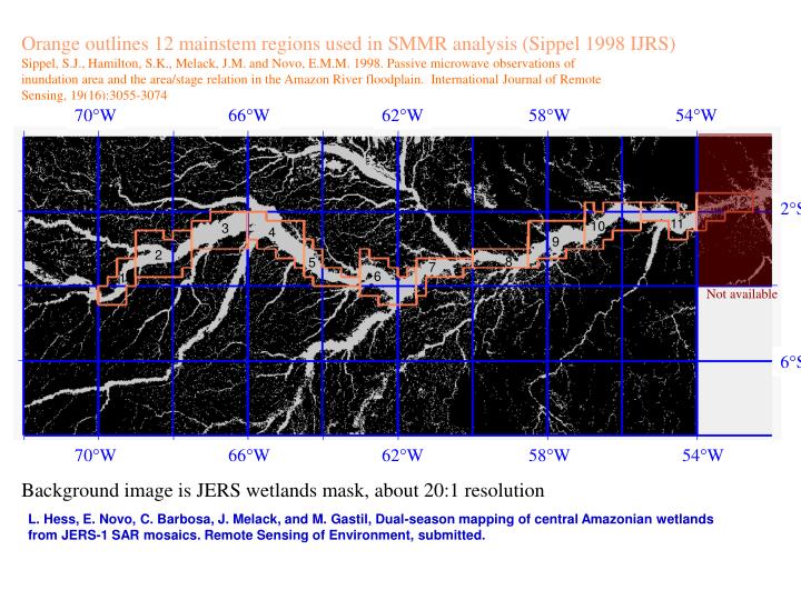
70 W. 66 W. 62 W. 58 W. 54 W. 12. 2 S. 11. 10. 3. 4. 9. 2. 8. 5. 7. 6. 1. 6 S. 70 W. 66 W. 62 W. 58 W. 54 W. Orange outlines 12 mainstem regions used in SMMR analysis (Sippel 1998 IJRS)

E N D
70W 66W 62W 58W 54W 12 2S 11 10 3 4 9 2 8 5 7 6 1 6S 70W 66W 62W 58W 54W Orange outlines 12 mainstem regions used in SMMR analysis (Sippel 1998 IJRS) Sippel, S.J., Hamilton, S.K., Melack, J.M. and Novo, E.M.M. 1998. Passive microwave observations of inundation area and the area/stage relation in the Amazon River floodplain. International Journal of Remote Sensing, 19(16):3055-3074 Not available Background image is JERS wetlands mask, about 20:1 resolution L. Hess, E. Novo, C. Barbosa, J. Melack, and M. Gastil, Dual-season mapping of central Amazonian wetlands from JERS-1 SAR mosaics. Remote Sensing of Environment, submitted.