Download
1 / 30
300 likes | 306 Views
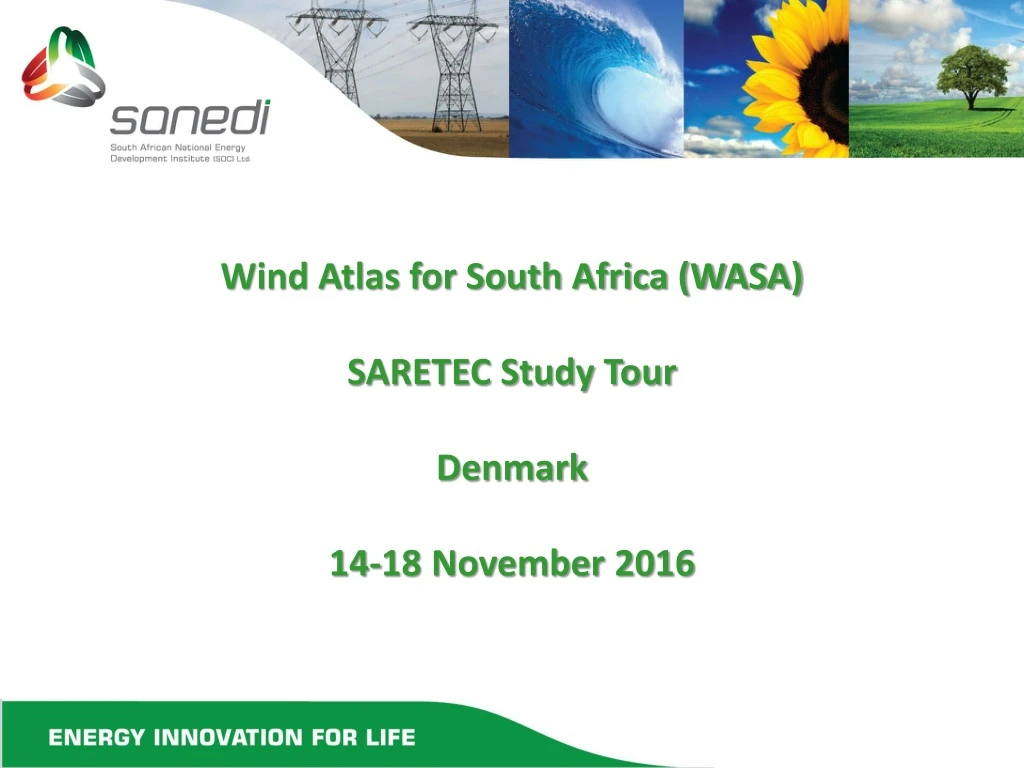
Wind Atlas for South Africa (WASA) SARETEC Study Tour Denmark 14-18 November 2016. Outline. Danish RE EE Program SANEDI Historical Wind Atlases for South Africa Wind Atlas for South Africa (WASA) WASA Implementation Partners WASA methodology, Application etc WASA Highlights Summary

E N D
Wind Atlas for South Africa (WASA) SARETEC Study Tour Denmark 14-18 November 2016
Outline • Danish RE EE Program • SANEDI • Historical Wind Atlases for South Africa • Wind Atlas for South Africa (WASA) • WASA Implementation Partners • WASA methodology, Application etc • WASA Highlights • Summary • Opportunities • Conclusion • Extreme Wind Atlas • WASA Highlights • Conclusion
Danish Renewable Energy & Energy Efficiency Program • The Danish Support to RE Development in the RSA DKK40 mill (2013-2017) comprise of 3 components: • Component 1: Technical assistance to the Department of Energy. • Development of alternative scenarios for RE deployment, carrying out socio-economic analyses of RE policies, and a smaller sub-component on energy efficiency. • Component 2: Further development of the wind atlas for RSA. • Completion of a wind atlas covering most potential wind areas of South Africa that will facilitate future decisions on introducing wind energy in national electricity supply. • Component 3: Technical assistance to Eskom for RE integration in electricity supply. • Development of decision support tools with the objective of achieving maximised carbon mitigation effect of RE generation in South African through planning and technical integration. • SANEDI is implementing WASA 2 and support (review, input ToRs, tender, procure, contract, admin) component 1 DoE and component 3 Eskom. SANEDI is a member of the Advisory Board and Management Committee
South African National Energy Development Institute (SANEDI) • The South African National Energy Development Institute (SANEDI) is a Schedule 3A state owned entity that was established as a successor to the previously created South African National Energy Research Institute (SANERI) and the National Energy Efficiency Agency (NEEA). • The main function of SANED is to direct, monitor and conduct applied energy research and development. Demonstration and deployment as well to undertake specific measures to promote the uptake of Green Energy and Energy Efficiency in South Africa. (http://www.sanedi.org.za)
SANEDI’s, vision, mission, programmes Vision Sustainable living for growth and prosperity in Africa Mission Using applied energy research and resource efficiency to develop innovative, integrated solutions that will catalyse growth and prosperity Programmes Advanced fossil fuels, Energy Efficiency, Green Transport, Smart Grids, Renewable Energy, Working for Energy (exclude nuclear)
Historical South African Wind Atlases SARERD, 2001 DME; R. Diab 1995 • Tripod Review of Wind Energy Resources in South Africa (2002) concluded: • These studies are inconclusive and under estimate the true wind energy potential as weather measurement stations at 10 m were used and in may cases these stations are shaded by buildings etc from measuring the true wind potential; and • Recommended that a dedicated wind energy measurement program be • undertaken to confirm South Africa’s true wind energy potential
Wind Atlas for South Africa (WASA) : The Wind Atlas for South Africa (WASA) Project is a Capacity Development and Research Cooperation Initiative of the South African Department of Energy (DoE). WASA is implemented by SANEDI.
WASA Implementation Partners • SANEDI • Project Management, Coordination & Dissemination • UCT CSAG (Climate System Analysis Group, University of Cape Town) • Mesoscale modelling • CSIR (Built Environment, Council for Scientific and Industrial Research) • Measurements, microscale modelling, application • SAWS (South African Weather Service) • Extreme wind assessment • DTU Wind Energy (Dept of Wind Energy, Technical University of Denmark) Skills transfer, Partner in all activities
WASA Methodology Numerical Wind Atlas Wind Resource Map Meso & micro corrections Verification WP1 Mesoscale Modelling WP2 Wind Measurements WP3 Microscale Modelling WP4 Application WP5 Extreme Wind Atlas WP6 Documentation & Dissemination, see: http://www.wasaproject.info
WASA wind measurements for Validation • 14 (9 WASA 1 since Sept 2010, 5 WASA 2 since Nov 2015) wind measurement masts with instruments were installed • Positions chosen carefully to • cover the WASA domain • be in the representative terrain types and climatology found in the domain • be suitable for modelling • Not chosen for • the ‘windiest’ locations • or ‘best locations’ for wind farms • Data automatically recorded and downloaded remotely and checked regularly to minimize loss of data or data gaps • Designed and installed to IEC standards and Measnet guidelines • Regular service & maintenance
WASA Wind Measurement stations WM14 WM13 WM15 WM1 WM12 WM11 - 15 WASA 2 (Oct 2015 -_) WM11 WM2 WM9 WM1-10 WASA 1 (2010 - ) WM3 WM10 WM6 WM4 WM7 10 minutes data and graphs available online: http://www.wasa.csir.co.za Data download: http://wasadata.csir.co.za/wasa1/WASAData WM5 WM8
Verified Numerical Wind Atlas (VNWA) VNWA for South Africa, based on WRF Weather Research & Forecasting model (generalised wind climate – mean wind speed, 100 m a.g.l, flat terrain, 3 km x 3 km grid spacing, 40 000 “virtual wind masts”) Measurements are used to verify not to create the VNWA
It is not all about average wind speeds • A comparison of the distributions of • wind directions • wind speeds • … for the WRF-based NWA also shows very good agreement WM05 Observed wind atlas WRF-based NWA Andrea Hahmann (DTU Wind Energy) “The WRF- based WASA wind atlas is the first wind atlas study where the generalisation has been carried out on the WRF-model output with excellent results.”
Seasonal and diurnal cycles in the observations and the WRF simulations WASA Final Wind Seminar
WASA Large Scale High Resolution Wind Resource map Large-scale high-resolution wind resource map launched in April 2014 (local wind climate, 250 m grid spacing with the mean wind speed @ 100 a.g.l On average, the large scale wind resource map underestimates the wind speed at the mast sites by just 1%
WASA Application • Wind Atlas: Estimation of Annual Energy Production AEP (WASA Guides). Saves time and money as the bankability of a potential wind farm site can now be estimated and physical wind measurements only to be undertaken for bankable wind sites. • Wind Resource map: The high-resolution wind resource map depicts the local wind climate that a wind turbine would encounter. It also offers important benefits for developers, policy makers, utilities and the industry, including the following: • Energy policy and planning (IRP, IEP) CSIR Energy Centre, SANEDI Eskom PV & Wind Aggregation study http://www.csir.co.za/Energy_Centre/wind_solarpv.html • Levels the playing field between small and large industry players to identify and develop wind hot spots. • Identifies possible wind development zones in line with the strategic environmental assessment (SEA) studies or in line with frameworks. The DEA’s SEA for solar photovoltaic and wind is an example of such an SEA study and is available at https://redzs.csir.co.za/ • Long-term grid planning to connect with high-potential wind development areas & • Wind farm planning in positioning (micro siting) the wind turbines for optimal wind exposures.
WRF Wind time series data • The wind time series provides hourly data that is particularly useful: • to study the annual, seasonal and diurnal variations in wind resources; • as input to power system modelling; • to study the geographical cross correlation of wind across South • Africa; and • for long-term corrections of the wind resources given by the WRF • wind climate files. • Time series data with spatial and temporal resolutions of 9 km and one hour are available online from 1 Sept 1990 to 31 Dec 2012 (WASA 1)
Extreme Wind Atlas 1:50 yr 10 min wind speed [m/s] @ 10 m above ground level (standard conditions)
Extreme Wind Atlas Application • Information on extreme winds essential in the design of wind farms situated in areas with relatively strong winds - extreme wind statistics with WAsP Eng. for IEC 61400-1 turbine safety standard • Updated extreme wind statistics critical for optimal design of built environment - SANS 10160 loading code • Disaster management – strong wind hazard profiles for risk estimation identified per local municipality to identify vulnerable local government areas
WASA Highlights • Website user statistics captured through registration on http://wasadata.csir.co.za/wasa1/WASAData 2056 registered users from 70 countries with 64491 downloads (May 2016) Project firsts: • The WASA WRF based wind atlas is the 1st wind atlas study where the generalisation has been carried out on the WRF-model output with excellent results. • WASA is the first project to use the DTU wind resource mapping tool Frogfoot successfully at a large scale when it created the large scale high resolution wind resource map. WASA is a technical partner and included in the IRENA Global Atlas for Renewable Energy (http://irena.masdar.ac.ae/?map=405 ) and used in the verification of the EUDP Global Wind Atlas (globalwindatlas.com) Some projects, programs etc referencing, making use of WASA: Dept of Environmental Affairs: Strategic Environmental Assessment, Renewable Energy (PV, Wind) Development zones, approved by Cabinet for Gazetting, 17 Feb 2016 https://www.environment.gov.za/mediarelease/cabinet_gazetting_redz
WASA Phase 1 Highlights cont. World Bank Energy Sector Management Assistance Programme, Renewable Energy Resource Mapping Initiative. 2013. Renewable Energy Mapping: Wind in Pakistan, South Asia Region, Project ID: P146140, Selection: 1118422. Palestinian Energy Authority. 2013. Request for Proposal for the Energy Section Assistance in Palestine, Phase V (RFP No. Phase V-PEA/CS-W). Feasibility of the WWF Renewable Energy Vision 2030 - South Africa http://www.wwf.org.za/media_room/publications/?14461/feasibility-of-the-wwf-renewable-energy-vision-2030---south-africa CSIR Energy Centre, SANEDI Eskom PV & Wind Aggregation study http://www.csir.co.za/Energy_Centre/wind_solarpv.html - wind on par with solar power Danish RE EE Program: System adequacy and reserve margins with increasing levels of variable generation Courses at Department of Wind Energy, Technical University of Denmark (DTU), making use of WASA: WAsP, WAsP e-learning courses, DTU course 46200 on Planning and Development of Wind Farms WASA Phase 1 book Launched Sept 2015 (see www.wasaproject.info)
Summary • WASA current 5 Provinces, 75%, 915 610 km2 • WASA 1 • Customised WRF model for wind resource assessment and validation through wind measurements with Wind Atlas & database, time series data, Wind Resource map, Extreme Wind Atlas with a Training course in applying the products of the WASA project • WASA 2 • Refining WRF model over extended area and masts (14) with increasing validation and updating of Wind Atlas & database, time series data, Wind Resource map, Extreme Wind Atlas • WASA 3 • Completion of current WASA with further refinement of WRF model over extended area and masts (18) with increasing validation and updating of Wind Atlas & database, time series data, Wind Resource map, Extreme Wind Atlas with Implementation blueprint for remaining provinces (North West, Mpumalanga, Gauteng, Limpopo) and regional cooperation, refined, representative WRF model with high quality, long term wind data bank for seasonal, climate change investigations
Opportunities • Wind Power Forecasting • It is becoming increasingly important for the sustainable growth of wind power in South Africa that accurate wind power forecasting by the utility is available, not only hours, but also days ahead for the SO to become aware and to plan for potential scheduling issues (e.g. over, under supply of wind power) in time and need for storage etc. • Recommend that an information seminar in South Africa on the topic of weather forecasting and prediction methodologies be supported that would assist the utility and stakeholders to better understand and to be able to make an informed choice regarding appropriate weather forecasting and prediction methodology for South Africa’s needs in support of a growing wind and solar power supply.
Opportunities cont. • Improving value of WASA for society and industry by adding LIDAR measurements • LIDAR wind resource validation and generation of knowledge regarding wind conditions above the height of available meteorological masts and at the height of the rotors of modern large wind turbines. This will enable improved resource mapping, siting and design of wind farms as well as choice of wind turbine technology in South African onshore locations, thus adding significant knowledge and value to society and industry. In addition such a project would contribute to the understanding of the suspected offshore jet along the West Coast. • Recommend cooperation between e.g. CSIR (have Windcube LIDAR), UCT, SAWS and DTU remote sensing research group with DTU also accredited for LIDAR calibration. The cooperation with LIDAR measurements at WASA met stations make it possible to tune the models with the exchange of knowledge and skills.
Opportunities cont. • Seasonal variation and Climate Change Impact on South Africa’s wind resource • The life span of a wind farm makes it susceptible to climate change impacts on the wind resource with potential techno-,socio and economic implications for Government policy and the growth of the wind industry in the long run. The long term (WASA 1 measurements since Sept 2010, WASA 2 since Nov 2015), uninterrupted and high quality WASA wind data is therefore of particular value to investigate the seasonal variation and climate change impact on South Africa's wind resource by comparing with past wind measurement data and modelling with scenarios for the future. • WASA 2 support of WASA 1 wind measurements (WASA 1 mast maintenance and service, data acquisition and reporting) ends November 2016. • Recommend ongoing support of WASA 1 wind measurements until end of WASA 2 wind measurements October 2018.
Opportunities cont. • Wind Energy Education program at graduate, masters level in South Africa • Currently there is no formal and dedicated wind energy education bachelor degree and higher (National Qualifications Framework NQF level 7 and higher) in South Africa besides SARETEC which focus on NQF 5+ and the DST Wind Spoke (Stellenbosch and Cape Town Universities) focussing on post graduate research. • Several “pull” factors start to emerge: turbine design and manufacturing (smaller kW size turbines, wind resource assessment, transmission system operator, developers, DoE REIPPPP SED etc) • Propose start with Denmark/SA students exchange/cooperation program, train the trainers, curriculum development and learning materials • Focus on “complete” package from wind resource assessment through to grid integration etc
Conclusion • State of the Art Wind Atlas method • Public domain through websites • Transparent methodology no “black box” • Verified with proper wind measurements, traceable • Data + Application, Guidelines, Training • Level playing field • Save time and money • Not a substitution for mandatory wind measurements • http://www.wasaproject.info/ (information, presentations) • http://www.wasa.csir.co.za (wind measurement mast online graphs) • http://wasadata.csir.co.za/wasa1/WASAData (final reports, guides, data downloads) • WRF http://veaonline.risoe.dk/wasa (WRF wind forecasting) • Numerical Wind Atlas database access through Tadpole • http://wasaclimates.eu/Tadpole/Viewer?gid=08aee5e5-e31f-416a-ad12-9a7a4d26f92e
Minister of Energy, Tina Joemat-Pettersson (speech delivered by Acting DG at the Windaba 2014) “I am now happy to say the key results of the First Phase that have been independently verified by a team of scientists working on the Wind Atlas project of South Africa using both numerically modelled data and practical observational methods and analysis, confirm that South Africa has an excellent wind resource” Johan van den Berg, CEO WASA WASA 1 Book “The opportunity exists now www.wasaproject.info with private sector continuing measuring the exact wind regime and WASA expanding to map the remainder of the country, together confirming and unlocking South Africa’s excellent wind resource. The future relevance of WASA looks as unequivocal as the historical relevance.” The WASA Phase 1 Book can be downloaded here http://www.wasaproject.info/docs/WASABooklet.pdf
Andre Otto andreo@sanedi.org.za +27828770128
Now 2016 (1.2 GW 230 x Darling Wind farms in operation) Then 2008 (1x 5.2 MW Darling Wind Farm in operation) Hopefield Wind farm, courtesy Umoya Energy Pty, Ltd