Download
1 / 24
240 likes | 388 Views
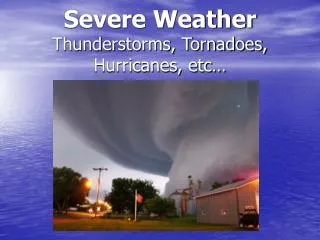
The 26 July, 2012 Twin Tier severe weather and tornado outbreak:. Part II : radar analysis Mike Evans, WFO Binghamton, NY. Outline. Reflectivity and conceptual models Rotational velocity and local research Spectrum width New dual polarization variables.

E N D
The 26 July, 2012 Twin Tier severe weather and tornado outbreak: Part II : radar analysis Mike Evans, WFO Binghamton, NY
Outline • Reflectivity and conceptual models • Rotational velocity and local research • Spectrum width • New dual polarization variables
Rotational velocity and low-level shear vs. tornado occurrence 0-1 km helicity for this case around 150 m2/s2
Recent work with dual polarization variables Modeling studies indicate that Zdr arcs on the southern edge of the forward flank precipitation shield, are associated with enhanced storm relative helicity. Enhanced shear is also indicated by separation between maxima of Zdr (large drops) and KDP (maxima of liquid water).
Event Summary • Radar reflectivity with this event was suggestive of a supercell, not a broken-S. • Rotational velocities observed on the KBGM radar were near the low-end of what has historically been observed with tornadoes in this area. • Rotation associated with the Steuben county storm appeared to develop at low and mid-levels simultaneously. • Spectrum width values greater than 20 ktswere associated with the two primary tornadoes over the central, southern tier of New York. • Some similarities noted with previous work related to dual pol (ZDR and KDP) variables.
References • Crowe, C.C., C.J. Schultz, M. Kumjian, L.D. Carey and W.A. Petersen, 2012: Use of dual-polarization signatures in diagnosing tornadic potential. Electronic J. Operational Meteor 2012-EJ5 - June 2012. • Kumjian, M., and A. Ryzhkov, 2008: Polarimetric signatures in supercell thunderstorms, Journal of Applied Meteorology and Climatology, 47, 1940-1961. • Lane, J. D., and P. D. Moore, 2006: Observations of a non-supercelltornadic thunderstorm from a Terminal Doppler Weather Radar. Preprints, 23rd Conf. on Severe Local Storms, St. Louis, MO, Amer. Meteor. Soc. • Romine, G.S., D.W. Burgess, R.B. Wilhelmson, 2008: A dual-polarization-radar-based assessment of the 8 May, 2003 Oklahoma City area tornadicsupercell, Mon. Wea. Rev., 136, 2849-2870. • Spoden, P.J., R.A. Wolf and L.R. Lemon, 2012: Operations uses of spectrum width, Electronic Journal of Severe Storms Meteorology, 7, 1-28.