Download
1 / 27
310 likes | 506 Views
Ecosystem Services Value Calculator ( ESVC). Jonathan Meyers Geog 596A December 19, 2011. Outline. Capstone project goals Ecosystem services (ES), ES valuation & benefit transfer Existing software tools ESVC description & benefits Design challenges Project timeline Questions.

E N D
Ecosystem Services Value Calculator (ESVC) Jonathan Meyers Geog 596A December 19, 2011
Outline • Capstone project goals • Ecosystem services (ES), ES valuation & benefit transfer • Existing software tools • ESVC description & benefits • Design challenges • Project timeline • Questions
Project Purpose & Goals Prototype a web-based application that will allow users, including the public, government & environmental stewards, to calculate ecosystem services values for a given area. The ESVC will enhance users’ decision-making capabilities.
…a brief example of who would use this tool & why… NJ Dept. of Environmental Protection/ Economic Survey of Natural Resources in State
Ecosystem Services one definition... “Ecosystem services refers to a wide range of conditions and processes through which natural ecosystems…helps sustain and fulfill human life. (Daily et al. 1997)“
Millennium Ecosystem Assessment (MEA) Starting in 2001, the United Nations initiated the MEA, which was designed to assess the effects of changes to our environment (ecosystems) and to determine what scientific research was necessary to monitor and quantify the resultant impacts (MEA, 2001). The MEA framework divides ES into four types(MEA, 2005): • Provisioning (equivalent to ecosystem goods) • Regulating • Supporting • Cultural
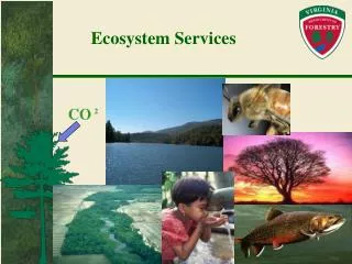
Examples of Ecosystem Services Produced or Derived from Wetlands
Ecosystem Services Valuation To better understand how actions (or inaction) we take affect the environment and thus ecosystem services, scientists have quantified the value of a variety of ecosystem goods and services.
Ecosystem Services Valuation (cont’d) • Quantifying ecosystem services values (ESV) can be very challenging as there are many assumptions to be made, including valuation methodology. • The scale and quality of the data inputs can greatly affect the ESV. • ESV only apply to ES in a given context, i.e. place and time. For example: • one may determine the dollar value of a recreation ES during September, 2011, located in Mercer County, NJ, using a forest polygon with an area of 125 acres.
Valuation methods • Avoided cost: Services allow society to avoid costs that would have been incurred in the absence of those services • Replacement cost: Services could be replaced with man-made systems • Factor income: Services provide for the enhancement of incomes • Travel cost: Service demand may require travel, whose costs can reflect the implied value of the service • Hedonic pricing: Service demand may be reflected in the prices people will pay for associated goods
Benefits or Value Transfer • determining ESV for a given research area requires extensive resources, including expertise and data. • users may attempt to assign ESV using the value transfer method, i.e. ESV previously determined for similar contexts are used (“transferred”) for calculations into the desired study area.
Benefits or Value Transfer (cont’d) • Troy and Wilson produced a decision framework for mapping ESV consisting of seven core steps: • Study area definition • Typology development (i.e. determine which indicators to measure) • Literature search & analysis • Mapping • Total value calculation • Summarize by designated geographic extent • Scenario change analysis: current vs future
Examples of existing tools -open source vspropietary -stand-alone vs software module (e.g. ArcGIS tool) -desktop & web-based tools/databases to calculate ESV include: • Integrated Valuation of Ecosystem Services and Trade-offs (InVEST) is a GIS tool that will calculate ESV and show how different scenarios affect ESV. • Multiscale Models of Integrated Models of Ecosystem Services(MIMES) values ecosystem services. • Artificial Intelligence for Ecosystem Services (ARIES) performs ecosystem service assessments and valuations.
Examples of existing tools (cont’d) web-based decision support tools • Rao et al. (2007) created a web-based decision support tool that runs models to help users assess various aspects of conservation lands. • Ghaemiet al. (2009) developed a web-based platform to support interactive planning in southern California. This tool has a unique feature that allows the users to change the land use of parcels and see the effects on the ESV of the surrounding area. • Chen et al. (2008) created a GIS desktop-based tool that estimated the ESV for all ES with a county in China and mapped the results. • The Land Use Decision Support (LUDS) tool (see http://bgis.sanbi.org) looks at effects of changes in landuse over time and space. -The Ecosystem-Based Management Tools Network (ebmtools.org) has a searchable database of thousands of ecosystem-based management tools that users can download.
Similar Prototypes -Analysis limited to specific area -Limited inventory of spatial data
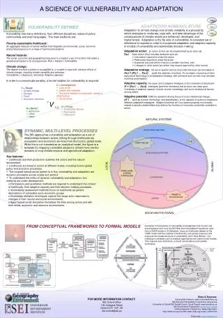
ESVC system architecture Data Software
Ecosystem Services Valuation Calculator • “standard” tools to analyze spatial data: • Areal & linear measurement • Feature queries • Feature information/identification • Multiple layer viewing • Layer transparency
Advantages include: • Easy-to-use user interface (UI) • **Ability to upload spatial data or use mapping services found on the Web** • **Unlimited spatial extent** • Ability to save various scenarios to allow users to observe spatiotemporal effects
Additional Application Features • Access web mapping services • View layer metadata • Associate layers to ES • Associate dollar values to layer/ES pairing • Select layers used in analyses • Select AOI to use in calculation
Challenges • Development challenges • Programming capabilities • Quality user interface • Production challenges • Access to web map services • Reliable servers/software
timeline • December 2011: proposal presentation • Mid-January 2012: produce working prototype of ESVC • Mid-February 2012: final presentation of application
Questions?? Jonathan Meyers jzm116@psu.edu jonathan@meyersgis.com