Download
1 / 77
790 likes | 1.1k Views
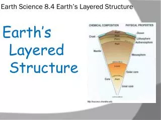
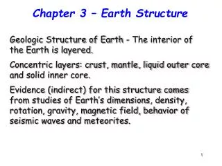
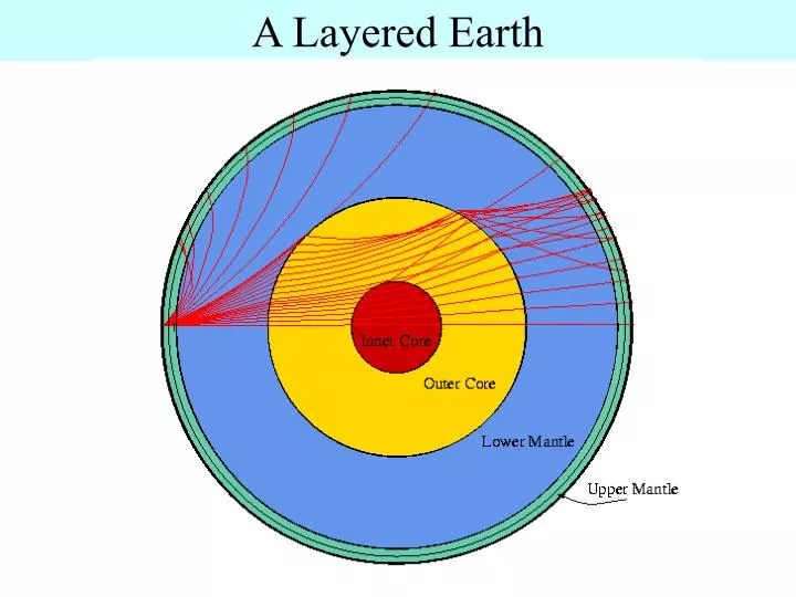
A Layered Earth. A Layered Earth Chemical Properties. Crust (oceanic crust versus continental crust) Mantle Core. A Layered Earth Chemical Properties. Oceanic Crust Thin Basalt Dark-colored (MAFIC) Composed of: oxygen, silicon, magnesium, iron. A Layered Earth

E N D
A Layered Earth Chemical Properties • Crust (oceanic crust versus continental crust) • Mantle • Core
A Layered Earth Chemical Properties • Oceanic Crust • Thin • Basalt • Dark-colored (MAFIC) • Composed of: oxygen, silicon, magnesium, iron
A Layered Earth Chemical Properties • Continental crust • Thick • Granite • Light-colored (FELSIC) • Composed of: oxygen, silicon and aluminum
A Layered Earth Chemical Properties • Mantle • Thickest layer, ~68% of Earth’s mass, 83% of volume • Layer beneath the crust • Thought to be composed of: oxygen, iron, magnesium • and silicon
A Layered Earth Chemical Properties • Core (outer and inner core) • Dense, inner layer • Composed of: iron and nickel
A Layered Earth Physical Properties • Lithosphere • Asthenosphere • Mantle • Core
A Layered Earth Physical Properties
A Layered Earth Physical Properties • Lithosphere (lithos = rock) • Earth’s cool, rigid outer layer • 100-200 km (60-125 miles thick) • Composed of: oceanic (2.9 g/cm3) • continental crust (2.7 g/cm3) • uppermost part of mantle (cool and rigid)
A Layered Earth Physical Properties • Asthenosphere (asthenes = weak) • Hot, partially melted upper mantle below the lithosphere • Extending to a depth of 350-650 km (220-400 miles) • Capable of flow • 3.3 g/cm3
A Layered Earth Physical Properties • Mantle • Extends to the core • Hot and dense, flows much more slowly • Lower mantle (4.5 g/cm3)
A Layered Earth Physical Properties • Core • Outer Core = dense, viscous liquid • Inner Core = Solid, max density of 16 g/cm3
Earth Structure and Plate tectonics • Earthquakes and earthquake waves • The layers of the Earth • Continental drift • Plate boundaries • The confirmation of plate tectonics
Earthquakes and earthquake waves • Seismic waves: Low-frequency pulses of energy generated • by the forces that cause earthquakes. Seismic waves can • spread rapidly through Earth in all directions and then return • to the surface. • Seismic waves tell us about the Earth’s interior • Recorded by seismographs
Earthquakes and earthquake waves • The Earth is not homogeneous in composition • Seismic waves speed up with depth because the Earth’s • density increases with depth • Geothermal gradient • Global distribution and current quakes
A Layered Earth • Internal Heat • Main source of heat within the Earth is caused by: • Radioactive decay: a process that generates heat when • unstable forms of elements are transformed into new • elements. • Conduction and Convection
A Layered Earth • Isostatic Equilibrium: • Less dense crust floats on top of the denser and • deformable rocks of the mantle • Concept of “floating” crust in gravitational balance is • called isostacy • If weight is added or removed from the crust, isostatic • adjustment will take place as the crust subsides or • rebounds
A Layered Earth • Isostacy examples • Large regions of Earth’s continents are held above • sea level by isostatic equilibrium, a process analogous • to a ship floating in water
A Layered Earth Buoyancy: the ability of an object to float in a fluid by displacing a volume of that fluid equal in weight to the floating object’s own weight Faults: fractures along a plane of weakness
Continental drift: An idea before its time • Alfred Wegener • First proposed his continental drift hypothesis in 1915 • Published The Origin of Continents and Oceans • Continental drift hypothesis • Supercontinent called Pangaea began breaking apart about 200 million years ago
Continental drift: An idea before its time • Continental drift hypothesis • Continents "drifted" to present positions • Evidence used in support of continental drift hypothesis • Fit of the continents • Fossil evidence • Rock type and structural similarities • Paleoclimatic evidence
The great debate • Objections to the continental drift hypothesis • Inability to provide a mechanism capable of moving continents across the globe • Wegner suggested that continents broke through the ocean crust, much like ice breakers cut through ice
Wegener’s matching of mountain ranges on different continents
The great debate • Continental drift and the scientific method • Wegner’s hypothesis was correct in principle, but contained incorrect details • For any scientific viewpoint to gain wide acceptance, supporting evidence from all realms of science must be found • A few scientists considered Wegner’s ideas plausible and continued the search
Plate tectonics: A modern version of an old idea • Much more encompassing theory than continental drift • The composite of a variety of ideas that explain the observed motion of Earth’s lithosphere through the mechanisms of subduction and seafloor spreading
Plate tectonics: A modern version of an old idea • Earth’s major plates • Associated with Earth's strong, rigid outer layer • Known as the lithosphere • Consists of uppermost mantle and overlying crust • Overlies a weaker region in the mantle called the asthenosphere
Plate tectonics: A modern version of an old idea • Earth’s major plates • Seven major lithospheric plates • Plates are in motion and continually changing in shape and size • Largest plate is the Pacific plate • Several plates include an entire continent plus a large area of seafloor
Plate tectonics: A modern version of an old idea • Plate boundaries • All major interactions among individual plates occur along their boundaries • Types of plate boundaries • Divergent plate boundaries (constructive margins) • Convergent plate boundaries (destructive margins) • Transform fault boundaries (conservative margins)
Plate tectonics: A modern version of an old idea • Plate boundaries • Each plate is bounded by a combination of the three types of boundaries • New plate boundaries can be created in response to changes in the forces acting on these rigid slabs
Plate tectonics: A modern version of an old idea • Earth’s major plates • Plates move relative to each other at a very slow but continuous rate • Average about 5 centimeters (2 inches) per year • Cooler, denser slabs of oceanic lithosphere descend into the mantle
Divergent Plate Boundaries Mid-Atlantic Ridge System DIVERGENT BOUNDARY
Divergent plate boundaries • Most are located along the crests of oceanic ridges and can be thought of as constructive plate margins • Oceanic ridges and seafloor spreading • Along well-developed divergent plate boundaries, the seafloor is elevated forming oceanic ridges
Divergent plate boundaries • Oceanic ridges and seafloor spreading • Seafloor spreading occurs along the oceanic ridge system • Spreading rates and ridge topography • Ridge systems exhibit topographic differences • Topographic differences are controlled by spreading rates
Divergent Plate Boundaries Oceanic ridges and seafloor spreading • Longest topographic feature on Earth’s surface • Represent 20% of Earth’s surface, 1000-4000 km wide • Create new seafloor! • Typical spreading rates ~5 cm (2 inches) per year • No ocean floor is older than the Jurassic! (180 my)
Divergent boundaries are located mainly along oceanic ridges
Seafloor Spreading • Most convincing evidence from ocean drilling • Age of deepest sediments • Youngest sediments are near the ridges • Older sediments are far away from the ridges • Confirms seafloor-spreading hypothesis • Ages show that the ocean basins are geologically young
Divergent plate boundaries • Spreading rates and ridge topography • Topographic differences are controlled by spreading rates • At slow spreading rates (1-5 centimeters per year), a prominent rift valley develops along the ridge crest that is wide (30 to 50 km) and deep (1500-3000 meters) • At intermediate spreading rates (5-9 centi-meters per year), rift valleys that develop are shallow with subdued topography
Divergent plate boundaries • Spreading rates and ridge topography • Topographic differences are controlled by spreading rates • At spreading rates greater than 9 centimeters per year no median rift valley develops and these areas are usually narrow and exten-sively faulted • Continental rifts • Splits landmasses into two or more smaller segments
Divergent plate boundaries • Continental rifts • Examples include the East African rifts valleys and the Rhine Valley in northern Europe • Produced by extensional forces acting on the lithospheric plates • Not all rift valleys develop into full-fledged spreading centers
Convergent Plate Boundaries CASCADE RANGE Mt. Hood
Convergent Plate Boundaries • Types: • oceanic-continental (Andes) • oceanic-oceanic (Aleutian trench) • continental-continental (Himalayas) p. 52
Convergent plate boundaries • Older portions of oceanic plates are returned to the mantle in these destruc-tive plate margins • Surface expression of the descending plate is an ocean trench • Called subduction zones • Average angle at which oceanic litho-sphere descends into the mantle is about 45