Download
1 / 15
150 likes | 289 Views
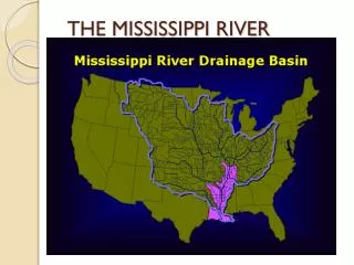
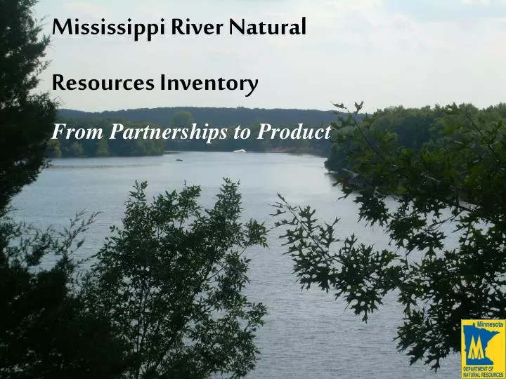
Mississippi River Natural Resources Inventory From Partnerships to Product. Mississippi River NRI Project Area Description. 29 miles of Mississippi River corridor between the Blanchard Dam near Royalton and the 10 th Street Dam in St. Cloud.

E N D
Mississippi River Natural Resources Inventory From Partnerships to Product
Mississippi River NRI Project Area Description 29 miles of Mississippi River corridor between the Blanchard Dam near Royalton and the 10th Street Dam in St. Cloud. High quality fishery including Smallmouth Bass, Walleye and Musky. This reach of river includes two pools created by dams at Sartell and St. Cloud. The entire reach of the river includes three dams. Much of the pool areas are developed to very high densities. Free run of the river areas are largely undeveloped. Region continues to be a growth hub. Commuter rail has potential to accelerate growth further. Growth while accommodating natural resources is the challenge.
Mississippi River NRI Other Significant Events Bioblitz Event – Residents help discover living things in and around river St. Cloud and Sartell enact environmental ordinances U of M landscape architecture students study the area St. Cloud State University research in biologically active toxins in waste water and how they combine to affect aquatic life in the Mississippi River The MN DNR begins a comprehensive fisheries survey
Mississippi River NRI What Started It Both north and south of this reach of the river, higher level management plans are in place to guide development to maintain the quality and the character of the River. Benton County Comprehensive Local Water Management Plan called for increased cooperation between counties with the goal of water quality and quantity protection along the Mississippi River.
Benton SWCD Mississippi River NRI Beginning with the Benton SWCD and the Mid Minnesota Mississippi River Resource Conservation and Development Council, assistance was sought for developing strategies to help maintain the quality of the Mississippi River despite growth and increased use. The Minnesota DNR became aware and contributed $45,000 to complete a Natural Resources Inventory for this reach of the river 1,000 meters from it’s banks. The McKnight Foundation, then joined with an additional $30,000 and was this was used for increasing the extent of the area in the South, where more growth is currently occurring. The inventory was completed by Jason Husveth, Critical Connections Ecological Services, Inc. in June, 2006 Mid Minnesota Mississippi River RC&D
Benton SWCD Mississippi River NRI Organizational Support • In October of 2006, the DNR placed staff in Sauk Rapids, in part to continue this effort. • The DNR also received a Bush Foundation grant to foster interjurisdictional cooperation and, among other things, was used to fund the assistance from Jean Coleman with CR Planning who assisted with meeting coordination and strategic planning. • In addition, Jason Husveth, CCES, Inc., was made available to all city councils and counties for map presentations to LGUs and NRI Technical Training, held this spring. Mid Minnesota Mississippi River RC&D
Mississippi River NRI The NRI… The NRI data was begun byprinting hard copies of FSAaerial photographs andidentifying areas of similarland cover. Other data sets were referencedincluding the DNR Forestryinfrared photographs, NWI.
Mississippi River NRI The NRI… The data was field checked to the greatest extent possibleand values were assigned tothe cover types using theMinnesota Land CoverClassification System, or MLCCS. The data represents datagathered to Level 5, orthe greatest level of detailused in the MLCCS.
Mississippi River NRI Coverage of NRIs Using the MLCCS…
Green Infrastructure Mapping Creating Connections in the Community In Benton, Stearns, Todd, Morrison, Mille Lacs and Kanabec Counties
Partial DNR Central Region Green Infrastructure Mapping
Green Infrastructure Mapping • Partnerships- • Along with the Natural Resources Inventories and Minnesota County Biological Surveys, the Green Infrastructure product helps identify opportunities for planning and protection strategies at the county and city level • Local Water Management Plan meetings were identified and meetings were held. Partners include NRCS, P&Z, SWCD, FWS, Co. Commissioners, lake associations, multiple DNR divisions, cities, townships • Hannah Texler, plant ecologist drafted the maps, sent them to me, I met with the counties and Bart Richardson, GIS Project Coordinator cleaned up polygons and managed the regional data set. This includes making the maps available not only on the DataDeli, but on a map server for easy access.
Green Infrastructure Mapping • What Are The Mapping Goals and Benefits? • Green Infrastructure mapping is intended to begin a discussion about, and support for, a regional land and water network. By collaborating, a network of significant natural areas, open spaces and connecting greenways can be identified in the six non-metro counties of DNR’s Central Region. • Helps communities provide multiple opportunities for residents to understand and enjoy our natural resources. • Identifies important natural areas to sustain their ecological functions as well as potential connections to and buffering areas around natural areas, and open spaces. • Helps the community gain a better understanding of existing opportunities to create an interconnected web of natural areas for the betterment of the habitats and people of Minnesota.