Download
1 / 26
270 likes | 439 Views
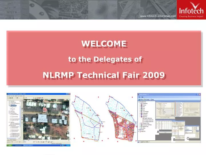
WELCOME to the Delegates of NLRMP Technical Fair 2009. A. C. B. New Delhi City (NCR). NLRMP – Some issues and way forward Chandrasekhar Nori Dec 16, 09. Creating Business Impact | Providing Expert Solutions | Delivering Quality Consistently | Building Partnerships Globally.

E N D
WELCOME to the Delegates ofNLRMP Technical Fair 2009 A C B New Delhi City (NCR)
NLRMP – Some issues and way forwardChandrasekhar NoriDec 16, 09 Creating Business Impact | Providing Expert Solutions | Delivering Quality Consistently | Building Partnerships Globally
82.3 34% revenue CAGR 36% profit CAGR Over 5 years 11.7 59 43 34 27 6 4.1 19 $ M 3.7 3.2 2.5 FY 01 FY 02 FY 03 FY 04 FY 05 FY 06 Revenue Net Profit Profile • Founded in 1991; corporate headquarters in Hyderabad, India • Largest independent offshore provider of geospatial and engineering design services • Focused on utilities, transportation, government and manufacturing verticals • Over 7000 resources across 25 global locations, including 7 development centers • CMMi Level 5, ISO 9001:2000, BS7799 • Rs. 889.75 Cr revenue & Rs. 92.48 Cr net income in FY 2009.
Experience • Karnataka - UPOR – SP and TSP on PPP • MP Land Records • Cadastral Data Management – Dubai • LRIMS – SAIL, Bokaro • KLR Urban Cadastre pilot • RPA, UK • Defence Estates UK…many more • Experimental Resurveys in AP • Photogrammetry pilot in Khammam, AP
Obtaining High Resolution Image Selection of Ground Control Points on Image Collection of Ground Control Points Reconnaissance Survey Documents/Records Collection Hardcopy Plots for Demarcation Demarcation Geo rectification of Satellite Imagery Unsupervised Extraction Field Supplementation Title Enquiry Process Digital Conversion of Title Enquiry Data Clean up & Topology Quality Check Quality Check Spatial & Attribute Data Integration 15% ETS (& Laser Ranger) Measurements Incorporation of Layouts Digital Transfer Deliverables & Final Report Statistical Analyses of WD Pts. & WD Prcls. |KLR – Pilot work -Process Flow Digital Transfer of Demarcated Data
NLRMP Main Objectives • usher in a system of updated land records • automated and automatic mutation • integration between textual and spatial records • replace the present deeds registration and presumptive title system with that of conclusive titling with title guarantee • The NLRMP has three major components: • Computerization of land record • Survey/ re-survey • Computerization of Registration
… a system of updated land records • The central objective of NLRMP is not just fresh cadastral surveys • Land records in almost all the states are not up-to-date • Given that the land records are not in continuous maintenance in most of the states • To meet the first objective, • land records should be made up-to-date at one instance of time and • be kept under continuous maintenance from then on
… a system of updated land records • Globally speaking, land records comprise of: • Graphical sketches depicting accurately the extent and boundaries of all parcels • An index map of the entire administrative unit • A textual record comprising of the owners name, occupier/ enjoyer’s name, approximate area, unique ID number of the parcel • The graphical records and the textual records should be individually correct and up-to-date and also be connected with each other properly to constitute the complete title cadastre • “modernisation” in the program refers to employment of appropriate technology that will ensure this integration
Mutation • Mutation is the process of recording and registering change of ownership and other changes in the statutory records • Change of ownership and other changes on the ground can occur in several ways, where transaction in land is only one of them • All such sources of change, as also the processes through which such changes occur, are to be fully understood and captured • The complete “as-is” business processes of the participating organisations should be understood, reengineered and rendered amenable for process automation • GIS technology can then be embedded into this IT framework, so that the graphical data is simultaneously updated along with the textual title record, during mutation.
Conclusive title • Weakness of the present land records management system is the lack of connectivity between the processes of the Registration and Revenue Departments. • In reality, registration does not confer title to the buyer; • It is actually the mutation of the change of title in the revenue records that validates the registration process • Every registration process – rather any process whatsoever by which ownership changes – should be immediately followed by mutation However, registration is carried out by the Department of Stamps and Registration, whereas mutation is carried out by the Revenue Dept. …
… Conclusive title • Integration of the business processes of these Departments takes us one step closer to the land title security regime. • There may be simpler methods to impart a semblance of “conclusiveness” to the land titles; • creation of an up-to-date land records database integrating textual and graphical record, • Business process integration between Revenue, Survey and Registration Departments and • Tweaking a few Departmental procedures to ensure proper consistency in their day-to-day implementation across the Departments.
Appropriate technologies • Aerial, field survey and HRSI – what are the criteria for appropriateness? • If accuracy is the only criterion, field survey is the best; but, is it scalable? • Is aerial photography the only alternative, for survey of large tracts? • How accurate is HRSI method? … … What is the real accuracy required? Are cost and time important considerations?
Departmental processes • Essential processes like boundary demarcation, title enquiry, adjudication, etc are time tested and should be preserved as such to sustain public confidence. • Technology should render itself amenable for incorporation into these essential processes rather than being end-all-be-all. • Technology is no panacea. Depts should shed their diffidence and refrain from “throwing-away-the-baby-with-bathwater”
Fresh survey vs updating existing record • Long-standing debate over condition of land records and their utility • Several states preferring fresh surveys over updating • Framework in tact in major parts of several states, which can be improved upon • Existing records enjoy acceptance by public. • Even in litigation-ridden peri-urban areas, disputed parcels do not exceed 10% Fresh surveys, the only solution?
Validation before modernization • Erstwhile CLR – a case in point • Correctness of data not considered as a pre-requisite • Result – digitized parcel data could not be put to routine maintenance • Fresh across-the-board surveys may not be the only plausible solution • No computerization before validation – graphical or textual • Costly re-surveys may be avoidable in many areas • Excellent village boundary framework is mandatory
The principle of precedence of boundary over extent In most disputes, areas and extents are not the only contention • Disputes are often caused by location, unique id, title etc. • Boundary is objective; area subjective • Correct boundary identification makes measurement accuracy less critical • Accurate measurement alone does not guarantee correct boundary
Correctness vs accuracy If boundary is correctly identified, measurement is redundant • Measurement accuracy is a function of technology • Technology does not guarantee correct identification • Boundary demarcation – essential pre-requisite to measurement survey • Required measurement accuracy can be chosen based on affordability
Capacity building • Cadastral surveys – domain of Govt. for times immemorial • Companies do not have adequate comprehension of legal cadastre • Private surveyors have technology awareness, no domain knowledge • Lack of capacity in private sector – a serious limitation • Large scale capacity building by state LR Depts. is the only solution
Approval process • On the other hand, Departmental surveyors are not exposed to technology • No exposure to modern survey instruments and computer processing • No knowledge of digital cadastre and GIS • Several projects suffering because of delayed and often incorrect approval process • Large scale staff training is mandatory for success of projects
Infotech in NLRMP • Pre project phase - Consulting, pre project support, NLRMP proposal preparation and funding support – Infotech has rich domain experience • Project execution phase – • Undertake digitization of the existing village maps, parcel sketches and RoR documents for creation of a comprehensive GIS – we have the entire life-cycle mapped in our facility at Hyderabad • Undertake comprehensive cadastral surveys with appropriate technology and/ or combinations thereof. • Undertake business process integration and automation in the Depts. involved, leading to creation of the essential framework for land title security • Development of necessary software for management of land information, applications, computerization of revenue and registration Depts., delivery to the public on the web etc. • Various engagement options – nomination, Consultancy, project management, competitive bidding and participatory modes
UPOR – KLR - Project Details • Public Private Partnership (PPP) Model Project • Recovery through User charges • Sharing of investment • Partial funding by Department for project implementation • Remaining Investment by Vendor during project • implementation and maintenance period • Project Period • 270 days for Application Development and Implementation • 6 years Services & Maintenance Present Implementation in 5 cities, services, expandable to 10 more cities in near future.
UPOR – KLR - Project Details • To create a robust system of Urban Property Ownership Records for every property which accurately record both for the spatial characteristics of the property as well as record of rights data. • This property record will serve as a trusted record for all transactions. • This property record created through this project will evidence property ownership for all regulatory and legal purpose. • The property record over the years will continue to remain current and accurate i.e. will not become obsolete or inaccurate. • All property record related transactions and services will be fulfilled through this project.
UPOR – KLR - Project Scope • Develop a UPOR Software Suite with following modules: • Data entry software • Scanning software • Vectorization (digitization) software • GIS module to view maps. • Portal Development for information on services • Portal Integration with a payment gateway • Bulk data (spatial and non spatial) upload module • Performance monitoring (of both SP and TSP) module • MIS reports Module for tracking delivery of various services • Module for reconciliation of accounts • Integration of finger print capture device • System maintenance (for 6 years) • Training • Help Desk support
Thank you chandra.nori@infotech-enterprises.com+91 98480 15566 Creating Business Impact | Providing Expert Solutions | Delivering Quality Consistently | Building Partnerships Globally