Download
1 / 88
880 likes | 1.01k Views
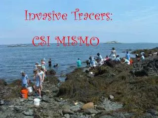
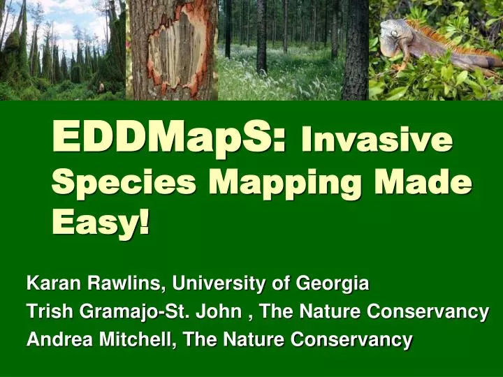
EDDMapS: Invasive Species Mapping Made Easy!. Karan Rawlins, University of Georgia Trish Gramajo-St. John , The Nature Conservancy Andrea Mitchell, The Nature Conservancy. Part I. EDDMapS overview Goals for CISMAs Entering Data. EDDMapS is a Tool IPAM is a Project FNAI is a Program

E N D
EDDMapS: Invasive Species Mapping Made Easy! Karan Rawlins, University of Georgia Trish Gramajo-St. John , The Nature Conservancy Andrea Mitchell, The Nature Conservancy
Part I EDDMapS overview Goals for CISMAs Entering Data
EDDMapS is a Tool IPAM is a Project FNAI is a Program CISEH is a Program
EDDMapS is a Tool Early Detection & Distribution Mapping System created by CISEH Chosen by FISP for CISMAs Chosen by Florida Fish & Wildlife for Invasive animals data Easy to use Easy to add images EDRR tracking
IPAM is a Project Invasive Plant Atlas of the MidSouth Designed to accomplish a specific goal Funded for a specific time frame Mapping tool created to accomplish the goal
FNAI is a Program FNAI: Florida Natural Areas Inventory Has several goals Mapping invasive species in Florida’s natural areas is one of the goals Requires more GIS knowledge to use
CISEH is a Program CISEH: The Center for Invasive Species and Ecosystem Health EDDMapS is a mapping tool created by CISEH Two way sharing of data with other projects and programs Entirely Grant Funded
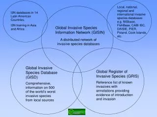
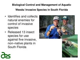
EDDMapS Partners National park Service USDA Forest Service U.S. Fish and Wildlife Service Southeast Exotic Pest Plant Council Mid-Atlantic Exotic Pest Plant Council Alaska Natural Heritage Program The Nature Conservancy Missouri River Watershed Coalition Center for Invasive Plant Management Center for Research on Invasive Species & Small Populations USDA NRCS Plants Database River to River CWMA Florida Invasive Species Partnership Everglades Cooperative Invasive Species Management Area Florida Fish and Wildlife Conservation Commission Florida Natural Areas Inventory Invasive Plant Atlas of the MidSouth Texas Invaders
Other CISEH Projects/Tools • 103,000 images available in multiple resolutions from 1500 photographers • Launch web interface in 2001 with 3,500 images www.forestryimages.org www.invasive.org www.ipmimages.org www.insectimages.org
Goals for each CISMASteps to get started Create a local Early Detection list Add EDDMapS to annual plant ID training Find a local verifier (or two) Create a list of audiences to train
1. EDRR Early Detection & Rapid Response
Simple EDRR Flow Chart Species reported (Create a List) Species verified Rapid assessment RESPONSE
Control & Containment Strategies/Priorities Outliers Advancing Front Severely Infested Zones Special Habitat
2. Annual EDDMapS Training Why EDDMapS?
Fast and easy to use - no knowledge of GIS required Web-based mapping of invasive species distribution to help fill gaps and identify “leading edge” ranges Facilitates Early Detection and Rapid Response implementation with online data entry forms, e-mail alerts and network of expert verifiers
One Database for both local and national data Data can be searched, queried and downloaded in a variety of formats Cooperates with and aggregates data from other invasive species mapping projects Custom/hosted applications can be quickly and inexpensively developed
Levels of Data County-level data Point data Verified Herbarium voucher - Highest Photograph Expert observation Unverified Report without specimen, photograph or verification by expert
Uses of Data More complete distribution data Early detection of new invaders Identification of “leading edges” Refinement of lists and priorities Clearer picture of invasive species problem Justification of need for management and resources
3. Find a Local Verifier
Why is it important? What do they do? Everything goes in as unverified until someone reviews it When something is reported an email is automatically generated and sent to verifier Verifier reviews report If trusted observer or clear pictures verify If not follow up with observer Worst case – verifier or CISMA member visits location
What is It? This animal was photographed in Northeast Georgia. Can you tell us what it is and if it is just an albino of a native species or, in fact, a non-native animal? Thanks for you help. Jake Reid
4. Create a List of Audiences to Train Florida Invasive SpeciesWorking Groups
Stakeholder Groups DNR Master Naturalists Master Gardeners Scouts DOT ???
Entering Data Helpful Hints Common Questions
60 feet 100 feet
60 feet 100 feet
60 feet 100 feet