Download

1 / 16
160 likes | 173 Views
Global Land Survey Update. Jeff Masek, NASA GSFC Rachel Headley, USGS EROS. Background: Global Land Survey Data Sets. Global cloud-free, orthorectified Landsat data sets centered on 1975, 1990, 2000, 2005, and 2010 Partnership between USGS and NASA, in support of USGCRP

E N D
Global Land Survey Update Jeff Masek, NASA GSFC Rachel Headley, USGS EROS
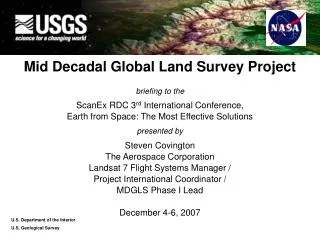
Background: Global Land Survey Data Sets • Global cloud-free, orthorectified Landsat data sets centered on 1975, 1990, 2000, 2005, and 2010 • Partnership between USGS and NASA, in support of USGCRP • Support global assessments of land-cover, land-cover change, and ecosystem dynamics (disturbance, vegetation health, etc) • GLS2010 currently in development Browse image mosaic of GLS2005 coverage for Africa; Global Land Survey data sets featured on the cover of Photogrammetric Engineering & Remote Sensing, January 2008
GLS2010 Campaign Station Status – August 2011 GLS2010 Data Acquisition Plans Wrapping Up
GLS2010 Data @ EROS (As of March, 2011) GLS Campaign >200,000 scenes 2009-2011
GLS2010 Selection & Processing Mapping epoch planned as 2009-2011 w/ both L5 & L7 - stronger preference for L5 than GLS2005 - some issues with seasonality in GLS2005 – probably inherited from use of AVHRR NDVI record within LASSI - original epoch was 2009-2010, but some regions (e.g. N. America) require a 3rd growing season Southern Hemisphere & Central Asia selections now complete - US archive data being processed at EROS - IC selection lists are being submitted to stations Northern Hemisphere selections begin in September 2011 Rolling processing through 2011…anticipate complete data set available by end of year
NDVI Once again, our highest priority is to maximize seasonal NDVI.
Area Coverage Since GLS2010 used a higher percentage of L5 compared to L7, the area coverage is much better.
Islands and Reefs: Background • Using EO1 to capture small islands and reefs distant from continental land • Monitoring acquisitions via browse imagery, closing requests as clear scenes are acquired
Acquisition Progress: Summer 2010 188 clear scenes 6 cancelled 677 open, of which 31 have an acquisition judged Very Close 306 have an acquisition judged Marginal or Close (93); 340 have no acquisitions judged at least Marginal (26) or have not yet been acquired
Statistics on EO1 Acquisition Progressas of 10 August 2011 414 clear scenes 451 open, of which: 10 have an acquisition judged Very Close 255 have an acquisition judged Marginal or Close (77); 186 have no acquisitions judged at least Marginal (25) or have not yet been acquired This time last year (June 2010): 188 clear 677 open 340 less than marginal or not yet acquired 6 cancelled
GLS2010 Format & Distribution • Format • Same processing applied as ‘normal’ Landsat scenes • L5 single scenes • L7 gap-filled scenes (at EROS) • Occasional single L7 scenes if inappropriate for gap-filling • Too cloudy • Poor gap match • Scenes will be made available as processed • Single scene downloads • Bulk distribution will be handled on external drive by user request
Future Directions • What’s next… • GLS2015 ? • Seasonal (leaf-on, leaf-off) global coverage ? • Prototype dense, multitemporal data collections (e.g. Sentinel-2 + LDCM + L7) ? • Improved global LCC/LUC products (e.g. Global land use) • Improved access tools for the archive for assembling GLS-style coverages