Download

1 / 12
120 likes | 238 Views
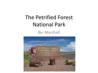
By: Carson P. The Petrified Forest. Map of location . The Petrified Forest National Park was founded in 1915. The trees were there before it was founded. It became a park to show citizens from near and far, the beauty of fallen redwoods. A scenic route down a long winding path. What fun!.

E N D
By: Carson P The Petrified Forest
The Petrified Forest National Park was founded in 1915. The trees were there before it was founded. It became a park to show citizens from near and far, the beauty of fallen redwoods. A scenic route down a long winding path. What fun! When it became a park, and why?
The park was naturally formed by a towering volcano. It had been silent for hundreds of years. Then one day, the volcano erupted! Sending lava across the land. It spilled over the trees, sending them tumbling to the ground! Now, all that stands today, is stumps, and dried up logs from the eruption. It sounds pretty cool to me! How was it formed?
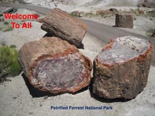
There are many types of rocks in the forest. Most developed from the trees, and peeled off, that means they are organic. Almost all of the rocks found at the park or organic, only a few are inorganic. Types of rocks
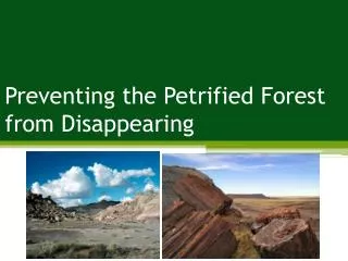
The Petrified Forest has a vast land space in the middle, then the sides curl up on the ends, to make a bowl shape. The curls are somewhat like hills, and then in the land space, it is just a dry desert. The hills have different layers of colors. Here’s a picture. Special landforms/features
The land in always changing. One day a dune is there. The next, its gone! The wind can affect the sand formation. The logs sometimes move about, but not usual. You might think that the logs could easily move about, because they are all dried out. But since they have been there so long, they are almost stuck to the ground. How is the land changing
Scientific studies are on-going at the park. Paleontologists find new fossils, including new species of plants and animals, each year. Biologists study living plants and animals, including vegetation surveys and reptile, amphibian, and mammal projects. Air quality, weather, and seismic monitoring stations constantly generate new data. Environmental issues
At the park, they have seismic monitoring stations, planted throughout the park, where they research, and are constantly generating new data. They use a GPS device to monitor the park, and whenever they need it, show them a birds eye view, from above the park. How is technology used?
These are the sites I visited to get all this info. http://www.nps.gov/pefo/index.htm http://www.google.com/imghp http://www.ask.com/answers/browse?id=78077921 bibliography
Director……………………… Carson Peasley Producer……………………….Carson Peasley Executive Producer……………… Carson Peasley credits