Download

1 / 10
100 likes | 337 Views
CRCT Review 2014. Unit 1 Page 1 and first part of the final page of your review packet. Unit 1: Geography of Georgia/Georgia’s Beginnings. Standards and Elements: SS8G1 SS8H1. Geography of Georgia. Georgia is located in the following areas: - Region : South, Southeast, etc.

E N D
CRCT Review 2014 Unit 1 Page 1 and first part of the final page of your review packet
Unit 1: Geography of Georgia/Georgia’s Beginnings Standards and Elements: • SS8G1 • SS8H1
Geography of Georgia • Georgia is located in the following areas: -Region: South, Southeast, etc. -Nation (Country): U.S.A. -Continent: North America -Hemispheres: Northern and Western • Georgia is divided into 5 Physiographic Regions: Coastal Plain, Piedmont, Blue Ridge, Valley and Ridge, and Appalachian Plateau. • Georgia’s warm and humid temperate climate help to make GA both a good farming area and a good tourist spot.
Geography of Georgia • Key Physical Features: • Fall Line – Divides Coastal Plain and Piedmont Regions. The best farm land in GA is located just north and south of the Fall Line. • Okefenokee – Largest freshwater wetland in GA. • Appalachian Mountains – Highest peak in GA is here (Brasstown Bald is 4,786 feet above sea level). Highest and wettest part of GA. This rain leads to rivers that provide drinking water for most of GA. • Chattahoochee and Savannah Rivers – Provide drinking water for GA. Also assists in transportation and electricity (hydroelectric power) • Barrier Islands – Important to the tourism of GA. Also houses industries such as paper production and fishing.
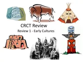
Georgia’s Beginnings • 4 Early periods of Native American cultures: • Paleo Indians – Period lasted about 10,000 (approximately 18,000 BC to 8,000 BC) years. Nomadic hunters. Used the atlatl to hunt large animals. • Archaic Indians – Period lasted from 8,000 to 1,000 BC. Moved with each season to find food. Used tools to assist with hunting and with work tasks. • Woodland Indians – Period lasted from 1,000 BC to 1,000 AD. Families began to live together and form tribes. Used bow and arrows to hunt. Held religious ceremonies. • Mississippian Indians – Period lasted from 900 AD until the arrival of European explorers (in the 1500’s). Most advanced group. Protected villages using fences and moats. Very religious group. Built Temple Mounds as places of worship.
Unit 1: Geo/Prehistory I. Where is GA? II. GA Regions II. GA Regions • Southeast/southern • United States of America • North America • Northern and Western • Piedmont • Appalachian Plateau • Coastal Plain • Blue Ridge Mountains • Ridge and Valley
Unit 1 Geo/Prehistory II. 6 Major Physical Features III. More Regions/Features Okefenokee Swamp Savannah River Hydroelectricity, transportation, drinking water, tourism, Barrier Islands Brasstown Bald
Unit 1 Geo/Prehistory IV. Prehistoric Peoples (Back page of packet) I. More Geography/Prehistory Archaic Climate Drought Deepwater ports Barrier islands Paleo Fall Line Chattahoochee River Appalachian mts. • Culture • Shelter • Atlatl • Mississippian • Woodland