Download
1 / 24
290 likes | 347 Views
Overview of HAZUS for Earthquake Loss Estimation. October 28, 2011. What is HAZUS?. Risk assessment tool for analyzing potential losses from hurricane, flood, and earthquake Uses current scientific and engineering concepts in a GIS to estimate hazard related damages

E N D
Overview of HAZUS for Earthquake Loss Estimation October 28, 2011
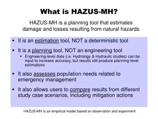
What is HAZUS? • Risk assessment tool for analyzing potential losses from hurricane, flood, and earthquake • Uses current scientific and engineering concepts in a GIS to estimate hazard related damages • HAZUS is only an estimation tool for losses due to a disaster and could be significantly different from an actual event
Loss Estimate Process Produce maps, tables, reports Analyze social and economic impacts Consider what is at risk Identify hazard Identify physical
How does HAZUS calculate damages? • Damage in HAZUS is described by five damage states: • HAZUS uses damage states to estimate life-safety consequences of building damage, expected monetary losses due to building damage, expected monetary losses due to business disruption, and other social and economic impacts.
How does HAZUS calculate damages? (Con’t) • Damage states and engineering calculations were used to develop fragility curves for each building type • Fragility curves describes the probability of being in a specific damage state as a function of the size of an earthquake • For structural damage a fragility curve expresses damage as a function of building displacement
HAZUS Modules • Six Major HAZUS Modules • Inventory • PESH • Physical • Induced Damage • Socio-Economic • Long Term
HAZUS Inventory Module • Aggregate Information • General Building Stock • Demographics • Site-specific Information • Essential Facilities • High Potential Loss Facilities • User Defined Structures • Hazardous Sites • Transportation Lifelines • Utility Systems
Potential Earth Science Hazard (PSEH) • Ground Motion • Location-specific shaking • Attenuation functions • Ground Failure • Liquefaction • Landslide • Surface Fault Rupture
HAZUS Losses • HAZUS calculates • Losses to buildings and their content and inventory (businesses) value • Debris generation from building damages • Displaced population (used to identify evacuation routes and shelter requirements • Damage to essential facilities (police, fire, medical, schools, and EOC’s) • Damage to transportation systems (highways, bridges, ports, ferry facilities etc.) • Damage to Utility systems (potable water, oil, natural gas etc. ) • High potential loss facilities (dams, levees, nuclear power plants etc. ) • Casualties (by time of day)
Where do I find data for use in HAZUS? • Local parcel/assessors data can be input into HAZUS. The following data is required for each parcel: • Building replacement value (typically use building improvement value). *Assessed values should not be used. • Building square footage • Building type (residential, commercial, industrial etc. ) • Building count (per parcel) • Can also update bridge, road, utility information • Shake Maps are available at USGS • http://earthquake.usgs.gov/earthquakes/shakemap/ • Choose a geographic area> Click Archive • Choose the appropriate network (Pacific NW)> Choose All Years> and choose Scenarios for Type • Once a Shakemap is selected choose Downloads. Download the HAZUS Zip File and the Shape Files.
HAZUS Earthquake Utilities and Procedure Documents • Shakemap Utility – Converts the downloaded shapefiles to a geodatabase (provided as a download) • Procedure for Importing Shakemaps into HAZUS (provided as a download) • SOP for Creation of Earthquake Scenario Priority Maps (contact Kelly Stone) • Earthquake Export tool – Allows the user to generate maps and tables automatically from HAZUS (contact Kelly Stone)
How Do I Run HAZUS? • A study region is created first in HAZUS which can be at a state, county, city, census tract, census block level • HAZUS Earthquake determines losses at a census tract level • A building specific analysis can be run in HAZUS, but requires additional building data structural engineering information • Shakemap, liquefaction, and soils can be input into HAZUS. Or an historic or arbitrary event can be ran. • Analysis is run for various building types, transportation, utilities, debris generation, displaced population etc. • Extract output and display data using ArcGIS
How to Use HAZUS Output • Disaster Response • HAZUS Earthquake events can be pre-run for use during disaster response • Pre-run earthquake events allow emergency management to stage resources where the highest damaged is modeled to occur • Shakemaps will be generated after an event. The post event Shakemap can be run in HAZUS providing more realistic damages during an event
How to Use HAZUS Output (Con’t) • Hazard Mitigation Planning • HAZUS output can be incorporated into a Hazard Mitigation Plan • HAZUS can identify hazard mitigation strategies *Tables were take from the Snohomish County Hazard Mitigation Plan located at http://www1.co.snohomish.wa.us/Departments/Emergency_Management/Information/Plans_Reports/
How to Use HAZUS Output (Con’t) • Community Planning • Future Development • Preparedness • Exercises • Validation Studies
Where to find information on HAZUS • FEMA HAZUS Website - http://www.fema.gov/plan/prevent/hazus/ • HAZUS User Group Information - http://www.usehazus.com/home/ • Washington HUG contact Kelly Stone, kelly.stone@fema.dhs.gov • Idaho HUG contact Ryan McDaniel, ryan.mcdaniel@idwr.idaho.gov • Alaska and Oregon information contact Jennifer Monroe, jennifer.meyer@fema.dhs.gov • Region X Earthquake Program Contacts • FEMA Earthquake Program Manager, Tamra Biasco, tamra.biasco@fema.dhs.gov • Washington Earthquake Program Manager, John Schelling, j.schelling@emd.wa.gov • Idaho Earthquake Program Manager, Mark Stephensen, mstephensen@bhs.idaho.gov • Alaska Earthquake Program Manager, Mark Roberts, mark.roberts@alaska.gov • Oregon Earthquake Program Manager, Althea Rizzo, althea.rizzo@state.or.us
HAZUS Training - Online • ESRI Virtual Campus – search for ‘Hazus’ • Examples • Hazus-MH for Decision Makers • Basic Hazus – 12 courses (Fall/Winter 2011) • Introduction to CDMS • User Defined Flood Hazard • Cost ranges from free to $32
HAZUS Training - Classroom • Training available at FEMA’s Emergency Management Institute, http://training.fema.gov/EMI/ • Funding is available for all expenses for State and Local governments • Training available is as follows: • E190 ArcGIS for Emergency Managers • E313 Basic Hazus-MH • E170 Hazus-MH for Hurricanes • E172 Hazus-MH for Floods • E174 Hazus-MH for Earthquakes • E296 Using Hazus-MH for Risk Management • E176 Hazus for Floodplain Managers • E179 Applications of Hazus-MH for Disaster Operations • E317 Comprehensive Data Management for Hazus-MH
Kelly S. Stone, Risk Analyst, FEMA Region X Kelly.stone@dhs.gov 425-487-4636 WA HUG Call – November 3rd, 2011 9:00-10:00am Call-in # 570-720-0113 PIN 186250, then press # Call information available on http://www.usehazus.com/ Preparing Data for HAZUS– November 9th, 2011 10-11am Contact and Upcoming Calls/ Webinars