Download
1 / 38
380 likes | 765 Views
When Disaster Strikes……… Dr. Iraphne Childs. When Strikes …. Geography of hazards Now more important than ever !. What do you already know about hazards?. The Geographical Perspective…. hazard/ risk - spatial distribution people & hazards: relative location, perception

E N D
When Disaster Strikes……… Dr. Iraphne Childs When Strikes ….
Geography of hazards Now more important than ever !
The Geographical Perspective… • hazard/ risk - spatial distribution • people & hazards: relative location, perception • landscapes - adaptation to hazards • communities - risks, vulnerability & resilience
Hazard Geography • Some questions to consider….. • What are “extremes”, “hazards” & “disasters”? • How can we describe hazards? • What makes people & places vulnerable or resilient to hazards? • How do we respond to hazards?
What are “extremes”, “hazards”, “disasters”…? • Some definitions….. • Extremes • – beyond what we would normally expect • Hazards • – a potential threat to humans & their welfare • Disaster • – levels of disruption and loss beyond a community’s ability to cope by themselves • Risk • – probability of occurring & resulting in a given level of damage
How many major hazards do you think occurred last week ? Where? http://www.earthweek.com/
Tropical Cyclone Yasi, Feb.2011 Bureau of Meteorology
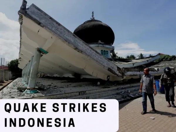
Queensland, 2012 Events • South West Flooding 4 – 10 February • Feb 4 Maranoa River at Roma and Mitchell • Feb 8 Balonne River at St George peaks at 13.96m • Sunshine Coast Region Flooding 25 – 27 February • Feb 25 Six Mile Creek flood peaks at 11.1m • Feb 26 Mary River flood peaks at 15.7m at Gympie • East Coast Low – Sunshine Coast to Fraser Coast 4 – 7 March • March 5 Mary River flood peaks at 5.35m at Maryborough • March 6 Mary River flood peaks at 14.65m at Gympie • Townsville Storm 20 March • 162 buildings storm-damaged • 22 buildings severely impacted including 18 homes • Thousands without power St George
When Disaster Strikes…. What can geographers do ?
AEM Handbook #2 Community Recovery. Fig. 4.1: Effect of disaster on ongoing community development and interface with relief and recovery
How do we respond to hazards? Emergency Management “PPRR” Framework Risk Assessment Prevention Preparedness Emergency Management Australia Response Recovery
Links to Geography syllabus… • geographic setting (phys. & human landscape features) e.g. • settlement patterns • vulnerable populations • lifelines • land-use planning
What makes people & places vulnerable or resilient to hazards ? • Severity of exposure to hazards (the event) • Physical & landscape & type of landuse (situation) • Knowledge & experience of hazards; risk perception • Ability to respond & recover • Planning& preparedness; resources & wealth; mobility; resourcefulness & social networks;, • Geography of key infrastructure • Warnings
Population Patterns Over 65 & living alone Socio-economic disadvantage
Spatial Science – Mapping / GIS How Prone is Cairns to Natural Hazards? AGSO / Granger,K. Cities Project 1996 Community risk in Cairns: a multi-hazard risk assessment • Who will need help? • Where are they? • How, where & when to evacuate • Will hospitals, power, water (“lifelines”)be affected?
Community Vulnerability Analysis AGSO / Granger,K. Cities Project 1996 Community risk in Cairns: a multi-hazard risk assessment • topographic maps • google earth • air photos • written reports • scenario of 2m storm surge • what are the disaster management options ? • vulnerable groups? evacuation ? lifelines? critical infrastructure?
How do we responds to hazards? Emergency Management “PPRR” Framework Risk Assessment Prevention Preparedness Emergency Management Australia Response Recovery
St George resident pumps water over his fence to protect his house from the rising Balonne River http://www.couriermail.com.au/news/gallery-e6frer9f-1226261605051?page=2
When Disaster Strikes…. Response and recovery What can geographers do ?
Evacuation Center:Monday Feb.6, 2012, key agencies meetings….daily, 8.00am& 4.00pm • Police (chair) • Red Cross (centre management) • Dalby Mayor or Council rep. LGDMC • Daly showgrounds facilities manager • Dept. of Community Services (DOCs) • Centrelink • Lions Club/Zonta/Rotary/Salvo’s – catering • St.John’s ambulance • Lifeline • Chaplains
2011 Flood Event – Remote sensing & clever mapping - Alluvial Soils & Vegetation Layer (Queensland Reconstruction Authority)
Recovery – planning for increasing resilience • Focus on hazard areas – which areas of town ? • Analyse results in levels of risk for land use purposes – low, medium and high • Which parts of town are at ‘high’ risk ? – retreat from these areas • Other properties closer to centre of town ‘low’ or ‘medium’ risk – adapt these areas to the risk Queensland Reconstruction Authority
Geography deals with “real world” problems • What do you get? • Where & how to get key information about places/regions • How to interpret information & statistics, patterns & trends • How to present & report information • Using maps, new mapping & spatial technologies • Working “in the field” - people or environment (surveys etc.) • Working in teams, with other cultures, in other places • Ability to integrate information & apply to practical problems • A broad & practical knowledge base • WORK SMARTER WITH GEOGRAPHICAL SKILLS – gives you the edge
Common Career Paths for Geographers: • Local and state government • Hazard management • Natural resource management • Teaching • Mapping (Geographic Information Systems) • Government Policy Development/ Analysts • Demography • Tourism Industry • Town Planning • … and more
Jobs for geographers… Geographers & Planners in the real world….
Some jobs for geographers … Emergency Management Planning Officer (City of Bendigo) …to use a risk based framework, to engage with key stakeholders and plan within an agreed set of priorities to prepare for, respond to and recover from fire and emergency situations. Project Officer, SA Department for Water, Land and Biodiversity Conservation …responsible for providing support to the Hazards Team for assisting in the project management and delivery of water-related and emergency management projects within South Australia.
Some jobs for geographers … Land Resources Officer… knowledge of …GIS; coordinate activities with multi-disciplinary teams; knowledge of factors affecting land use and land suitability. Extension Officer (ICM/Landcare)… ability to facilitate the development of Community Based Natural Resource Management Groups and solutions to natural resource issues; communicate and network effectively
Some jobs for geographers… Project Officer (Riverine Assessment)… ability to work in multi-disciplinary teams Natural Resource Officer … ability to coordinate, integrate, and disseminate information Research Officer, Local Government Grants Commission - Undertake collection, research and analysis of financial, demographic and statistical data
Queensland Reconstruction Authority Disaster recovery monitoring Michael Kraus Business Analyst – GPEM Graduate (Geography/Planning) http://www.gpem.uq.edu.au/michael-kraus
Planning for a resilient Queensland Land Use Planning Manager, (GPEM graduate, Geography/Planning) Senior Planner (GPEM Planning graduate) 28 May 2012
References Queensland Government, Disaster Management http://www.disaster.qld.gov.au/ World Bank/ Queensland Reconstruction Authority (June 2011) Queensland Recovery and Reconstruction in the Aftermath of the 2010/2011 Flood Events and Cyclone Yasi http://www.qldreconstruction.org.au/publications-guides/reports/world-bank-report AGSO / Granger,K. (1999) Cities Project 1996 Community risk in Cairns: a multi-hazard risk assessment Australian Emergency Management Handbook http://www.em.gov.au/Publications/Australianemergencymanualseries/Pages/default.aspx Queensland Reconstruction Authority (2012) Planning for stronger, more resilient floodplains http://qldreconstruction.org.au/publications-guides/land-use-planning/planning-for-stronger-more-resilient-flood-plains
Thank you Questions ?