Download
1 / 21
230 likes | 265 Views
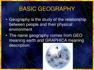
Basic Concepts in Geography. Vocabulary and examples. Human Geography – The Why of Where…. The study of where and WHY human activities are located where they are. HG examines the relationships between people and the places they live using a variety of scales (from local to global)

E N D
Basic Concepts in Geography Vocabulary and examples
Human Geography – The Why of Where… • The study of where and WHY human activities are located where they are. HG examines the relationships between people and the places they live using a variety of scales (from local to global) • What are some topics a human geographer might address? • What would you be curious to know?
Physical Geography • Geography literally means , “to describe the Earth” The study of why natural forces occur where they do • Human interest in geography – maps from early on… • Why were maps important to ancient peoples?Most people did not travel more than 20 miles from their place of birth before the invention of the automobile. • Are maps as important today? Why or why not?
Maps… • Maps are tools that are used for a variety of reasons • Examples…?? • Maps are imperfect however • Projection – transferring locations on the Earth’s surface to a flat map. Leads to distortion of images in regards to shape, distance, direction or size
Different types of projection • Robinson – shows information across oceans, with less distortion there • Mercator – the poles are the area of greatest distortion • Goode homolosine projection – interrupted map that preserves angles and scale, most distorted around Asia.
Various types of maps • Thematic Maps – may be broken down in a variety of ways and will show a particular feature that may be: Economic, Social, Agricultural, Cultural, Political, etc…. • Thematic Maps are used to show a specific feature, like, “cattle populations worldwide,” or “number of registered Democrats in the Northeast” • Can be used to draw generalizations and to compare items from two different maps
Choropleth (“multiple regions”) Maps • Special type of thematic map that uses shading or different colors to show a proportion or particular measurement in an area
Geography in History • Remind me, from time to time, that this is NOT a history class (otherwise I may not move on…) • Ancient cultures have been mapping out locations well before the advent of modern technologies like the GPS
Example – Polynesian Stick Charts • Used to track wave patterns around specific island(s) • Made by men from roots or coconut fronds • Concentrated on the swells of the waves and the refractions the waves made after hitting land • Example of how ancient maps were a reflection of a particular culture’s values and resources
Ancient traditions • 700 BCE – Turkish city of Miletus was known as a center for geography and cartography • Thales – first applied geographic concepts to measuring land area • Anaximander – map of the world from the anecdotes of sailors. Thought Earth was cylindrical. • Greeks continued… • Herodotus – map of the world • Aristotle – Earth was spherical (~400 BCE) • Eratosthenes – Calculated circumference of the Earth by measuring the angle of the summer solstice in two places
More historical geography • Ptolemy - (~100 CE) Compiled the records of the Roman empire to create an 8 volume series on geography of the world • Chinese mapmaker Phei Hsiu (Pei Xiu) used a consistent grid system that was already in place in China well before his cartography career began. Records from China have not been as well preserved as early European efforts • Chinese use magnetic compass around 260 CE
Muslims • Revived map-making and geography after Middle Ages – Muhammad al-Idrisi • Wrote various books on geography, economics, botany and zoology. • Used and emulated by Europeans for centuries • Expanded on the Greek astrolabe to help guide sailors – determines latitude by star position